Click here for more info on on SMS!

K4M7

RUSSELLVILLE-LOGAN COUNTY
RUSSELLVILLE
KY
Time Zone: Central
Lat: N 3648.0
Long: W 08648.7
Elev: 692
Var: +04
Longest Runway: 4500
CTAF: 122.7

FBO & Flight Services info for K4M7

FBOs: Update your Fuel Prices

RUSSELLVILLE-LOGAPh: 270-726-3214
-
Freq: 122.7
Service
Jet
100LL
SAF
MoGas
Fuel Avail: ASSISTED SELF SERVICE , $0.10 CASH DISCOUNT
Full        Last Update: 04/01/2024 10:57

Self4.655.52    
 Address: 348 AIRPORT RD   RUSSELLVILLE, KY 42276
If you are an FBO, call 1-203-262-1700 to update your info or email: FltPlan.Advertising@garmin.com
Advertise your FBO on FltPlan.com

Runway & Approach Info for K4M7
Rwy
Length
Land Dist**
Approach*
  Rwy
Length
Land Dist**
Approach*
07
4500x75  4500'          
 
  
25
  4500x75  4500'          
 
 * only ILS, LOC, LDA, and SDF approaches to a specific runway are shown
** For any Declared Landing Distance Available, please see A/FD or Approach plates
Runway Weight Capability (lbs.) Help
Runway IDSingle WheelDouble WheelDouble Tandem WheelDual Double Wheel
07/2512,500N/AN/AN/A
These numbers are Advisory and are not limits.   The Airport Manager should have more accurate Weight Limits
Approach Charts
Approaches    
Current Weather/Notams
Customs Information Send updates to Support@FltPlan.com
Customs Not Available
Database effective 05/16/2024
Airport Diagram of K4M7
Airport Diagram might not be current.

Facility Name: RUSSELLVILLE-LOGAN COUNTY
City Name: RUSSELLVILLE
County: LOGAN
State abbrev: KY
State Name: KENTUCKY
   
Ownership: PUBLICLY OWNED
Use: OPEN TO THE PUBLIC
Owner's Name: CITY COUNTY ARPT BOARD; AIRPORT BOARD CHAIRMAN STEVE DILLIHA
Address: 385 AIRPORT RD.
 RUSSELLVILLE, KY 42276
Owner's Phone: (270) 847-7622
  
Manager's Name: CASSIE SOBEY
Address: 385 AIRPORT RD.
 RUSSELLVILLE, KY 42276
Phone: 270-726-3214
   
FAA Region: SOUTHERN
FAA Field Office: MEM


Sunrise / Sunset times for RUSSELLVILLE-LOGAN COUNTY

DateSunriseSunset
04/22/24 Monday6:0319:29
04/23/24 Tuesday6:0219:30
04/24/24 Wednesday6:0119:30
04/25/24 Thursday5:5919:31
04/26/24 Friday5:5819:32
04/27/24 Saturday5:5719:33
04/28/24 Sunday5:5619:34
04/29/24 Monday5:5519:35
04/30/24 Tuesday5:5419:36
05/01/24 Wednesday5:5219:37
05/02/24 Thursday5:5119:37
05/03/24 Friday5:5019:38
05/04/24 Saturday5:4919:39
05/05/24 Sunday5:4819:40

Airport Facilities

Airport Attendance Schedule7 Days A Week 0900-1800
Airport Status OPERATIONAL (This Status can change at any time - please check NOTAMS)
Airport Lighting ScheduleACTVT REIL RYS 07 & 25; PAPI RYS 07 & 25; MIRL RY 07/25 - CTAF.
Airport Storage AvailableTie Downs
Extra Services AvailableNONE
Wind IndicatorYES - (lighted)
Control TowerNO
CTAF Frequency122.700
Unicom Frequency122.700
Rotating Beacon ColorWG
Segmented CircleYES
Landing FeeNO

Airport Inspection Data

Airport InspectedSTATE - performed by STATE AERONAUTICAL PERSONNEL
Inspection Date11/05/2019

Airport Services

Type of Fuel AvailableGrade 100LL, JET A
Airframe Repair ServiceNONE
Power Plant Repair ServiceNONE

Geographic Data

LatitudeN3648.0
LongitudeW08648.7 (ESTIMATED)
Arpt Elevation691ft (SURVEYED)
Magnetic Variation04W
4 miles SEof RUSSELLVILLE
Traffic Pattern Altitude
Sectional ChartST LOUIS

Aircraft Data

Operations (Reported)YearlyAvg. Daily
General Aviation Transient 15004
General Aviation Local 29008
Air Taxi 6202
Commerical 00
Commuter 00
Military 20005
Aircraft based on Field
General Aviation Singles 17
General Aviation Multi 2
Jet Aircraft 1
General Aviation Helicopters 0
Military Aircraft 0
Gliders 0
Ultralights 0

FAA Services

FSS on field NO
FSS tie-in LOUISVILLE
FSS Phone 1-800-WX-BRIEF
Who issues Notams LOU
Notam D service at airport YES
ARTCC Name MEMPHIS

Federal Status

Airport Certification
Aircraft Rescue & Firefighting IndexNone
Airport of EntryNo
Custom Landing RightsNo
Joint Civil/MilitaryNo
Military Landing rightsYES

Federal Agreements

NATIONAL PLAN OF INTEGRATED AIRPORT SYSTEMS (NPIAS)
GRANT AGREEMENTS UNDER FAAP/ADAP/AIP
ASSURANCES PURSUANT TO TITLE VI, CIVIL RIGHTS ACT OF 1964

Remarks

DEER ON & INVOF ARPT.
WILDLIFE NEAR ARPT.
FOR CD CTC MEMPHIS ARTCC AT 901-368-8453/8449.
Airport Communications & Frequencies:
CTAF Frequency:
122.700
Unicom Frequency:
122.700
Remarks
  • APCH/DEP SVC PRVDD BY MEMPHIS ARTCC ON FREQS 133.85/317.6 (NASHVILLE RCAG).
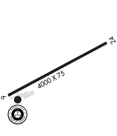
  • Runway Identifications
    Runway Identification: 07/25
    Length: 4500 ft
    Width: 75 ft
    Surface: ASPHALT-GOOD CONDITION
    Edge lights: Medium Intensity

    Treatment: NONE

     Runway: 07   Runway: 25
    Mag heading: 67°Mag heading: 247°
    Rwy Slope: -.81% DownRwy Slope: .81% Up
    Approach: Approach:
    Pattern: Left TrafficPattern: Left Traffic
    Markings: NONPRECISION INSTRUMENTMarkings: NONPRECISION INSTRUMENT
    Marking Condition: GOODMarking Condition: GOOD
    Arresting Dev: Arresting Dev:
    Lat & Long: N3647.8  W08649.1Lat. & Long.: N3648.1  W08648.2
    Elev: 691.7 ft. MSLElev: 655.1 ft. MSL
    TCH: 39 ft. AGLTCH: 43 ft. AGL
    Visual Glide Path: 3.00 degreesVisual Glide Path: 3.00 degrees
    Displaced Threshold: NoDisplaced Threshold: No
    Touchdown Zone: YESTouchdown Zone: YES
    Touchdown Elev.: 691.7 feetTouchdown Elev.: 680.8 feet
    Visual Glide Slope: 2-Light PAPI on LEFT side of RunwayVisual Glide Slope: 2-Light PAPI on LEFT side of Runway
    RVR Equipment: RVR Equipment:
    RVV Equipment: NORVV Equipment: NO
    Approach Lights: Approach Lights:
    REIL: YESREIL: YES
    Centerline Lights: NOCenterline Lights: NO
    Touchdown lights: NOTouchdown lights: NO
    Runway Category: Runway with a Visual ApproachRunway Category: Runway with a Non-precision Approach
    Declared Distances: Declared Distances:
    Obstructions: Obstructions: TREES
    Marked: Marked: NOT Marked/Lighted
    Clearance slope: 20:1Clearance slope: 8:1
    Obstruction height: Obstruction height: 8 feet AGL
    Dist. from runway: Dist. from runway: 270 feet
    Centerline offset: Centerline offset: 249 feet right of centerline
    Comments: Comments:
    C:1/P: