Click here for more info on on SMS!

K4K0

PEDRO BAY AIRPORT
PEDRO BAY
AK
Time Zone: Alaska
Lat: N 5947.8
Long: W 15407.8
Elev: 84
Var: -22
Longest Runway: 3002
CTAF: 122.9

FBO & Flight Services info for K4K0

FBOs: Update your Fuel Prices

AIRPORTPh: 907-571-1261
-
Freq: 122.9
RUNWAY - GRAVEL
-
-
 
If you are an FBO, call 1-203-262-1700 to update your info or email: FltPlan.Advertising@garmin.com
Advertise your FBO on FltPlan.com

Runway & Approach Info for K4K0
Rwy
Length
Land Dist**
Approach*
  Rwy
Length
Land Dist**
Approach*
09
3002x60  3002'          
 
  
27
  3002x60  3002'          
 
 * only ILS, LOC, LDA, and SDF approaches to a specific runway are shown
** For any Declared Landing Distance Available, please see A/FD or Approach plates
Runway Weight Capability (lbs.) Help
Runway IDSingle WheelDouble WheelDouble Tandem WheelDual Double Wheel
09/27N/AN/AN/AN/A
These numbers are Advisory and are not limits.   The Airport Manager should have more accurate Weight Limits
Approach Charts
FltPlan does not have IFR approach charts available for K4K0.
Current Weather/Notams
Customs Information Send updates to Support@FltPlan.com
Customs Not Available
Database effective 05/16/2024
Airport Diagram of K4K0
Airport Diagram might not be current.

Facility Name: PEDRO BAY
City Name: PEDRO BAY
County: LAKE AND PENINSULA
State abbrev: AK
State Name: ALASKA
   
Ownership: PUBLICLY OWNED
Use: OPEN TO THE PUBLIC
Owner's Name: ALASKA DOT&PF SOUTHCOAST REGION
Address: PO BOX 196900
 ANCHORAGE, AK 99519-6900
Owner's Phone: 907-269-0760
  
Manager's Name: CLINTON ANELON
Address: BOX 187
 ILIAMNA, AK 99606
Phone: 907-571-1261
   
FAA Region: ALASKA
FAA Field Office: NONE


Sunrise / Sunset times for PEDRO BAY

DateSunriseSunset
04/25/24 Thursday6:2922:01
04/26/24 Friday6:2622:04
04/27/24 Saturday6:2322:06
04/28/24 Sunday6:2122:08
04/29/24 Monday6:1822:11
04/30/24 Tuesday6:1522:13
05/01/24 Wednesday6:1322:16
05/02/24 Thursday6:1022:18
05/03/24 Friday6:0722:21
05/04/24 Saturday6:0522:23
05/05/24 Sunday6:0222:26
05/06/24 Monday5:5922:28
05/07/24 Tuesday5:5722:30
05/08/24 Wednesday5:5422:33

Airport Facilities

Airport Attendance ScheduleUNATTENDED
Airport Status OPERATIONAL (This Status can change at any time - please check NOTAMS)
Airport Lighting ScheduleACTVT WINDSOCK LGT; MIRL RY 09/27 - CTAF.; ACTVT ROTG BCN - CTAF.
Airport Storage AvailableNONE
Extra Services AvailableCargo Handling
Wind IndicatorYES - (lighted)
Control TowerNO
CTAF Frequency122.900
Unicom Frequency
Rotating Beacon ColorWG
Segmented CircleYES
Landing FeeNO

Airport Inspection Data

Airport InspectedSTATE - performed by PRIVATE CONTRACT PERSONNEL
Inspection Date05/24/2021

Airport Services

Type of Fuel AvailableNone
Airframe Repair ServiceNONE
Power Plant Repair ServiceNONE

Geographic Data

LatitudeN5947.8
LongitudeW15407.8 (ESTIMATED)
Arpt Elevation83ft (SURVEYED)
Magnetic Variation22E
1 miles Wof PEDRO BAY
Traffic Pattern Altitude
Sectional ChartKODIAK

Aircraft Data

Operations (Reported)YearlyAvg. Daily
General Aviation Transient 5502
General Aviation Local 2001
Air Taxi 5001
Commerical 00
Commuter 00
Military 00
Aircraft based on Field
General Aviation Singles 1
General Aviation Multi 0
Jet Aircraft 0
General Aviation Helicopters 0
Military Aircraft 0
Gliders 0
Ultralights 0

FAA Services

FSS on field NO
FSS tie-in ILIAMNA
FSS Phone 571-1240 (Local call)
Nearby FSS KENAI
Phone 1-800-866-864-1737
Who issues Notams ILI
Notam D service at airport YES
ARTCC Name ANCHORAGE

Federal Status

Airport Certification
Aircraft Rescue & Firefighting IndexNone
Airport of EntryNo
Custom Landing RightsNo
Joint Civil/MilitaryNo
Military Landing rightsYES

Federal Agreements

NATIONAL PLAN OF INTEGRATED AIRPORT SYSTEMS (NPIAS)
GRANT AGREEMENTS UNDER FAAP/ADAP/AIP
ASSURANCES PURSUANT TO TITLE VI, CIVIL RIGHTS ACT OF 1964

Remarks

STRONG WINDS CREATE SEVERE TURBULENCE & POSSIBLE WIND SHEAR AT AIRPORT.
HIGH MOUNTAINOUS TERRAIN NORTH OF ARPT.
RY SOFT DURING BREAK-UP & FREEZE-UP; ALSO AFTER RAINY PERIODS.
WX CAMERA AVBL ON INTERNET AT HTTPS://WEATHERCAMS.FAA.GOV
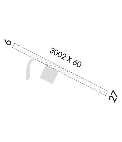
Runway Identifications
Runway Identification: 09/27
Length: 3002 ft
Width: 60 ft
Surface: NATURAL SOIL-GOOD CONDITION
Edge lights: Medium Intensity

Treatment: NONE

 Runway: 09   Runway: 27
Mag heading: 89°Mag heading: 269°
Rwy Slope: -.57% DownRwy Slope: .57% Up
Approach: Approach:
Pattern: Right TrafficPattern: Left Traffic
Markings: Markings:
Marking Condition: 09/27 MKD WITH REFLECTIVE CONES & THR PANELS; SOME PANELS DAMAGED.Marking Condition:
Arresting Dev: Arresting Dev:
Lat & Long: N5947.9  W15408.3Lat. & Long.: N5947.7  W15407.3
Elev: 83.2 ft. MSLElev: 66.1 ft. MSL
TCH: TCH:
Visual Glide Path: Visual Glide Path:
Displaced Threshold: NoDisplaced Threshold: No
Touchdown Zone: YESTouchdown Zone: YES
Touchdown Elev.: 83.9 feetTouchdown Elev.: 83.9 feet
Visual Glide Slope: Visual Glide Slope:
RVR Equipment: RVR Equipment:
RVV Equipment: NORVV Equipment: NO
Approach Lights: Approach Lights:
REIL: NOREIL: NO
Centerline Lights: NOCenterline Lights: NO
Touchdown lights: NOTouchdown lights: NO
Runway Category: Runway with a Visual ApproachRunway Category: Runway with a Visual Approach
Declared Distances: Declared Distances:
Obstructions: BRUSHObstructions: BRUSH
Marked: NOT Marked/LightedMarked: NOT Marked/Lighted
Clearance slope: Clearance slope:
Obstruction height: 4 feet AGLObstruction height: 3 feet AGL
Dist. from runway: 0 feetDist. from runway: 0 feet
Centerline offset: 74 right of centerlineCenterline offset: 65 feet right of centerline
Comments: Comments:
C:/P: