Approach Charts
| FltPlan does not have IFR approach charts available for K4F9. |
Current Weather/Notams (Metars, TAFs, Notams, NWS Forecast, PIREPS, and nearby weather)
Customs Information Send updates to Support@FltPlan.com
Customs Not Available
Database effective 05/16/2024
Airport Diagram might not be current.
|
| Facility Name: | LA MOURE ROTT MUNI |
| City Name: | LA MOURE |
| County: | LA MOURE |
| State abbrev: | ND |
| State Name: | NORTH DAKOTA |
| | |
| Ownership: | PRIVATELY OWNED |
| Use: | OPEN TO THE PUBLIC |
| Owner's Name: | JAMES BITZ |
| Address: | 7381 COUNTY ROAD 60 |
| | LAMOURE, ND 58458 |
| Owner's Phone: | 701-883-5968 |
| | |
| Manager's Name: | BLANE ROBERT |
| Address: | 7357 COUNTY ROAD 60 |
| | LAMOURE, ND 58458 |
| Phone: | 701-883-5047; AMGR ALT CTC 701-320-4189. |
| | |
| FAA Region: | GREAT LAKES |
| FAA Field Office: | DMA |
Runway Identifications
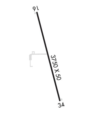
Runway Identification: 16/34Length: 3400 ft
Width: 50 ft
Surface: ASPHALT-GOOD CONDITION
Edge lights: Non-Standard Lighting SystemTreatment: NONE
| | Runway: 16 | | Runway: 34 |
| Mag heading: | 158° | Mag heading: | 338° |
| Rwy Slope: | -.08% Down | Rwy Slope: | .08% Up |
| Approach: | | Approach: | |
| Pattern: | Left Traffic | Pattern: | Left Traffic |
| Markings: | BASIC | Markings: | BASIC |
| Marking Condition: | GOOD | Marking Condition: | GOOD |
| Arresting Dev: | | Arresting Dev: | |
| Lat & Long: | N4621.1 W09817.0 | Lat. & Long.: | N4620.6 W09816.8 |
| Elev: | 1308.7 ft. MSL | Elev: | 1306.1 ft. MSL |
| TCH: | | TCH: | |
| Visual Glide Path: | | Visual Glide Path: | |
| Displaced Threshold: | No | Displaced Threshold: | No |
| Touchdown Zone: | NO | Touchdown Zone: | NO |
| Touchdown Elev.: | | Touchdown Elev.: | |
| Visual Glide Slope: | | Visual Glide Slope: | |
| RVR Equipment: | | RVR Equipment: | |
| RVV Equipment: | NO | RVV Equipment: | NO |
| Approach Lights: | | Approach Lights: | |
| REIL: | NO | REIL: | NO |
| Centerline Lights: | NO | Centerline Lights: | NO |
| Touchdown lights: | NO | Touchdown lights: | NO |
| Runway Category: | Runway with a Visual Approach | Runway Category: | Runway with a Visual Approach |
| Declared Distances: | | Declared Distances: | |
| Obstructions: | OTHER; 14 FT AGL MOBILE IRRIGATOR E OF RWY SWINGS INTO APCH 0:1 CLNC SLOPE. | Obstructions: | |
| Marked: | NOT Marked/Lighted | Marked: | |
| Clearance slope: | 14 FT AGL MOBILE IRRIGATOR E OF RWY SWINGS INTO APCH 0:1 CLNC SLOPE. | Clearance slope: | 20:1 |
| Obstruction height: | 14 feet AGL | Obstruction height: | |
| Dist. from runway: | 200 feet | Dist. from runway: | |
| Centerline offset: | 120 left of centerline | Centerline offset: | |
| Comments: | 14 FT AGL MOBILE IRRIGATOR IN APCH 200 FT FM RWY THR 120 FT L. | Comments: | |

