Approach Charts
| FltPlan does not have IFR approach charts available for K45K. |
Current Weather/Notams (Metars, TAFs, Notams, NWS Forecast, PIREPS, and nearby weather)
Customs Information Send updates to Support@FltPlan.com
Customs Not Available
Database effective 05/16/2024
Airport Diagram might not be current.
|
| Facility Name: | MINNEAPOLIS CITY COUNTY |
| City Name: | MINNEAPOLIS |
| County: | OTTAWA |
| State abbrev: | KS |
| State Name: | KANSAS |
| | |
| Ownership: | PUBLICLY OWNED |
| Use: | OPEN TO THE PUBLIC |
| Owner's Name: | CITY OF MINNEAPOLIS |
| Address: | 218 N. ROCK ST. |
| | MINNEAPOLIS, KS 67467 |
| Owner's Phone: | 785-392-2176 |
| | |
| Manager's Name: | PAT DONOVAN |
| Address: | BOX 42 |
| | MINNEAPOLIS, KS 67467 |
| Phone: | 785-392-3300 |
| | |
| FAA Region: | CENTRAL |
| FAA Field Office: | NONE |
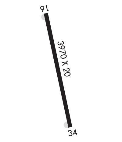
Runway Identifications
Runway Identification: 16/34Length: 3970 ft
Width: 20 ft
Surface: ASPHALT-GOOD CONDITION
Edge lights: Treatment: NONE
| | Runway: 16 | | Runway: 34 |
| Mag heading: | 158° | Mag heading: | 338° |
| Rwy Slope: | -.10% Down | Rwy Slope: | .10% Up |
| Approach: | | Approach: | |
| Pattern: | Left Traffic | Pattern: | Left Traffic |
| Markings: | NUMBERS ONLY | Markings: | NUMBERS ONLY |
| Marking Condition: | GOOD | Marking Condition: | GOOD |
| Arresting Dev: | | Arresting Dev: | |
| Lat & Long: | N3906.0 W09743.4 | Lat. & Long.: | N3905.3 W09743.2 |
| Elev: | 1246.0 ft. MSL | Elev: | 1242.0 ft. MSL |
| TCH: | | TCH: | |
| Visual Glide Path: | | Visual Glide Path: | |
| Displaced Threshold: | No | Displaced Threshold: | No |
| Touchdown Zone: | NO | Touchdown Zone: | NO |
| Touchdown Elev.: | | Touchdown Elev.: | |
| Visual Glide Slope: | | Visual Glide Slope: | |
| RVR Equipment: | | RVR Equipment: | |
| RVV Equipment: | NO | RVV Equipment: | NO |
| Approach Lights: | | Approach Lights: | |
| REIL: | NO | REIL: | NO |
| Centerline Lights: | NO | Centerline Lights: | NO |
| Touchdown lights: | NO | Touchdown lights: | NO |
| Runway Category: | Runway with a Visual Approach | Runway Category: | Runway with a Visual Approach |
| Declared Distances: | | Declared Distances: | |
| Obstructions: | TREES | Obstructions: | TREES |
| Marked: | NOT Marked/Lighted | Marked: | NOT Marked/Lighted |
| Clearance slope: | 15:1 | Clearance slope: | 17:1 |
| Obstruction height: | 59 feet AGL | Obstruction height: | 65 feet AGL |
| Dist. from runway: | 1118 feet | Dist. from runway: | 1150 feet |
| Centerline offset: | | Centerline offset: | 250 feet left of centerline |
| Comments: | | Comments: | RWY 34 NUMEROUS SHRUBS AND SMALL TREES 22 FT AND 94 FT FROM RWY END & 27 FT LEFT. |

