
| ||||||||||||||||||||||||||||||||
| ||||||||||||||||||||||||||||||||
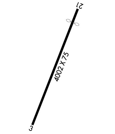
| Rwy | Rwy | |||||||
| 4002x75 | 4002' | 4002x75 | 3544' | |||||
| Runway ID | Single Wheel | Double Wheel | Double Tandem Wheel | Dual Double Wheel |
| 03/21 | 20,000 | N/A | N/A | N/A |
| These numbers are Advisory and are not limits. The Airport Manager should have more accurate Weight Limits | ||||
 Airport Diagram might not be current. | |
| Facility Name: | MONTGOMERY COUNTY |
| City Name: | STAR |
| County: | MONTGOMERY |
| State abbrev: | NC |
| State Name: | NORTH CAROLINA |
| Ownership: | PUBLICLY OWNED |
| Use: | OPEN TO THE PUBLIC |
| Owner's Name: | MONTGOMERY COUNTY |
| Address: | PO BOX 425 |
| TROY, NC 27371 | |
| Owner's Phone: | 910-576-4221 |
| Manager's Name: | KEVIN MCNEILL |
| Address: | PO BOX 425 |
| TROY, NC 27371 | |
| Phone: | (910) 220-1218; MGR PHONE 910-220-1218. |
| FAA Region: | SOUTHERN |
| FAA Field Office: | MEM |
| Date | Sunrise | Sunset |
|---|---|---|
| 04/23/24 Tuesday | 6:36 | 19:59 |
| 04/24/24 Wednesday | 6:35 | 20:00 |
| 04/25/24 Thursday | 6:34 | 20:01 |
| 04/26/24 Friday | 6:32 | 20:02 |
| 04/27/24 Saturday | 6:31 | 20:03 |
| 04/28/24 Sunday | 6:30 | 20:03 |
| 04/29/24 Monday | 6:29 | 20:04 |
| 04/30/24 Tuesday | 6:28 | 20:05 |
| 05/01/24 Wednesday | 6:27 | 20:06 |
| 05/02/24 Thursday | 6:26 | 20:07 |
| 05/03/24 Friday | 6:25 | 20:08 |
| 05/04/24 Saturday | 6:24 | 20:08 |
| 05/05/24 Sunday | 6:23 | 20:09 |
| 05/06/24 Monday | 6:22 | 20:10 |
| Airport Attendance Schedule | UNATTENDED |
| Airport Status | OPERATIONAL (This Status can change at any time - please check NOTAMS) |
| Airport Lighting Schedule | ACTVT PAPI RWY 03 & 21; MIRL RWY 03/21 - CTAF. |
| Airport Storage Available | Tie Downs |
| Extra Services Available | NONE |
| Wind Indicator | YES - (lighted) |
| Control Tower | NO |
| CTAF Frequency | 122.800 |
| Unicom Frequency | 122.800 |
| Rotating Beacon Color | WG |
| Segmented Circle | NO |
| Landing Fee | NO |
| Airport Inspected | STATE - performed by STATE AERONAUTICAL PERSONNEL |
| Inspection Date | 07/03/2022 |
| Type of Fuel Available | Grade 100LL; -10AVGAS 100LL 24 HR SELF SVC WITH CREDIT CARD. |
| Airframe Repair Service | NONE |
| Power Plant Repair Service | NONE |
| Latitude | N3523.1 |
| Longitude | W07947.4 (ESTIMATED) |
| Arpt Elevation | 632ft (SURVEYED) |
| Magnetic Variation | 06W |
| 0 miles NE | of STAR |
| Traffic Pattern Altitude | |
| Sectional Chart | CHARLOTTE |
| Operations (Reported) | Yearly | Avg. Daily |
|---|---|---|
| General Aviation Transient | 1500 | 4 |
| General Aviation Local | 1300 | 4 |
| Air Taxi | 0 | 0 |
| Commerical | 0 | 0 |
| Commuter | 0 | 0 |
| Military | 2000 | 5 |
| Aircraft based on Field | |
|---|---|
| General Aviation Singles | 10 |
| General Aviation Multi | 0 |
| Jet Aircraft | 0 |
| General Aviation Helicopters | 0 |
| Military Aircraft | 0 |
| Gliders | 0 |
| Ultralights | 0 |
| FSS on field | NO |
| FSS tie-in | RALEIGH |
| FSS Phone | 1-800-WX-BRIEF |
| Who issues Notams | RDU |
| Notam D service at airport | YES |
| ARTCC Name | WASHINGTON |
| Airport Certification | |
| Aircraft Rescue & Firefighting Index | None |
| Airport of Entry | No |
| Custom Landing Rights | No |
| Joint Civil/Military | No |
| Military Landing rights | YES |
| NATIONAL PLAN OF INTEGRATED AIRPORT SYSTEMS (NPIAS) |
| ASSURANCES PURSUANT TO TITLE VI, CIVIL RIGHTS ACT OF 1964 |
| GRANT AGREEMENT HAS EXPIRED; HOWEVER, AGREEMENT REMAINS IN EFFECT FOR THIS FACILITY AS LONG AS IT IS PUBLIC USE. |
| DEER OCCASIONALLY ON RWY. |
| UNMARKED 40 FT PLINE 350-750 FT FM THR RWY 21 ACROSS & L OF CNTRLN. |
| 20-25 FT DEPRESSION 180 FT S OF RWY 03 THR ON CNTRLN. |
| RWY 03 HAS UPHILL GRADE. |
| 35-40 FT DROP-OFF 80 FT W OF RWY 03 CNTRLN; 30 FT DROP-OFF 300 FT FM RWY 21 THR ON CNTRLN; 30 FT DROP-OFF 80 FT R OF RWY 21 CNTRLN. |
| FOR CD CTC FAYETTEVILLE APCH AT 910-484-8012. |
| RWY 21 HAS A PARALLEL GRAVEL DRIVEWAY 130 FT RIGHT OF CNTRLN. |
Airport Communications & Frequencies:
| ||||||||||||||
| Runway: 03 | Runway: 21 | ||
| Mag heading: | 27° | Mag heading: | 207° |
| Rwy Slope: | 1.49% Up | Rwy Slope: | -1.49% Down |
| Approach: | Approach: | ||
| Pattern: | Left Traffic | Pattern: | Left Traffic |
| Markings: | NONPRECISION INSTRUMENT | Markings: | NONPRECISION INSTRUMENT |
| Marking Condition: | GOOD | Marking Condition: | GOOD |
| Arresting Dev: | Arresting Dev: | ||
| Lat & Long: | N3522.8 W07947.6 | Lat. & Long.: | N3523.4 W07947.3 |
| Elev: | 572.7 ft. MSL | Elev: | 632.5 ft. MSL |
| TCH: | 48 ft. AGL | TCH: | 33 ft. AGL |
| Visual Glide Path: | 3.50 degrees | Visual Glide Path: | 4.00 degrees |
| Displaced Threshold: | No | Displaced Threshold: | 458 feet |
| Touchdown Zone: | YES | Touchdown Zone: | YES |
| Touchdown Elev.: | 617.3 feet | Touchdown Elev.: | 625.6 feet |
| Visual Glide Slope: | 2-Light PAPI on LEFT side of Runway | Visual Glide Slope: | 2-Light PAPI on LEFT side of Runway |
| RVR Equipment: | RVR Equipment: | ||
| RVV Equipment: | NO | RVV Equipment: | NO |
| Approach Lights: | Approach Lights: | ||
| REIL: | NO | REIL: | NO |
| Centerline Lights: | NO | Centerline Lights: | NO |
| Touchdown lights: | NO | Touchdown lights: | NO |
| Runway Category: | Runway with a Non-precision Approach | Runway Category: | Runway with a Non-precision Approach |
| Declared Distances: | Declared Distances: | ||
| Obstructions: | TREES | Obstructions: | POLE |
| Marked: | NOT Marked/Lighted | Marked: | NOT Marked/Lighted |
| Clearance slope: | 22:1 | Clearance slope: | 8:1; APCH RATIO 19:1 TO DSPLCD THR. |
| Obstruction height: | 56 feet AGL | Obstruction height: | 30 feet AGL |
| Dist. from runway: | 1449 feet | Dist. from runway: | 449 feet |
| Centerline offset: | 5 right of centerline | Centerline offset: | 110 feet left of centerline |
| Comments: | Comments: |
