
| ||||||||||||||||||||||||||||||||||||||||||||
| ||||||||||||||||||||||||||||||||||||||||||||
| ||||||||||||||||||||||||||||||||||||||||||||
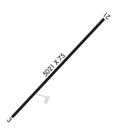
| Rwy | Rwy | |||||||
| 5021x75 | 5021' | 5021x75 | 5021' | |||||
| Runway ID | Single Wheel | Double Wheel | Double Tandem Wheel | Dual Double Wheel |
| 03/21 | 24,000 | N/A | N/A | N/A |
| These numbers are Advisory and are not limits. The Airport Manager should have more accurate Weight Limits | ||||
 Airport Diagram might not be current. | |
| Facility Name: | MANTI-EPHRAIM |
| City Name: | MANTI |
| County: | SANPETE |
| State abbrev: | UT |
| State Name: | UTAH |
| Ownership: | PUBLICLY OWNED |
| Use: | OPEN TO THE PUBLIC |
| Owner's Name: | CITIES OF MANTI & EPHRAIM |
| Address: | 5 SOUTH MAIN |
| EPHRAIM, UT 84627 | |
| Owner's Phone: | 435-283-4631 |
| Manager's Name: | SEAN LEWIS; CITY/AMGR. |
| Address: | 5 SOUTH MAIN |
| EPHRAIM, UT 84627 | |
| Phone: | 435-283-4631 |
| FAA Region: | NORTHWEST MOUNTAIN |
| FAA Field Office: | DEN |
| Date | Sunrise | Sunset |
|---|---|---|
| 04/22/24 Monday | 6:38 | 20:12 |
| 04/23/24 Tuesday | 6:37 | 20:13 |
| 04/24/24 Wednesday | 6:36 | 20:14 |
| 04/25/24 Thursday | 6:34 | 20:15 |
| 04/26/24 Friday | 6:33 | 20:16 |
| 04/27/24 Saturday | 6:32 | 20:17 |
| 04/28/24 Sunday | 6:30 | 20:18 |
| 04/29/24 Monday | 6:29 | 20:19 |
| 04/30/24 Tuesday | 6:28 | 20:20 |
| 05/01/24 Wednesday | 6:27 | 20:21 |
| 05/02/24 Thursday | 6:26 | 20:22 |
| 05/03/24 Friday | 6:24 | 20:23 |
| 05/04/24 Saturday | 6:23 | 20:24 |
| 05/05/24 Sunday | 6:22 | 20:25 |
| Airport Attendance Schedule | UNATTENDED |
| Airport Status | OPERATIONAL (This Status can change at any time - please check NOTAMS) |
| Airport Lighting Schedule | ACTVT REIL RWY 03 & 21; PAPI RWY 03 & 21; MIRL RWY 03/21 - CTAF. |
| Airport Storage Available | Tie Downs |
| Extra Services Available | Flight Instruction |
| Wind Indicator | NONE |
| Control Tower | NO |
| CTAF Frequency | 122.800 |
| Unicom Frequency | 122.800 |
| Rotating Beacon Color | WG |
| Segmented Circle | YES |
| Landing Fee | NO |
| Airport Inspected | STATE - performed by PRIVATE CONTRACT PERSONNEL |
| Inspection Date | 09/27/2023 |
| Type of Fuel Available | Grade 100LL, JET A (freeze point -40C) |
| Airframe Repair Service | MINOR |
| Power Plant Repair Service | MINOR |
| Latitude | N3919.9 |
| Longitude | W11136.8 (ESTIMATED) |
| Arpt Elevation | 5515ft (SURVEYED) |
| Magnetic Variation | 11E |
| 4 miles NE | of MANTI |
| Traffic Pattern Altitude | |
| Sectional Chart | LAS VEGAS |
| Operations (Reported) | Yearly | Avg. Daily |
|---|---|---|
| General Aviation Transient | 1114 | 3 |
| General Aviation Local | 215 | 1 |
| Air Taxi | 30 | 0 |
| Commerical | 0 | 0 |
| Commuter | 0 | 0 |
| Military | 0 | 0 |
| Aircraft based on Field | |
|---|---|
| General Aviation Singles | 13 |
| General Aviation Multi | 0 |
| Jet Aircraft | 1 |
| General Aviation Helicopters | 0 |
| Military Aircraft | 0 |
| Gliders | 0 |
| Ultralights | 0 |
| FSS on field | NO |
| FSS tie-in | CEDAR CITY |
| FSS Phone | 1-800-WX-BRIEF |
| Who issues Notams | CDC |
| Notam D service at airport | YES |
| ARTCC Name | SALT LAKE CITY |
| Airport Certification | |
| Aircraft Rescue & Firefighting Index | None |
| Airport of Entry | No |
| Custom Landing Rights | No |
| Joint Civil/Military | No |
| Military Landing rights | YES |
| NATIONAL PLAN OF INTEGRATED AIRPORT SYSTEMS (NPIAS) |
| GRANT AGREEMENTS UNDER FAAP/ADAP/AIP |
| ASSURANCES PURSUANT TO TITLE VI, CIVIL RIGHTS ACT OF 1964 |
| 100LL AND JET A SELF SVC FUEL AVBL 24HRS. |
| FOR CD CTC SALT LAKE ARTCC AT 801-320-2568. |
| (CONTACT TITLE) OTR CTC: SHAUN.KJAR@EPHRAIMCITY.ORG |
Airport Communications & Frequencies:
| |||||||||
| Runway: 03 | Runway: 21 | ||
| Mag heading: | 34° | Mag heading: | 214° |
| Rwy Slope: | .84% Up | Rwy Slope: | -.84% Down |
| Approach: | Approach: | ||
| Pattern: | Left Traffic | Pattern: | Left Traffic |
| Markings: | NONPRECISION INSTRUMENT | Markings: | NONPRECISION INSTRUMENT |
| Marking Condition: | GOOD | Marking Condition: | GOOD |
| Arresting Dev: | Arresting Dev: | ||
| Lat & Long: | N3919.6 W11137.1 | Lat. & Long.: | N3920.2 W11136.4 |
| Elev: | 5473.8 ft. MSL | Elev: | 5515.8 ft. MSL |
| TCH: | 40 ft. AGL | TCH: | 40 ft. AGL |
| Visual Glide Path: | 3.00 degrees | Visual Glide Path: | 3.00 degrees |
| Displaced Threshold: | No | Displaced Threshold: | No |
| Touchdown Zone: | YES | Touchdown Zone: | YES |
| Touchdown Elev.: | 5503.3 feet | Touchdown Elev.: | 5515.8 feet |
| Visual Glide Slope: | 2-Light PAPI on LEFT side of Runway | Visual Glide Slope: | 2-Light PAPI on LEFT side of Runway |
| RVR Equipment: | RVR Equipment: | ||
| RVV Equipment: | NO | RVV Equipment: | NO |
| Approach Lights: | Approach Lights: | ||
| REIL: | YES | REIL: | YES |
| Centerline Lights: | NO | Centerline Lights: | NO |
| Touchdown lights: | NO | Touchdown lights: | NO |
| Runway Category: | Runway with a Visual Approach | Runway Category: | Runway with a Visual Approach |
| Declared Distances: | Declared Distances: | ||
| Obstructions: | Obstructions: | PLINE | |
| Marked: | Marked: | NOT Marked/Lighted | |
| Clearance slope: | 20:1 | Clearance slope: | 14:1 |
| Obstruction height: | Obstruction height: | 49 feet AGL | |
| Dist. from runway: | Dist. from runway: | 921 feet | |
| Centerline offset: | Centerline offset: | 113 feet left of centerline | |
| Comments: | Comments: |
