Approach Charts
| FltPlan does not have IFR approach charts available for K40U. |
Current Weather/Notams (Metars, TAFs, Notams, NWS Forecast, PIREPS, and nearby weather)
Customs Information Send updates to Support@FltPlan.com
Customs Not Available
Database effective 05/16/2024
Airport Diagram might not be current.
|
| Facility Name: | MANILA |
| City Name: | MANILA |
| County: | DAGGETT |
| State abbrev: | UT |
| State Name: | UTAH |
| | |
| Ownership: | PUBLICLY OWNED |
| Use: | OPEN TO THE PUBLIC |
| Owner's Name: | DAGGETT COUNTY |
| Address: | 95 N. 1ST W., PO BOX 219 |
| | MANILA, UT 84046-0219 |
| Owner's Phone: | 435-784-3154 |
| | |
| Manager's Name: | BRIAN RAYMOND; CITY/ARPT MGR. |
| Address: | 95 NORTH 1ST WEST, PO BOX 219 |
| | MANILA, UT 84046-0219 |
| Phone: | 435-784-3218 |
| | |
| FAA Region: | NORTHWEST MOUNTAIN |
| FAA Field Office: | DEN |
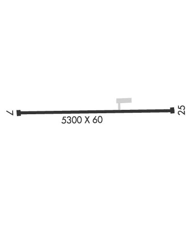
Runway Identifications
Runway Identification: 07/25Length: 5305 ft
Width: 60 ft
Surface: ASPHALT-GOOD CONDITION
Edge lights: Medium IntensityTreatment: NONE
| | Runway: 07 | | Runway: 25 |
| Mag heading: | 75° | Mag heading: | 255° |
| Rwy Slope: | -1.20% Down | Rwy Slope: | 1.20% Up |
| Approach: | | Approach: | |
| Pattern: | Left Traffic | Pattern: | Left Traffic |
| Markings: | BASIC | Markings: | BASIC |
| Marking Condition: | GOOD | Marking Condition: | GOOD |
| Arresting Dev: | | Arresting Dev: | |
| Lat & Long: | N4059.2 W10941.3 | Lat. & Long.: | N4059.2 W10940.1 |
| Elev: | 6178.7 ft. MSL | Elev: | 6115.3 ft. MSL |
| TCH: | | TCH: | |
| Visual Glide Path: | | Visual Glide Path: | |
| Displaced Threshold: | No | Displaced Threshold: | No |
| Touchdown Zone: | YES | Touchdown Zone: | YES |
| Touchdown Elev.: | 6178.7 feet | Touchdown Elev.: | 6141.3 feet |
| Visual Glide Slope: | | Visual Glide Slope: | |
| RVR Equipment: | | RVR Equipment: | |
| RVV Equipment: | NO | RVV Equipment: | NO |
| Approach Lights: | | Approach Lights: | |
| REIL: | NO | REIL: | NO |
| Centerline Lights: | NO | Centerline Lights: | NO |
| Touchdown lights: | NO | Touchdown lights: | NO |
| Runway Category: | Runway with a Visual Approach | Runway Category: | Runway with a Visual Approach |
| Declared Distances: | | Declared Distances: | |
| Obstructions: | HILL | Obstructions: | |
| Marked: | NOT Marked/Lighted | Marked: | |
| Clearance slope: | 20:1 | Clearance slope: | 20:1 |
| Obstruction height: | 21 feet AGL | Obstruction height: | |
| Dist. from runway: | 634 feet | Dist. from runway: | |
| Centerline offset: | | Centerline offset: | |
| Comments: | | Comments: | 15 FT TREES, 50-195 FT DSTC, 75-100 FT R. |

