
| ||||||||||||||||||||||||||||||||
| ||||||||||||||||||||||||||||||||
| Rwy | Rwy | |||||||
| 3299x60 | 3299' | 3299x60 | 3299' | |||||
| Runway ID | Single Wheel | Double Wheel | Double Tandem Wheel | Dual Double Wheel |
| 08/26 | N/A | N/A | N/A | N/A |
| These numbers are Advisory and are not limits. The Airport Manager should have more accurate Weight Limits | ||||
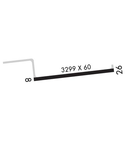 Airport Diagram might not be current. | |
| Facility Name: | BOYCEVILLE MUNI |
| City Name: | BOYCEVILLE |
| County: | DUNN |
| State abbrev: | WI |
| State Name: | WISCONSIN |
| Ownership: | PUBLICLY OWNED |
| Use: | OPEN TO THE PUBLIC |
| Owner's Name: | VILLAGE OF BOYCEVILLE |
| Address: | VILLAGE HALL, PO BOX 368 |
| BOYCEVILLE, WI 54725 | |
| Owner's Phone: | 715-643-2351 |
| Manager's Name: | JOEL TIMBLIN |
| Address: | 735 AIRPORT CAMP PARK RD; EMAIL ADDRESS: JOEL.TIMBLIN@FLYER411.COM (ALL LOWER CASE) |
| BOYCEVILLE, WI 54725 | |
| Phone: | (218) 393-5264 |
| FAA Region: | GREAT LAKES |
| FAA Field Office: | CHI |
| Date | Sunrise | Sunset |
|---|---|---|
| 04/18/24 Thursday | 6:17 | 19:58 |
| 04/19/24 Friday | 6:15 | 20:00 |
| 04/20/24 Saturday | 6:13 | 20:01 |
| 04/21/24 Sunday | 6:12 | 20:02 |
| 04/22/24 Monday | 6:10 | 20:04 |
| 04/23/24 Tuesday | 6:09 | 20:05 |
| 04/24/24 Wednesday | 6:07 | 20:06 |
| 04/25/24 Thursday | 6:05 | 20:07 |
| 04/26/24 Friday | 6:04 | 20:09 |
| 04/27/24 Saturday | 6:02 | 20:10 |
| 04/28/24 Sunday | 6:01 | 20:11 |
| 04/29/24 Monday | 5:59 | 20:12 |
| 04/30/24 Tuesday | 5:58 | 20:14 |
| 05/01/24 Wednesday | 5:56 | 20:15 |
| Airport Attendance Schedule | UNATTND |
| Airport Status | OPERATIONAL (This Status can change at any time - please check NOTAMS) |
| Airport Lighting Schedule | ACTVT REIL RY 26; PAPI RY 08/26; MIRL RY 08/26 - CTAF. |
| Airport Storage Available | Tie Downs |
| Extra Services Available | Flight Instruction |
| Wind Indicator | YES - (lighted) |
| Control Tower | NO |
| CTAF Frequency | 122.800 |
| Unicom Frequency | 122.800 |
| Rotating Beacon Color | WG |
| Segmented Circle | YES |
| Landing Fee | NO |
| Airport Inspected | STATE - performed by STATE AERONAUTICAL PERSONNEL |
| Inspection Date | 07/30/2021 |
| Type of Fuel Available | Grade 100LL; -10FUEL AVBL 24 HRS WITH CREDIT CARD. |
| Airframe Repair Service | MAJOR |
| Power Plant Repair Service | MINOR |
| Latitude | N4502.6 |
| Longitude | W09201.3 (ESTIMATED) |
| Arpt Elevation | 967ft (SURVEYED) |
| Magnetic Variation | 00E |
| 0 miles SE | of BOYCEVILLE |
| Traffic Pattern Altitude | |
| Sectional Chart | GREEN BAY |
| Operations (Reported) | Yearly | Avg. Daily |
|---|---|---|
| General Aviation Transient | 1500 | 4 |
| General Aviation Local | 8800 | 24 |
| Air Taxi | 50 | 0 |
| Commerical | 0 | 0 |
| Commuter | 0 | 0 |
| Military | 400 | 1 |
| Aircraft based on Field | |
|---|---|
| General Aviation Singles | 20 |
| General Aviation Multi | 0 |
| Jet Aircraft | 0 |
| General Aviation Helicopters | 0 |
| Military Aircraft | 0 |
| Gliders | 0 |
| Ultralights | 0 |
| FSS on field | NO |
| FSS tie-in | GREEN BAY |
| FSS Phone | 1-800-WX-BRIEF |
| Who issues Notams | GRB |
| Notam D service at airport | YES |
| ARTCC Name | MINNEAPOLIS |
| Airport Certification | |
| Aircraft Rescue & Firefighting Index | None |
| Airport of Entry | No |
| Custom Landing Rights | No |
| Joint Civil/Military | No |
| Military Landing rights | No |
| NATIONAL PLAN OF INTEGRATED AIRPORT SYSTEMS (NPIAS) |
| DEER ON & INVOF ARPT, PRIMARILY AFTER DUSK. |
| FOR CD CTC MINNEAPOLIS ARTCC AT 651-463-5588. |
Airport Communications & Frequencies:
| |||||||||
| Runway: 08 | Runway: 26 | ||
| Mag heading: | 84° | Mag heading: | 264° |
| Rwy Slope: | .46% Up | Rwy Slope: | -.46% Down |
| Approach: | Approach: | ||
| Pattern: | Left Traffic | Pattern: | Left Traffic |
| Markings: | NONPRECISION INSTRUMENT | Markings: | NONPRECISION INSTRUMENT |
| Marking Condition: | FAIR | Marking Condition: | FAIR |
| Arresting Dev: | Arresting Dev: | ||
| Lat & Long: | N4502.6 W09201.7 | Lat. & Long.: | N4502.7 W09200.9 |
| Elev: | 952.0 ft. MSL | Elev: | 967.1 ft. MSL |
| TCH: | 34 ft. AGL | TCH: | 20 ft. AGL |
| Visual Glide Path: | 4.00 degrees | Visual Glide Path: | 3.00 degrees |
| Displaced Threshold: | No | Displaced Threshold: | No |
| Touchdown Zone: | YES | Touchdown Zone: | YES |
| Touchdown Elev.: | 964.5 feet | Touchdown Elev.: | 967.1 feet |
| Visual Glide Slope: | 2-Light PAPI on LEFT side of Runway | Visual Glide Slope: | 2-Light PAPI on LEFT side of Runway |
| RVR Equipment: | RVR Equipment: | ||
| RVV Equipment: | NO | RVV Equipment: | NO |
| Approach Lights: | Approach Lights: | ||
| REIL: | NO | REIL: | YES |
| Centerline Lights: | NO | Centerline Lights: | NO |
| Touchdown lights: | NO | Touchdown lights: | NO |
| Runway Category: | Runway with a Non-precision Approach | Runway Category: | Runway with a Non-precision Approach |
| Declared Distances: | Declared Distances: |
