
| ||||||||||||||||||||||||||||||||||||||||||||
| ||||||||||||||||||||||||||||||||||||||||||||
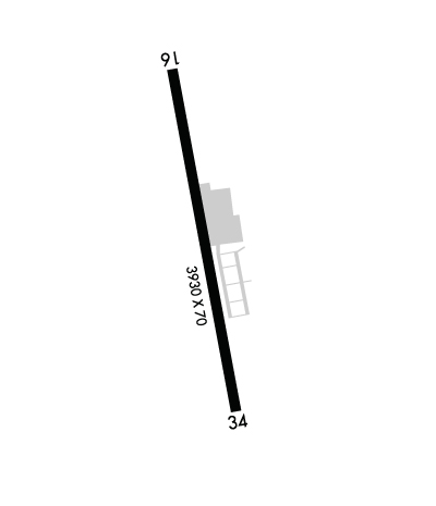
| Rwy | Rwy | |||||||
| 3930x70 | 3148' | 3930x70 | 3306' | |||||
| Runway ID | Single Wheel | Double Wheel | Double Tandem Wheel | Dual Double Wheel |
| 16/34 | 9,000 | N/A | N/A | N/A |
| These numbers are Advisory and are not limits. The Airport Manager should have more accurate Weight Limits | ||||
 Airport Diagram might not be current. | |
| Facility Name: | LAKEWAY AIRPARK |
| City Name: | LAKEWAY |
| County: | TRAVIS |
| State abbrev: | TX |
| State Name: | TEXAS |
| Ownership: | PRIVATELY OWNED |
| Use: | OPEN TO THE PUBLIC |
| Owner's Name: | LAKEWAY AIRPARK INC |
| Address: | 115 FLYING SCOT |
| LAKEWAY, TX 78734 | |
| Owner's Phone: | 512-261-4385 |
| Manager's Name: | AIRPARK BOARD |
| Address: | 115 FLYING SCOT |
| LAKEWAY, TX 78734 | |
| Phone: | 512-261-4385 |
| FAA Region: | SOUTHWEST |
| FAA Field Office: | TEX |
| Date | Sunrise | Sunset |
|---|---|---|
| 04/24/24 Wednesday | 6:54 | 20:06 |
| 04/25/24 Thursday | 6:53 | 20:07 |
| 04/26/24 Friday | 6:53 | 20:07 |
| 04/27/24 Saturday | 6:52 | 20:08 |
| 04/28/24 Sunday | 6:51 | 20:09 |
| 04/29/24 Monday | 6:50 | 20:09 |
| 04/30/24 Tuesday | 6:49 | 20:10 |
| 05/01/24 Wednesday | 6:48 | 20:10 |
| 05/02/24 Thursday | 6:47 | 20:11 |
| 05/03/24 Friday | 6:46 | 20:12 |
| 05/04/24 Saturday | 6:45 | 20:12 |
| 05/05/24 Sunday | 6:44 | 20:13 |
| 05/06/24 Monday | 6:44 | 20:14 |
| 05/07/24 Tuesday | 6:43 | 20:14 |
| Airport Attendance Schedule | UNATTENDED; ARPT CLSD SS-SR. |
| Airport Status | OPERATIONAL (This Status can change at any time - please check NOTAMS) |
| Airport Lighting Schedule | |
| Airport Storage Available | Tie Downs |
| Extra Services Available | NONE |
| Wind Indicator | YES - (unlit) |
| Control Tower | NO |
| CTAF Frequency | 123.000 |
| Unicom Frequency | 123.000 |
| Rotating Beacon Color | |
| Segmented Circle | NO |
| Landing Fee | YES; LNDG FEE FOR TURBINES & JETS. OVNGT TIEDOWN FEE. |
| Airport Inspected | STATE - performed by PRIVATE CONTRACT PERSONNEL |
| Inspection Date | 06/07/2023 |
| Type of Fuel Available | Grade 100LL; -10FUEL SELF-SVC. |
| Airframe Repair Service | None |
| Power Plant Repair Service | None |
| Latitude | N3021.4 |
| Longitude | W09759.7 (ESTIMATED) |
| Arpt Elevation | 909ft (SURVEYED) |
| Magnetic Variation | 04E |
| 2 miles SW | of LAKEWAY |
| Traffic Pattern Altitude | |
| Sectional Chart | SAN ANTONIO |
| Operations (Reported) | Yearly | Avg. Daily |
|---|---|---|
| General Aviation Transient | 3000 | 8 |
| General Aviation Local | 6000 | 16 |
| Air Taxi | 0 | 0 |
| Commerical | 0 | 0 |
| Commuter | 0 | 0 |
| Military | 0 | 0 |
| Aircraft based on Field | |
|---|---|
| General Aviation Singles | 55 |
| General Aviation Multi | 3 |
| Jet Aircraft | 0 |
| General Aviation Helicopters | 0 |
| Military Aircraft | 0 |
| Gliders | 0 |
| Ultralights | 0 |
| FSS on field | NO |
| FSS tie-in | SAN ANGELO |
| FSS Phone | 1-800-WX-BRIEF |
| Who issues Notams | SJT |
| Notam D service at airport | YES |
| ARTCC Name | HOUSTON |
| Airport Certification | |
| Aircraft Rescue & Firefighting Index | None |
| Airport of Entry | No |
| Custom Landing Rights | No |
| Joint Civil/Military | No |
| Military Landing rights | No |
| NO TGLS. NO LOW PASSES |
| MNTN RWY HDG TIL 1 MI & 400 FT AGL (1300 FT MSL) FOR NOISE ABATEMENT. |
| BLDGS, TREES & PARKED ACFT NEAR RWY. |
| 2-WAY RADIO COM RQRD ON CTAF. |
| 3 FT NON-FRANGIBLE SIGNS 10 FT FM RWY EDGE AT DSPLCD THR, BOTH SIDES. |
| FOR CD CTC AUSTIN APCH AT 512-369-7865. |
| NO COML OPNS PER CITY ORDINANCE. |
| RWY 34, 30 FT MKD PWR LINES ACRS APCH 155 FT DSTC. |
| RWY 34, 30 FT MKD ELEC TMTN LINES CRS THRU APCH 200 FT DSTC. |
| NO NGT OPNS PER CITY ORDINANCE. |
| ARPT WX SR-SS CLICK MIKE 5X ON CTAF. |
| DEER ON & INVOF ARPT. |
| NUMEROUS OBJECTS IN PRIM SFC. |
| ARPT OPNS LTD TO ACFT WITH MAX GWT OF 12500 LBS OR LESS BY CITY ORDINANCE.. |
| ULTRALIGHT AND GLIDER OPNS PROHIBITED. |
| RWY 16/3 4 RWY RISES FM S TO N 32 FT. ACFT NOT VISIBLE AT OPPOSITE END. |
Airport Communications & Frequencies:
| ||||||||||||||
| Runway: 16 | Runway: 34 | ||
| Mag heading: | 165° | Mag heading: | 345° |
| Rwy Slope: | .68% Up | Rwy Slope: | -.68% Down |
| Approach: | Approach: | ||
| Pattern: | Left Traffic | Pattern: | Left Traffic |
| Markings: | BASIC | Markings: | BASIC |
| Marking Condition: | GOOD | Marking Condition: | GOOD |
| Arresting Dev: | Arresting Dev: | ||
| Lat & Long: | N3021.8 W09759.7 | Lat. & Long.: | N3021.1 W09759.6 |
| Elev: | 882.4 ft. MSL | Elev: | 909.3 ft. MSL |
| TCH: | TCH: | ||
| Visual Glide Path: | Visual Glide Path: | ||
| Displaced Threshold: | 782 feet | Displaced Threshold: | 624 feet |
| Touchdown Zone: | YES | Touchdown Zone: | YES |
| Touchdown Elev.: | 902.8 feet | Touchdown Elev.: | 909.3 feet |
| Visual Glide Slope: | Visual Glide Slope: | ||
| RVR Equipment: | RVR Equipment: | ||
| RVV Equipment: | NO | RVV Equipment: | NO |
| Approach Lights: | Approach Lights: | ||
| REIL: | NO | REIL: | NO |
| Centerline Lights: | NO | Centerline Lights: | NO |
| Touchdown lights: | NO | Touchdown lights: | NO |
| Runway Category: | Runway with a Non-precision Approach | Runway Category: | Runway with a Visual Approach |
| Declared Distances: | Declared Distances: | ||
| Obstructions: | TREE | Obstructions: | TREES |
| Marked: | NOT Marked/Lighted | Marked: | NOT Marked/Lighted |
| Clearance slope: | APCH RATIO 0:1 TO DSPLCD THR OVR 40 FT TREE, 0 FT DSTC, 150 FT L. | Clearance slope: | APCH SLOPE 0:1 TO DSPLCD THR OVR 27 FT BLDG 166 FT R & 42 FT TREES 208 FT L 0 FT DSTC, |
| Obstruction height: | 30 feet AGL | Obstruction height: | 34 feet AGL |
| Dist. from runway: | 205 feet | Dist. from runway: | 201 feet |
| Centerline offset: | Centerline offset: | ||
| Comments: | 3 FT BANK 70 FT R OF CNTRLN 0-199 FT DSTC. | Comments: | 34 FT TREES 75--200 FT DSTC ACRS APCH. |
