
| ||||||
|
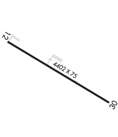
| Rwy | Rwy | |||||||
| 4402x75 | 4402' | 4402x75 | 4402' | |||||
| Runway ID | Single Wheel | Double Wheel | Double Tandem Wheel | Dual Double Wheel |
| 12/30 | 6,000 | N/A | N/A | N/A |
| These numbers are Advisory and are not limits. The Airport Manager should have more accurate Weight Limits | ||||
 Airport Diagram might not be current. | |
| Facility Name: | HART |
| City Name: | MANY |
| County: | SABINE |
| State abbrev: | LA |
| State Name: | LOUISIANA |
| Ownership: | PUBLICLY OWNED |
| Use: | OPEN TO THE PUBLIC |
| Owner's Name: | CITY OF MANY |
| Address: | PO BOX 1330 |
| MANY, LA 71449 | |
| Owner's Phone: | 318-256-3651 |
| Manager's Name: | MILES GREER |
| Address: | 950 AIRPORT RD |
| MANY, LA 71449 | |
| Phone: | 318-256-5857 |
| FAA Region: | SOUTHWEST |
| FAA Field Office: | LNM |
| Date | Sunrise | Sunset |
|---|---|---|
| 04/18/24 Thursday | 6:41 | 19:45 |
| 04/19/24 Friday | 6:40 | 19:46 |
| 04/20/24 Saturday | 6:39 | 19:47 |
| 04/21/24 Sunday | 6:38 | 19:47 |
| 04/22/24 Monday | 6:37 | 19:48 |
| 04/23/24 Tuesday | 6:36 | 19:49 |
| 04/24/24 Wednesday | 6:35 | 19:49 |
| 04/25/24 Thursday | 6:34 | 19:50 |
| 04/26/24 Friday | 6:33 | 19:51 |
| 04/27/24 Saturday | 6:32 | 19:52 |
| 04/28/24 Sunday | 6:31 | 19:52 |
| 04/29/24 Monday | 6:30 | 19:53 |
| 04/30/24 Tuesday | 6:29 | 19:54 |
| 05/01/24 Wednesday | 6:28 | 19:54 |
| Airport Attendance Schedule | UNATTENDED |
| Airport Status | OPERATIONAL (This Status can change at any time - please check NOTAMS) |
| Airport Lighting Schedule | DUSK-DAWN. MIRL RY 12/30, REIL RYS 12 & 30 PRESET LOW INTST DUSK-DAWN; TO INCR INTST ACTVT - CTAF. |
| Airport Storage Available | Tie Downs |
| Extra Services Available | Flight Instruction |
| Wind Indicator | YES - (lighted) |
| Control Tower | NO |
| CTAF Frequency | 122.800 |
| Unicom Frequency | 122.800 |
| Rotating Beacon Color | WG; BCN LCTD .44 MI FM APCH END RWY 12. |
| Segmented Circle | NO |
| Landing Fee | NO |
| Airport Inspected | STATE - performed by STATE AERONAUTICAL PERSONNEL |
| Inspection Date | 01/30/2024 |
| Type of Fuel Available | Grade 100LL; -10SELF SERVICE FUEL AVBL AFT HRS WITH CREDIT CARD. |
| Airframe Repair Service | NONE |
| Power Plant Repair Service | NONE |
| Latitude | N3132.7 |
| Longitude | W09329.0 (ESTIMATED) |
| Arpt Elevation | 318ft (SURVEYED) |
| Magnetic Variation | 04E |
| 2 miles SW | of MANY |
| Traffic Pattern Altitude | |
| Sectional Chart | HOUSTON |
| Operations (Reported) | Yearly | Avg. Daily |
|---|---|---|
| General Aviation Transient | 3000 | 8 |
| General Aviation Local | 2000 | 5 |
| Air Taxi | 0 | 0 |
| Commerical | 0 | 0 |
| Commuter | 0 | 0 |
| Military | 100 | 0 |
| Aircraft based on Field | |
|---|---|
| General Aviation Singles | 9 |
| General Aviation Multi | 1 |
| Jet Aircraft | 0 |
| General Aviation Helicopters | 0 |
| Military Aircraft | 0 |
| Gliders | 0 |
| Ultralights | 0 |
| FSS on field | NO |
| FSS tie-in | DE RIDDER |
| FSS Phone | 1-800-WX-BRIEF |
| Who issues Notams | DRI |
| Notam D service at airport | YES |
| ARTCC Name | HOUSTON |
| Airport Certification | |
| Aircraft Rescue & Firefighting Index | None |
| Airport of Entry | No |
| Custom Landing Rights | No |
| Joint Civil/Military | No |
| Military Landing rights | YES |
| NATIONAL PLAN OF INTEGRATED AIRPORT SYSTEMS (NPIAS) |
| GRANT AGREEMENTS UNDER FAAP/ADAP/AIP |
| ASSURANCES PURSUANT TO TITLE VI, CIVIL RIGHTS ACT OF 1964 |
| GCO AVBL ON FREQ 135.075 THRU POLK APCH AND DE RIDDER FSS. |
| FOR CD CTC IF UNA VIA GCO CTC POLK APCH AT 337-531-2352. |
Airport Communications & Frequencies:
| ||||||||||||||
| Runway: 12 | Runway: 30 | ||
| Mag heading: | 117° | Mag heading: | 297° |
| Rwy Slope: | -.25% Down | Rwy Slope: | .25% Up |
| Approach: | Approach: | ||
| Pattern: | Left Traffic | Pattern: | Left Traffic |
| Markings: | NONPRECISION INSTRUMENT | Markings: | NONPRECISION INSTRUMENT |
| Marking Condition: | FAIR | Marking Condition: | FAIR |
| Arresting Dev: | Arresting Dev: | ||
| Lat & Long: | N3132.8 W09329.4 | Lat. & Long.: | N3132.5 W09328.7 |
| Elev: | 318.3 ft. MSL | Elev: | 307.2 ft. MSL |
| TCH: | 50 ft. AGL | TCH: | 56 ft. AGL |
| Visual Glide Path: | 3.00 degrees | Visual Glide Path: | 3.50 degrees |
| Displaced Threshold: | No | Displaced Threshold: | No |
| Touchdown Zone: | YES | Touchdown Zone: | YES |
| Touchdown Elev.: | 318.5 feet | Touchdown Elev.: | 310.8 feet |
| Visual Glide Slope: | 2-Light PAPI on LEFT side of Runway | Visual Glide Slope: | 2-Light PAPI on LEFT side of Runway |
| RVR Equipment: | RVR Equipment: | ||
| RVV Equipment: | NO | RVV Equipment: | NO |
| Approach Lights: | Approach Lights: | ||
| REIL: | YES | REIL: | YES |
| Centerline Lights: | NO | Centerline Lights: | NO |
| Touchdown lights: | NO | Touchdown lights: | NO |
| Runway Category: | Runway with a Non-precision Approach | Runway Category: | Runway with a Non-precision Approach |
| Declared Distances: | Declared Distances: | ||
| Obstructions: | TREES | Obstructions: | TREES |
| Marked: | NOT Marked/Lighted | Marked: | NOT Marked/Lighted |
| Clearance slope: | 38:1 | Clearance slope: | 20:1 |
| Obstruction height: | 38 feet AGL | Obstruction height: | 78 feet AGL |
| Dist. from runway: | 1681 feet | Dist. from runway: | 1830 feet |
| Centerline offset: | 227 right of centerline | Centerline offset: | |
| Comments: | Comments: |
