
| ||||||||||||||||||||||||||||||||
| ||||||||||||||||||||||||||||||||
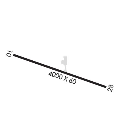
| Rwy | Rwy | |||||||
| 4001x60 | 4001' | 4001x60 | 4001' | |||||
| Runway ID | Single Wheel | Double Wheel | Double Tandem Wheel | Dual Double Wheel |
| 10/28 | 12,500 | N/A | N/A | N/A |
| These numbers are Advisory and are not limits. The Airport Manager should have more accurate Weight Limits | ||||
| FltPlan does not have IFR approach charts available for K3P3. |
 Airport Diagram might not be current. | |
| Facility Name: | MOTT MUNI |
| City Name: | MOTT |
| County: | HETTINGER |
| State abbrev: | ND |
| State Name: | NORTH DAKOTA |
| Ownership: | PUBLICLY OWNED |
| Use: | OPEN TO THE PUBLIC |
| Owner's Name: | MOTT AIRPORT AUTHORITY; OWEN BLICKENSDERFER CHRMN APT AUTH 701-567-3861. |
| Address: | 406 MEADOW LANE |
| MOTT, ND 58646 | |
| Owner's Phone: | 701-260-3525 |
| Manager's Name: | DEREK MAYER; ADDL CTC DEREK MAYER 701-260-3525. |
| Address: | 406 MEADOW LANE |
| MOTT, ND 58646 | |
| Phone: | 701-824-2030 |
| FAA Region: | GREAT LAKES |
| FAA Field Office: | DMA |
| Date | Sunrise | Sunset |
|---|---|---|
| 04/25/24 Thursday | 5:44 | 19:51 |
| 04/26/24 Friday | 5:42 | 19:53 |
| 04/27/24 Saturday | 5:40 | 19:54 |
| 04/28/24 Sunday | 5:39 | 19:55 |
| 04/29/24 Monday | 5:37 | 19:57 |
| 04/30/24 Tuesday | 5:36 | 19:58 |
| 05/01/24 Wednesday | 5:34 | 19:59 |
| 05/02/24 Thursday | 5:33 | 20:01 |
| 05/03/24 Friday | 5:31 | 20:02 |
| 05/04/24 Saturday | 5:30 | 20:03 |
| 05/05/24 Sunday | 5:28 | 20:04 |
| 05/06/24 Monday | 5:27 | 20:06 |
| 05/07/24 Tuesday | 5:25 | 20:07 |
| 05/08/24 Wednesday | 5:24 | 20:08 |
| Airport Attendance Schedule | UNATTENDED |
| Airport Status | OPERATIONAL (This Status can change at any time - please check NOTAMS) |
| Airport Lighting Schedule | ACTVT PAPI RWY 10 & 28; MIRL RWY 10/28 - CTAF. |
| Airport Storage Available | Tie Downs, Hanger |
| Extra Services Available | Crop Dusting |
| Wind Indicator | YES - (lighted) |
| Control Tower | NO |
| CTAF Frequency | 122.900 |
| Unicom Frequency | |
| Rotating Beacon Color | WG |
| Segmented Circle | YES |
| Landing Fee | NO |
| Airport Inspected | STATE - performed by STATE AERONAUTICAL PERSONNEL |
| Inspection Date | 08/03/2023 |
| Type of Fuel Available | Grade 100LL; -10SELF SVC FUEL AVBL H24 VIA CREDIT CARD. |
| Airframe Repair Service | NONE |
| Power Plant Repair Service | NONE |
| Latitude | N4621.5 |
| Longitude | W10219.7 (ESTIMATED) |
| Arpt Elevation | 2413ft (SURVEYED) |
| Magnetic Variation | 11E |
| 1 miles S | of MOTT |
| Traffic Pattern Altitude | |
| Sectional Chart | BILLINGS |
| Operations (Reported) | Yearly | Avg. Daily |
|---|---|---|
| General Aviation Transient | 600 | 2 |
| General Aviation Local | 1200 | 3 |
| Air Taxi | 50 | 0 |
| Commerical | 0 | 0 |
| Commuter | 0 | 0 |
| Military | 100 | 0 |
| Aircraft based on Field | |
|---|---|
| General Aviation Singles | 12 |
| General Aviation Multi | 0 |
| Jet Aircraft | 0 |
| General Aviation Helicopters | 0 |
| Military Aircraft | 0 |
| Gliders | 0 |
| Ultralights | 0 |
| FSS on field | NO |
| FSS tie-in | GRAND FORKS |
| FSS Phone | 1-800-WX-BRIEF |
| Who issues Notams | GFK |
| Notam D service at airport | YES |
| ARTCC Name | MINNEAPOLIS |
| Airport Certification | |
| Aircraft Rescue & Firefighting Index | None |
| Airport of Entry | No |
| Custom Landing Rights | No |
| Joint Civil/Military | No |
| Military Landing rights | YES |
| NATIONAL PLAN OF INTEGRATED AIRPORT SYSTEMS (NPIAS) |
| GRANT AGREEMENTS UNDER FAAP/ADAP/AIP |
| ASSURANCES PURSUANT TO TITLE VI, CIVIL RIGHTS ACT OF 1964 |
| +100 FT TWR - L ON FARMSTEAD 1800 FT R OF RWY 28 THR. |
| VFY WINTER CONDS CALL 701-260-2535 OR 701-824-2163. |
| DEER ON & INVOF ARPT. |
| FOR CD CTC MINNEAPOLIS ARTCC AT 651-463-5588. |
| Runway: 10 | Runway: 28 | ||
| Mag heading: | 95° | Mag heading: | 275° |
| Rwy Slope: | .01% Up | Rwy Slope: | -.01% Down |
| Approach: | Approach: | ||
| Pattern: | Left Traffic | Pattern: | Left Traffic |
| Markings: | NONPRECISION INSTRUMENT | Markings: | NONPRECISION INSTRUMENT |
| Marking Condition: | GOOD | Marking Condition: | GOOD |
| Arresting Dev: | Arresting Dev: | ||
| Lat & Long: | N4621.6 W10220.2 | Lat. & Long.: | N4621.5 W10219.2 |
| Elev: | 2410.3 ft. MSL | Elev: | 2410.6 ft. MSL |
| TCH: | 27 ft. AGL | TCH: | 28 ft. AGL |
| Visual Glide Path: | 3.00 degrees | Visual Glide Path: | 3.00 degrees |
| Displaced Threshold: | No | Displaced Threshold: | No |
| Touchdown Zone: | YES | Touchdown Zone: | YES |
| Touchdown Elev.: | 2413.9 feet | Touchdown Elev.: | 2413.9 feet |
| Visual Glide Slope: | 2-Light PAPI on LEFT side of Runway | Visual Glide Slope: | 2-Light PAPI on LEFT side of Runway |
| RVR Equipment: | RVR Equipment: | ||
| RVV Equipment: | NO | RVV Equipment: | NO |
| Approach Lights: | Approach Lights: | ||
| REIL: | NO | REIL: | NO |
| Centerline Lights: | NO | Centerline Lights: | NO |
| Touchdown lights: | NO | Touchdown lights: | NO |
| Runway Category: | Runway with a Visual Approach | Runway Category: | Runway with a Visual Approach |
| Declared Distances: | Declared Distances: |
