Click here for more info on on SMS!

K3M7

LAFAYETTE MUNI
LAFAYETTE
TN
Time Zone: Central
Lat: N 3631.2
Long: W 08603.5
Elev: 969
Var: +02
Longest Runway: 5200
CTAF: 122.8

FBO & Flight Services info for K3M7

FBOs: Update your Fuel Prices

SKY CHASER AVPh: 615-666-6542
-
Freq: 122.8
Service
Jet
100LL
SAF
MoGas
Fuel Avail: 24 hours No call out fees!
Full3.994.89    Last Update: 04/19/2024 17:54

Self3.994.89    
 Address: 1000 AIRPORT RD   LAFAYETTR, TN 37083
If you are an FBO, call 1-203-262-1700 to update your info or email: FltPlan.Advertising@garmin.com
Advertise your FBO on FltPlan.com

Runway & Approach Info for K3M7
Rwy
Length
Land Dist**
Approach*
  Rwy
Length
Land Dist**
Approach*
01
5200x75  5000'          
 
  
19
  5200x75  5200'          
 
 * only ILS, LOC, LDA, and SDF approaches to a specific runway are shown
** For any Declared Landing Distance Available, please see A/FD or Approach plates
Runway Weight Capability (lbs.) Help
Runway IDSingle WheelDouble WheelDouble Tandem WheelDual Double Wheel
01/1921,00031,000N/AN/A
These numbers are Advisory and are not limits.   The Airport Manager should have more accurate Weight Limits
Approach Charts
Approaches    
Current Weather/Notams
Customs Information Send updates to Support@FltPlan.com
Customs Not Available
Database effective 05/16/2024
Airport Diagram of K3M7
Airport Diagram might not be current.

Facility Name: LAFAYETTE MUNI
City Name: LAFAYETTE
County: MACON
State abbrev: TN
State Name: TENNESSEE
   
Ownership: PUBLICLY OWNED
Use: OPEN TO THE PUBLIC
Owner's Name: CITY OF LAFAYETTE
Address: CITY HALL
 LAFAYETTE, TN 37083
Owner's Phone: 615-666-2194
  
Manager's Name: RICHARD THOMAS
Address: 1000 AIRPORT RD
 LAFAYETTE, TN 37083
Phone: 615-666-6542
   
FAA Region: SOUTHERN
FAA Field Office: MEM


Sunrise / Sunset times for LAFAYETTE MUNI

DateSunriseSunset
04/24/24 Wednesday5:5819:27
04/25/24 Thursday5:5719:28
04/26/24 Friday5:5619:29
04/27/24 Saturday5:5419:30
04/28/24 Sunday5:5319:30
04/29/24 Monday5:5219:31
04/30/24 Tuesday5:5119:32
05/01/24 Wednesday5:5019:33
05/02/24 Thursday5:4919:34
05/03/24 Friday5:4819:35
05/04/24 Saturday5:4719:36
05/05/24 Sunday5:4619:37
05/06/24 Monday5:4519:37
05/07/24 Tuesday5:4419:38

Airport Facilities

Airport Attendance ScheduleMON-FRI 0830-1500, SAT 0830-1200
Airport Status OPERATIONAL (This Status can change at any time - please check NOTAMS)
Airport Lighting ScheduleSS-SR
Airport Storage AvailableTie Downs
Extra Services AvailableFlight Instruction
Wind IndicatorYES - (lighted)
Control TowerNO
CTAF Frequency122.800
Unicom Frequency122.800
Rotating Beacon ColorWG
Segmented CircleYES
Landing FeeNO

Airport Inspection Data

Airport InspectedSTATE - performed by STATE AERONAUTICAL PERSONNEL
Inspection Date06/04/2021

Airport Services

Type of Fuel AvailableGrade 100LL, JET A; -10CREDIT CARD SVC H24 AVBL.
Airframe Repair ServiceMINOR
Power Plant Repair ServiceMINOR

Geographic Data

LatitudeN3631.2
LongitudeW08603.5 (ESTIMATED)
Arpt Elevation969ft (SURVEYED)
Magnetic Variation02W
2 miles Wof LAFAYETTE
Traffic Pattern Altitude
Sectional ChartST LOUIS

Aircraft Data

Operations (Reported)YearlyAvg. Daily
General Aviation Transient 500014
General Aviation Local 500014
Air Taxi 1000
Commerical 00
Commuter 00
Military 2401
Aircraft based on Field
General Aviation Singles 23
General Aviation Multi 3
Jet Aircraft 0
General Aviation Helicopters 1
Military Aircraft 0
Gliders 0
Ultralights 0

FAA Services

FSS on field NO
FSS tie-in NASHVILLE
FSS Phone 1-800-WX-BRIEF
Who issues Notams BNA
Notam D service at airport YES
ARTCC Name MEMPHIS

Federal Status

Airport Certification
Aircraft Rescue & Firefighting IndexNone
Airport of EntryNo
Custom Landing RightsNo
Joint Civil/MilitaryNo
Military Landing rightsYES

Federal Agreements

NATIONAL PLAN OF INTEGRATED AIRPORT SYSTEMS (NPIAS)
GRANT AGREEMENTS UNDER FAAP/ADAP/AIP
ASSURANCES PURSUANT TO TITLE VI, CIVIL RIGHTS ACT OF 1964

Remarks

FOR CD CTC NASHVILLE APCH AT 615-695-4522.
Airport Communications & Frequencies:
CTAF Frequency:
122.800
Unicom Frequency:
122.800
NASHVILLE Primary Approach Frequencies:  
118.4
360.7
NASHVILLE Primary Departure Frequencies:  
118.4
360.7
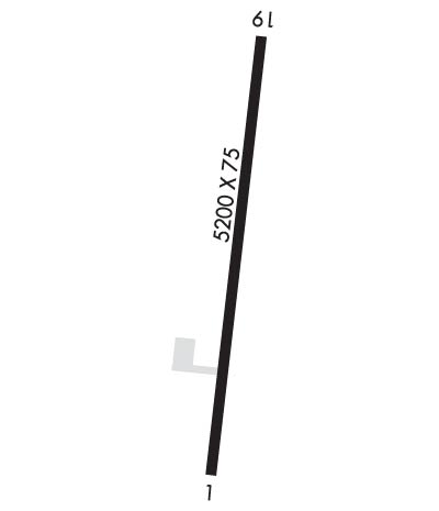
Runway Identifications
Runway Identification: 01/19
Length: 5200 ft
Width: 75 ft
Surface: ASPHALT
Edge lights: Medium Intensity

Treatment: NONE
Weight: PCN 11 /F/C/X/T

 Runway: 01   Runway: 19
Mag heading: Mag heading: 188°
Rwy Slope: -.45% DownRwy Slope: .45% Up
Approach: Approach:
Pattern: Left TrafficPattern: Left Traffic
Markings: BASICMarkings: BASIC
Marking Condition: GOODMarking Condition: GOOD
Arresting Dev: Arresting Dev:
Lat & Long: N3630.8  W08603.5Lat. & Long.: N3631.6  W08603.4
Elev: 969.0 ft. MSLElev: 945.4 ft. MSL
TCH: 37 ft. AGLTCH: 40 ft. AGL
Visual Glide Path: 3.50 degreesVisual Glide Path: 3.00 degrees
Displaced Threshold: 200 feetDisplaced Threshold: No
Touchdown Zone: YESTouchdown Zone: YES
Touchdown Elev.: 969.0 feetTouchdown Elev.: 961.0 feet
Visual Glide Slope: 2-Light PAPI on LEFT side of RunwayVisual Glide Slope: 2-Light PAPI on LEFT side of Runway
RVR Equipment: RVR Equipment:
RVV Equipment: NORVV Equipment: NO
Approach Lights: Approach Lights:
REIL: YESREIL: YES
Centerline Lights: NOCenterline Lights: NO
Touchdown lights: NOTouchdown lights: NO
Runway Category: Runway with a Non-precision Approach having visibility minimums greater than 3/4 mileRunway Category: Runway with a Non-precision Approach having visibility minimums greater than 3/4 mile
Declared Distances: TORA:5200' TODA:5200' ASDA:5200' LDA:5000'Declared Distances: TORA:5200' TODA:5200' ASDA:5000' LDA:5000'
Obstructions: TREEObstructions: TREE
Marked: NOT Marked/LightedMarked: NOT Marked/Lighted
Clearance slope: 22:1; 25:1 FM DTHR.Clearance slope: 24:1
Obstruction height: 149 feet AGLObstruction height: 32 feet AGL
Dist. from runway: 3335 feetDist. from runway: 973 feet
Centerline offset: 311 left of centerlineCenterline offset: 96 feet left of centerline
Comments: Comments:
C:1/P: