Click here for more info on on SMS!

K3J0

HAMPTON COUNTY AIRPORT
HAMPTON
SC
Time Zone: Eastern
Lat: N 3252.0
Long: W 08104.9
Elev: 112
Var: +04
Longest Runway: 3601
CTAF: 122.9

FBO & Flight Services info for K3J0

FBOs: Update your Fuel Prices

AIRPORTPh: 803-942-3369
-
Freq: 122.9
Service
Jet
100LL
SAF
MoGas
Fuel Avail: Self Service 100LL and JET
Full        Last Update: 04/19/2024 14:38

Self5.385.38    
 Address: 745 AIRPORT ROAD VARNVILLE, SC 29944
If you are an FBO, call 1-203-262-1700 to update your info or email: FltPlan.Advertising@garmin.com
Advertise your FBO on FltPlan.com

Runway & Approach Info for K3J0
Rwy
Length
Land Dist**
Approach*
  Rwy
Length
Land Dist**
Approach*
11
3601x60  3601'          
 
  
29
  3601x60  3601'          
 
 * only ILS, LOC, LDA, and SDF approaches to a specific runway are shown
** For any Declared Landing Distance Available, please see A/FD or Approach plates
Runway Weight Capability (lbs.) Help
Runway IDSingle WheelDouble WheelDouble Tandem WheelDual Double Wheel
11/298,000N/AN/AN/A
These numbers are Advisory and are not limits.   The Airport Manager should have more accurate Weight Limits
Approach Charts
FltPlan does not have IFR approach charts available for K3J0.
Current Weather/Notams
Customs Information Send updates to Support@FltPlan.com
Customs Not Available
Database effective 04/18/2024
Airport Diagram of K3J0
Airport Diagram might not be current.

Facility Name: HAMPTON COUNTY
City Name: HAMPTON
County: HAMPTON
State abbrev: SC
State Name: SOUTH CAROLINA
   
Ownership: PUBLICLY OWNED
Use: OPEN TO THE PUBLIC
Owner's Name: HAMPTON COUNTY
Address: 201 JACKSON AVENUE WEST
 HAMPTON, SC 29924
Owner's Phone: 803-914-2100
  
Manager's Name: DOBIE HIERS; DOBIE HIERS 803-942-2702
Address: 201 JACKSON AVENUE W
 HAMPTON, SC 29924
Phone: (803) 942-2702
   
FAA Region: SOUTHERN
FAA Field Office: ATL


Sunrise / Sunset times for HAMPTON COUNTY

DateSunriseSunset
04/19/24 Friday6:4919:58
04/20/24 Saturday6:4819:59
04/21/24 Sunday6:4719:59
04/22/24 Monday6:4620:00
04/23/24 Tuesday6:4520:01
04/24/24 Wednesday6:4320:02
04/25/24 Thursday6:4220:02
04/26/24 Friday6:4120:03
04/27/24 Saturday6:4020:04
04/28/24 Sunday6:3920:05
04/29/24 Monday6:3820:05
04/30/24 Tuesday6:3720:06
05/01/24 Wednesday6:3620:07
05/02/24 Thursday6:3520:08

Airport Facilities

Airport Attendance ScheduleMON-FRI 0800-1700, SAT 0830-1700, SUN 1200-1700
Airport Status OPERATIONAL (This Status can change at any time - please check NOTAMS)
Airport Lighting Schedule
Airport Storage AvailableTie Downs
Extra Services AvailableNONE
Wind IndicatorYES - (lighted)
Control TowerNO
CTAF Frequency122.900
Unicom Frequency
Rotating Beacon Color
Segmented CircleNO
Landing FeeNO

Airport Inspection Data

Airport InspectedSTATE - performed by STATE AERONAUTICAL PERSONNEL
Inspection Date05/26/2023

Airport Services

Type of Fuel AvailableGrade 100LL, JET A (freeze point -40C); -10100LL & JET A FUEL ABL 24 HRS SELF SVC WITH CREDIT CARD.
Airframe Repair ServiceNONE
Power Plant Repair ServiceNONE

Geographic Data

LatitudeN3252.0
LongitudeW08104.9 (ESTIMATED)
Arpt Elevation112ft (SURVEYED)
Magnetic Variation04W
1 miles Eof HAMPTON
Traffic Pattern Altitude
Sectional ChartCHARLOTTE

Aircraft Data

Operations (Reported)YearlyAvg. Daily
General Aviation Transient 3431
General Aviation Local 570
Air Taxi 00
Commerical 00
Commuter 00
Military 00
Aircraft based on Field
General Aviation Singles 19
General Aviation Multi 0
Jet Aircraft 0
General Aviation Helicopters 0
Military Aircraft 0
Gliders 0
Ultralights 0

FAA Services

FSS on field NO
FSS tie-in ANDERSON
FSS Phone 1-800-WX-BRIEF
Who issues Notams AND
Notam D service at airport YES
ARTCC Name JACKSONVILLE

Federal Status

Airport Certification
Aircraft Rescue & Firefighting IndexNone
Airport of EntryNo
Custom Landing RightsNo
Joint Civil/MilitaryNo
Military Landing rightsYES

Remarks

MARKED WATER TANK APRXLY 680 FT FROM RY 29.
FOR CD CTC JACKSONVILLE ARTCC AT 904-845-1592.
Runway Identifications
Runway Identification: 11/29
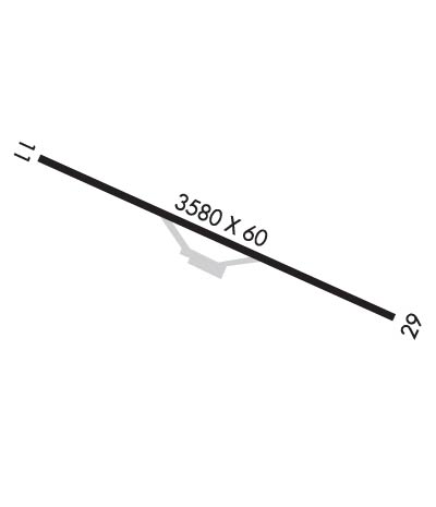
Length: 3601 ft
Width: 60 ft
Surface: ASPHALT-FAIR CONDITION
Edge lights:

Treatment: NONE

 Runway: 11   Runway: 29
Mag heading: 114°Mag heading: 294°
Rwy Slope: .14% UpRwy Slope: -.14% Down
Approach: Approach:
Pattern: Left TrafficPattern: Left Traffic
Markings: BASICMarkings: BASIC
Marking Condition: GOODMarking Condition: GOOD
Arresting Dev: Arresting Dev:
Lat & Long: N3252.1  W08105.2Lat. & Long.: N3251.9  W08104.5
Elev: 106.5 ft. MSLElev: 111.4 ft. MSL
TCH: TCH:
Visual Glide Path: Visual Glide Path:
Displaced Threshold: NoDisplaced Threshold: No
Touchdown Zone: YESTouchdown Zone: YES
Touchdown Elev.: 112.1 feetTouchdown Elev.: 112.1 feet
Visual Glide Slope: Visual Glide Slope:
RVR Equipment: RVR Equipment:
RVV Equipment: NORVV Equipment: NO
Approach Lights: Approach Lights:
REIL: NOREIL: NO
Centerline Lights: NOCenterline Lights: NO
Touchdown lights: NOTouchdown lights: NO
Runway Category: Runway with a Visual ApproachRunway Category: Runway with a Visual Approach
Declared Distances: Declared Distances:
Obstructions: TREEObstructions: TREE
Marked: NOT Marked/LightedMarked: NOT Marked/Lighted
Clearance slope: 11:1Clearance slope: 9:1
Obstruction height: 77 feet AGLObstruction height: 100 feet AGL
Dist. from runway: 1057 feetDist. from runway: 1184 feet
Centerline offset: 158 left of centerlineCenterline offset: 96 feet right of centerline
Comments: Comments: OFF RWY 29, A YELLOW PROPERTY POST 100' FM. THLD. AND 35' LEFT OF CNTRL. ALSO A 20' POWER POLE 145' FM. THLD. AND 75' LEFT OF CNTRL. ALSO A 23' TREE 131' FM. THLD. AND 66' LEFT OF CNTRL.
C:1/P: