Current Weather/Notams (Metars, TAFs, Notams, NWS Forecast, PIREPS, and nearby weather)
Customs Information Send updates to Support@FltPlan.com
Customs Not Available
Database effective 04/18/2024
Airport Diagram might not be current.
|
| Facility Name: | HOBART SKY RANCH |
| City Name: | HOBART |
| County: | LAKE |
| State abbrev: | IN |
| State Name: | INDIANA |
| | |
| Ownership: | PRIVATELY OWNED |
| Use: | OPEN TO THE PUBLIC |
| Owner's Name: | DON NIEMEYER |
| Address: | 3600 N LAKE PARK AVENUE |
| | HOBART, IN 46342 |
| Owner's Phone: | 219-962-3020 |
| | |
| Manager's Name: | DON NIEMEYER |
| Address: | 3600 N LAKE PARK AVENUE |
| | HOBART, IN 46342 |
| Phone: | 219-962-3020 |
| | |
| FAA Region: | GREAT LAKES |
| FAA Field Office: | CHI |
Runway Identifications
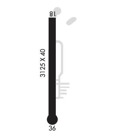
Runway Identification: 18/36Length: 3125 ft
Width: 40 ft
Surface: ASPHALT-FAIR CONDITION
Edge lights: Treatment: NONE
| | Runway: 18 | | Runway: 36 |
| Mag heading: | 181° | Mag heading: | 1° |
| Rwy Slope: | .00% Up | Rwy Slope: | .00% Down |
| Approach: | | Approach: | |
| Pattern: | Left Traffic | Pattern: | Left Traffic |
| Markings: | NONSTANDARD | Markings: | BASIC |
| Marking Condition: | POOR; NUMBERING SMALLER THAN STD & OFFSET TO L SIDE OF RWY. NON STD DSPLCD THLD MARKINGS. | Marking Condition: | POOR; NUMBERING SMALLER THAN STD. NON STD DSPLCD THLD MARKINGS. |
| Arresting Dev: | | Arresting Dev: | |
| Lat & Long: | N4133.6 W08715.8 | Lat. & Long.: | N4133.1 W08715.8 |
| Elev: | 630.0 ft. MSL | Elev: | 630.1 ft. MSL |
| TCH: | | TCH: | |
| Visual Glide Path: | | Visual Glide Path: | |
| Displaced Threshold: | No | Displaced Threshold: | No |
| Touchdown Zone: | YES | Touchdown Zone: | YES |
| Touchdown Elev.: | 630.0 feet | Touchdown Elev.: | 630.1 feet |
| Visual Glide Slope: | | Visual Glide Slope: | |
| RVR Equipment: | | RVR Equipment: | |
| RVV Equipment: | NO | RVV Equipment: | NO |
| Approach Lights: | | Approach Lights: | |
| REIL: | NO | REIL: | NO |
| Centerline Lights: | NO | Centerline Lights: | NO |
| Touchdown lights: | NO | Touchdown lights: | NO |
| Runway Category: | Runway with a Visual Approach | Runway Category: | Runway with a Visual Approach |
| Declared Distances: | | Declared Distances: | |
| Obstructions: | TREES | Obstructions: | TREES |
| Marked: | NOT Marked/Lighted | Marked: | NOT Marked/Lighted |
| Clearance slope: | APCH SLOPE 14:1 AT DSPLCD THR. | Clearance slope: | APCH SLOPE 22:1. |
| Obstruction height: | 60 feet AGL | Obstruction height: | 70 feet AGL |
| Dist. from runway: | 201 feet | Dist. from runway: | 201 feet |
| Centerline offset: | | Centerline offset: | |
| Comments: | 15 FT ROAD 130 FT FM RWY END | Comments: | 40 FT TREES FM RWY END, 50 FT TO 70 FT L & R OF RWY |

