Click here for more info on on SMS!

K3F7

JONES MEMORIAL
BRISTOW
OK
Time Zone: Central
Lat: N 3548.4
Long: W 09625.3
Elev: 870
Var: -05
Longest Runway: 4001
CTAF: 122.9

FBO & Flight Services info for K3F7

FBOs: Update your Fuel Prices

BRISTOW AIRPORTPh: 918-894-8450 Fax: 918-367-2755 Freq: 122.8
Service
Jet
100LL
SAF
MoGas
Full        Last Update: 04/05/2024 11:47

Self  4.65    
 Address: 110 W 71TH ST   BRISTOW, OK 74010
If you are an FBO, call 1-203-262-1700 to update your info or email: FltPlan.Advertising@garmin.com
Advertise your FBO on FltPlan.com

Runway & Approach Info for K3F7
Rwy
Length
Land Dist**
Approach*
  Rwy
Length
Land Dist**
Approach*
18
4001x75  4001'          
 
  
36
  4001x75  4001'          
 
 * only ILS, LOC, LDA, and SDF approaches to a specific runway are shown
** For any Declared Landing Distance Available, please see A/FD or Approach plates
Runway Weight Capability (lbs.) Help
Runway IDSingle WheelDouble WheelDouble Tandem WheelDual Double Wheel
18/364,000N/AN/AN/A
These numbers are Advisory and are not limits.   The Airport Manager should have more accurate Weight Limits
Approach Charts
Approaches    
Current Weather/Notams
Customs Information Send updates to Support@FltPlan.com
Customs Not Available
Database effective 04/18/2024
Airport Diagram of K3F7
Airport Diagram might not be current.

Facility Name: JONES MEML
City Name: BRISTOW
County: CREEK
State abbrev: OK
State Name: OKLAHOMA
   
Ownership: PUBLICLY OWNED
Use: OPEN TO THE PUBLIC
Owner's Name: CITY OF BRISTOW
Address: 110 W 7TH ST
 BRISTOW, OK 74010
Owner's Phone: 918-367-6244
  
Manager's Name: VICKI ROTH
Address: 24503 S 385TH WEST AVE
 BRISTOW, OK 74010
Phone: 832-392-9040
   
FAA Region: SOUTHWEST
FAA Field Office: AOK


Sunrise / Sunset times for JONES MEML

DateSunriseSunset
04/17/24 Wednesday6:4920:01
04/18/24 Thursday6:4820:02
04/19/24 Friday6:4720:03
04/20/24 Saturday6:4520:04
04/21/24 Sunday6:4420:05
04/22/24 Monday6:4320:06
04/23/24 Tuesday6:4220:07
04/24/24 Wednesday6:4120:07
04/25/24 Thursday6:3920:08
04/26/24 Friday6:3820:09
04/27/24 Saturday6:3720:10
04/28/24 Sunday6:3620:11
04/29/24 Monday6:3520:12
04/30/24 Tuesday6:3420:12

Airport Facilities

Airport Attendance ScheduleUNATTENDED
Airport Status OPERATIONAL (This Status can change at any time - please check NOTAMS)
Airport Lighting ScheduleMIRL RWY 18/36 ON DUSK - DAWN. INCR INTST - CTAF.
Airport Storage AvailableTie Downs
Extra Services AvailableNONE
Wind IndicatorYES - (unlit)
Control TowerNO
CTAF Frequency122.900
Unicom Frequency
Rotating Beacon ColorWG
Segmented CircleNO
Landing FeeNO

Airport Inspection Data

Airport InspectedSTATE - performed by STATE AERONAUTICAL PERSONNEL
Inspection Date09/09/2022

Airport Services

Type of Fuel AvailableGrade 100LL; -1024 HR. AUTOMATED FUEL SERVICE SYSTEM.
Airframe Repair ServiceNone
Power Plant Repair ServiceNone

Geographic Data

LatitudeN3548.4
LongitudeW09625.3 (ESTIMATED)
Arpt Elevation869ft (SURVEYED)
Magnetic Variation05E
3 miles SWof BRISTOW
Traffic Pattern Altitude
Sectional ChartDALLAS-FT WORTH

Aircraft Data

Operations (Reported)YearlyAvg. Daily
General Aviation Transient 15004
General Aviation Local 5001
Air Taxi 00
Commerical 00
Commuter 00
Military 00
Aircraft based on Field
General Aviation Singles 12
General Aviation Multi 1
Jet Aircraft 0
General Aviation Helicopters 0
Military Aircraft 0
Gliders 0
Ultralights 0

FAA Services

FSS on field NO
FSS tie-in MC ALESTER
FSS Phone 1-800-WX-BRIEF
Who issues Notams MLC
Notam D service at airport YES
ARTCC Name KANSAS CITY

Federal Status

Airport Certification
Aircraft Rescue & Firefighting IndexNone
Airport of EntryNo
Custom Landing RightsNo
Joint Civil/MilitaryNo
Military Landing rightsNo

Federal Agreements

NATIONAL PLAN OF INTEGRATED AIRPORT SYSTEMS (NPIAS)

Remarks

FOR CD CTC KANSAS CITY ARTCC AT 913-254-8508.
Airport Communications & Frequencies:
CTAF Frequency:
122.900
Remarks
  • APCH/DEP CTL SVC PRVDD BY KANSAS CITY ARTCC (ZKC) ON FREQS 127.8/319.1(PONCA CITY RCAG).
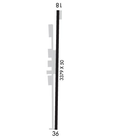
  • Runway Identifications
    Runway Identification: 18/36
    Length: 4001 ft
    Width: 75 ft
    Surface: ASPHALT
    Edge lights: Medium Intensity

    Treatment: NONE

     Runway: 18   Runway: 36
    Mag heading: 176°Mag heading: 356°
    Rwy Slope: 1.59% UpRwy Slope: -1.59% Down
    Approach: Approach:
    Pattern: Left TrafficPattern: Left Traffic
    Markings: PRECISION INSTRUMENTMarkings: PRECISION INSTRUMENT
    Marking Condition: GOODMarking Condition: GOOD
    Arresting Dev: Arresting Dev:
    Lat & Long: N3548.8  W09625.3Lat. & Long.: N3548.1  W09625.3
    Elev: 806.0 ft. MSLElev: 869.6 ft. MSL
    TCH: TCH:
    Visual Glide Path: Visual Glide Path:
    Displaced Threshold: NoDisplaced Threshold: No
    Touchdown Zone: YESTouchdown Zone: YES
    Touchdown Elev.: 853.9 feetTouchdown Elev.: 869.6 feet
    Visual Glide Slope: Visual Glide Slope:
    RVR Equipment: RVR Equipment:
    RVV Equipment: NORVV Equipment: NO
    Approach Lights: Approach Lights:
    REIL: NOREIL: NO
    Centerline Lights: NOCenterline Lights: NO
    Touchdown lights: NOTouchdown lights: NO
    Runway Category: Runway with a Non-precision Approach having visibility minimums greater than 3/4 mileRunway Category: Runway with a Non-precision Approach having visibility minimums greater than 3/4 mile
    Declared Distances: Declared Distances:
    Obstructions: Obstructions: TREE
    Marked: Marked: MARKED
    Clearance slope: 34:1Clearance slope: 15:1
    Obstruction height: Obstruction height: 40 feet AGL
    Dist. from runway: Dist. from runway: 837 feet
    Centerline offset: Centerline offset: 196 feet right of centerline
    Comments: Comments:
    C:/P: