Click here for more info on on SMS!

K3F4

VIVIAN
VIVIAN
LA
Time Zone: Central
Lat: N 3251.7
Long: W 09400.6
Elev: 260
Var: -02
Longest Runway: 2998
CTAF: 122.8

FBO & Flight Services info for K3F4

FBOs: Update your Fuel Prices

TOWN OF VIVIANPh: 318-375-5427
-
Freq: 122.8
If you are an FBO, call 1-203-262-1700 to update your info or email: FltPlan.Advertising@garmin.com
Advertise your FBO on FltPlan.com

Runway & Approach Info for K3F4
Rwy
Length
Land Dist**
Approach*
  Rwy
Length
Land Dist**
Approach*
09
2998x75  2998'          
 
  
27
  2998x75  2998'          
 
 * only ILS, LOC, LDA, and SDF approaches to a specific runway are shown
** For any Declared Landing Distance Available, please see A/FD or Approach plates
Runway Weight Capability (lbs.) Help
Runway IDSingle WheelDouble WheelDouble Tandem WheelDual Double Wheel
09/2712,000N/AN/AN/A
These numbers are Advisory and are not limits.   The Airport Manager should have more accurate Weight Limits
Approach Charts
Approaches    
Current Weather/Notams
Customs Information Send updates to Support@FltPlan.com
Customs Not Available
Database effective 05/16/2024
Airport Diagram of K3F4
Airport Diagram might not be current.

Facility Name: VIVIAN
City Name: VIVIAN
County: CADDO
State abbrev: LA
State Name: LOUISIANA
   
Ownership: PUBLICLY OWNED
Use: OPEN TO THE PUBLIC
Owner's Name: TOWN OF VIVIAN
Address: P. O. BOX 832
 VIVIAN, LA 71082
Owner's Phone: 318-375-3856
  
Manager's Name: MR. MARTY MUSICK
Address: P. O. BOX 648
 VIVIAN, LA 71082
Phone: (318) 455-5499
   
FAA Region: SOUTHWEST
FAA Field Office: LNM


Sunrise / Sunset times for VIVIAN

DateSunriseSunset
04/24/24 Wednesday6:3519:53
04/25/24 Thursday6:3419:54
04/26/24 Friday6:3319:55
04/27/24 Saturday6:3219:56
04/28/24 Sunday6:3119:56
04/29/24 Monday6:3019:57
04/30/24 Tuesday6:2919:58
05/01/24 Wednesday6:2819:59
05/02/24 Thursday6:2719:59
05/03/24 Friday6:2620:00
05/04/24 Saturday6:2520:01
05/05/24 Sunday6:2420:02
05/06/24 Monday6:2320:02
05/07/24 Tuesday6:2320:03

Airport Facilities

Airport Attendance ScheduleMON-SAT DAWN-DUSK
Airport Status OPERATIONAL (This Status can change at any time - please check NOTAMS)
Airport Lighting ScheduleMIRL RY 09/27 AND REIL RY 09 PRESET LOW INTST DUSK-DAWN; TO INCR INTST ACTVT - CTAF.
Airport Storage AvailableTie Downs, Hanger
Extra Services AvailableCrop Dusting, Flight Instruction
Wind IndicatorYES - (lighted)
Control TowerNO
CTAF Frequency122.800
Unicom Frequency122.800
Rotating Beacon ColorWG
Segmented CircleNO
Landing FeeNO

Airport Inspection Data

Airport InspectedSTATE - performed by STATE AERONAUTICAL PERSONNEL
Inspection Date11/15/2023

Airport Services

Type of Fuel AvailableGrade 100LL; -10FUEL AVBL 24 HRS SELF SVC WITH CREDIT CARD.
Airframe Repair ServiceMAJOR
Power Plant Repair ServiceMAJOR

Geographic Data

LatitudeN3251.7
LongitudeW09400.6 (ESTIMATED)
Arpt Elevation260ft (SURVEYED)
Magnetic Variation02E
2 miles SWof VIVIAN
Traffic Pattern Altitude
Sectional ChartMEMPHIS

Aircraft Data

Operations (Reported)YearlyAvg. Daily
General Aviation Transient 800022
General Aviation Local 30008
Air Taxi 00
Commerical 00
Commuter 00
Military 120
Aircraft based on Field
General Aviation Singles 10
General Aviation Multi 0
Jet Aircraft 0
General Aviation Helicopters 1
Military Aircraft 0
Gliders 0
Ultralights 0

FAA Services

FSS on field NO
FSS tie-in DE RIDDER
FSS Phone 1-800-WX-BRIEF
Who issues Notams DRI
Notam D service at airport YES
ARTCC Name FORT WORTH

Federal Status

Airport Certification
Aircraft Rescue & Firefighting IndexNone
Airport of EntryNo
Custom Landing RightsNo
Joint Civil/MilitaryNo
Military Landing rightsNo

Federal Agreements

NATIONAL PLAN OF INTEGRATED AIRPORT SYSTEMS (NPIAS)

Remarks

THIS AIRPORT HAS BEEN SURVEYED BY THE NATIONAL GEODETIC SURVEY.
GCO AVBL ON FREQ 135.075 THRU BAD APCH CTL AND FLT SVCS.
FOR CD IF UNA VIA GCO CTC FORT WORTH ARTCC AT 817-858-7584.
Airport Communications & Frequencies:
CTAF Frequency:
122.800
Unicom Frequency:
122.800
SHREVEPORT Primary Approach Frequencies:  
119.9
335.55
SHREVEPORT Primary Departure Frequencies:  
119.9
335.55
Runway Identifications
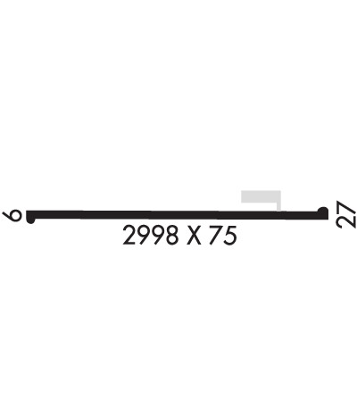
Runway Identification: 09/27
Length: 2998 ft
Width: 75 ft
Surface: ASPHALT-GOOD CONDITION
Edge lights: Medium Intensity

Treatment: NONE

 Runway: 09   Runway: 27
Mag heading: 88°Mag heading: 268°
Rwy Slope: .40% UpRwy Slope: -.40% Down
Approach: Approach:
Pattern: Left TrafficPattern: Left Traffic
Markings: NONPRECISION INSTRUMENTMarkings: NONPRECISION INSTRUMENT
Marking Condition: GOODMarking Condition: GOOD
Arresting Dev: Arresting Dev:
Lat & Long: N3251.7  W09400.9Lat. & Long.: N3251.7  W09400.3
Elev: 247.0 ft. MSLElev: 259.0 ft. MSL
TCH: 52 ft. AGLTCH:
Visual Glide Path: 3.00 degreesVisual Glide Path:
Displaced Threshold: NoDisplaced Threshold: No
Touchdown Zone: YESTouchdown Zone: YES
Touchdown Elev.: 260.0 feetTouchdown Elev.: 260.0 feet
Visual Glide Slope: 2-Light PAPI on LEFT side of Runway; RWY 09 PAPI OUT OF SERVICEVisual Glide Slope:
RVR Equipment: RVR Equipment:
RVV Equipment: NORVV Equipment: NO
Approach Lights: Approach Lights:
REIL: YESREIL: YES; RWY 27 REIL OTS
Centerline Lights: NOCenterline Lights: NO
Touchdown lights: NOTouchdown lights: NO
Runway Category: Runway with a Non-precision ApproachRunway Category: Runway with a Non-precision Approach
Declared Distances: Declared Distances:
Obstructions: TREESObstructions: TREES
Marked: NOT Marked/LightedMarked: NOT Marked/Lighted
Clearance slope: 19:1Clearance slope: 20:1
Obstruction height: 27 feet AGLObstruction height: 106 feet AGL
Dist. from runway: 720 feetDist. from runway: 2392 feet
Centerline offset: 62 left of centerlineCenterline offset: 208 feet right of centerline
Comments: Comments:
C:/P: