Click here for more info on on SMS!

K3DW

DOWNTOWN
SPRINGFIELD
MO
Time Zone: Central
Lat: N 3713.4
Long: W 09314.9
Elev: 1375
Var: -01
Longest Runway: 4037
CTAF: 122.8

FBO & Flight Services info for K3DW

FBOs: Update your Fuel Prices

  click here  
Providing high quality fuel and services to you and your customers, from Phillips 66 Aviation.
Ph: 417-862-2418
-
Freq: 122.8WebsiteE-Mail
                               
Service
Jet
100LL
SAF
MoGas
Fuel Avail: 24 hrs/ day
Full4.925.39    Caution: Fuel prices have not been updated in 34 days.
Last Update: 03/22/2024 11:26

Self4.925.39    
Misc. Info: PCL Now available on 122.80 (3 Clicks for activation)Address: 2546 E DIVISION   SPRINGFIELD, MO 65803

If you are an FBO, call 1-203-262-1700 to update your info or email: FltPlan.Advertising@garmin.com
Advertise your FBO on FltPlan.com

Runway & Approach Info for K3DW
Rwy
Length
Land Dist**
Approach*
  Rwy
Length
Land Dist**
Approach*
11
4037x50  4037'          
 
  
29
  4037x50  4037'          
 
 * only ILS, LOC, LDA, and SDF approaches to a specific runway are shown
** For any Declared Landing Distance Available, please see A/FD or Approach plates
Runway Weight Capability (lbs.) Help
Runway IDSingle WheelDouble WheelDouble Tandem WheelDual Double Wheel
11/298,000N/AN/AN/A
These numbers are Advisory and are not limits.   The Airport Manager should have more accurate Weight Limits
Approach Charts
Approaches    
Current Weather/Notams
Customs Information Send updates to Support@FltPlan.com
Customs Not Available
Database effective 05/16/2024
Airport Diagram of K3DW
Airport Diagram might not be current.

Facility Name: DOWNTOWN
City Name: SPRINGFIELD
County: GREENE
State abbrev: MO
State Name: MISSOURI
   
Ownership: PRIVATELY OWNED
Use: OPEN TO THE PUBLIC
Owner's Name: SHERMAN STREET ACQUISITION CO INC
Address: 605 N. SHERMAN ST
 SPRINGFIELD, MO 65803
Owner's Phone:
  
Manager's Name: BRADLEY BYRON
Address: 2546 E DIVISION ST
 SPRINGFIELD, MO 65803
Phone: 417-862-2418
   
FAA Region: CENTRAL
FAA Field Office: NONE


Sunrise / Sunset times for DOWNTOWN

DateSunriseSunset
04/24/24 Wednesday6:2619:57
04/25/24 Thursday6:2419:58
04/26/24 Friday6:2319:59
04/27/24 Saturday6:2220:00
04/28/24 Sunday6:2120:00
04/29/24 Monday6:2020:01
04/30/24 Tuesday6:1920:02
05/01/24 Wednesday6:1720:03
05/02/24 Thursday6:1620:04
05/03/24 Friday6:1520:05
05/04/24 Saturday6:1420:06
05/05/24 Sunday6:1320:07
05/06/24 Monday6:1220:08
05/07/24 Tuesday6:1120:08

Airport Facilities

Airport Attendance ScheduleMON-FRI 0730-1800, SAT 0900-1600
Airport Status OPERATIONAL (This Status can change at any time - please check NOTAMS)
Airport Lighting ScheduleACTVT NSTD MIRL RWY 11/29 - CTAF-THREE CLICKS.
Airport Storage AvailableTie Downs, Hanger
Extra Services AvailableNONE
Wind IndicatorYES - (lighted)
Control TowerNO
CTAF Frequency122.800
Unicom Frequency122.800
Rotating Beacon Color
Segmented CircleNO
Landing FeeNO

Airport Inspection Data

Airport InspectedSTATE - performed by STATE AERONAUTICAL PERSONNEL
Inspection Date06/28/2021

Airport Services

Type of Fuel AvailableGrade 100LL, JET A (freeze point -40C)
Airframe Repair ServiceMAJOR
Power Plant Repair ServiceMAJOR

Geographic Data

LatitudeN3713.4
LongitudeW09314.9 (ESTIMATED)
Arpt Elevation1375ft (ESTIMATED)
Magnetic Variation01E
0 miles Eof SPRINGFIELD
Traffic Pattern Altitude
Sectional ChartKANSAS CITY

Aircraft Data

Operations (Reported)YearlyAvg. Daily
General Aviation Transient 984827
General Aviation Local 423012
Air Taxi 5021
Commerical 00
Commuter 00
Military 1200
Aircraft based on Field
General Aviation Singles 37
General Aviation Multi 3
Jet Aircraft 2
General Aviation Helicopters 0
Military Aircraft 0
Gliders 0
Ultralights 0

FAA Services

FSS on field NO
FSS tie-in COLUMBIA
FSS Phone 1-800-WX-BRIEF
Who issues Notams COU
Notam D service at airport YES
ARTCC Name KANSAS CITY

Federal Status

Airport Certification
Aircraft Rescue & Firefighting IndexNone
Airport of EntryNo
Custom Landing RightsNo
Joint Civil/MilitaryNo
Military Landing rightsNo

Remarks

600 FT LGTD TOWER 950 FT N OF RY 29 THLD.
NTSD RY SAFETY AREA BYD RY 29 THLD; LARGE SLOPE.
PEDESTRIAN GATE CODE IS CTAF FREQ.
FOR CD CTC SPRINGFIELD APCH AT 417-868-5620/5619.
RWY 11/2 9 NSTD MIRL; 3 THR LGTS EACH RWY, EDGE LGTS SPACED 240 FT APART.
Airport Communications & Frequencies:
CTAF Frequency:
122.800
Unicom Frequency:
122.800
SPRINGFIELD Primary Approach Frequencies:  
124.95
353.925
SPRINGFIELD Primary Departure Frequencies:  
124.95
353.925
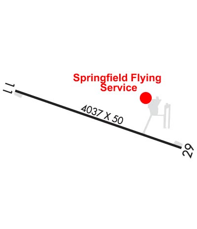
Runway Identifications
Runway Identification: 11/29
Length: 4037 ft
Width: 50 ft
Surface: ASPHALT-GOOD CONDITION
Edge lights: Non-Standard Lighting System

Treatment: NONE

 Runway: 11   Runway: 29
Mag heading: 108°Mag heading: 288°
Rwy Slope: .50% UpRwy Slope: -.50% Down
Approach: Approach:
Pattern: Left TrafficPattern: Left Traffic
Markings: NONPRECISION INSTRUMENTMarkings: NONPRECISION INSTRUMENT
Marking Condition: FAIRMarking Condition: FAIR
Arresting Dev: Arresting Dev:
Lat & Long: N3713.5  W09315.3Lat. & Long.: N3713.3  W09314.5
Elev: 1355.0 ft. MSLElev: 1375.0 ft. MSL
TCH: TCH:
Visual Glide Path: Visual Glide Path:
Displaced Threshold: NoDisplaced Threshold: No
Touchdown Zone: YESTouchdown Zone: YES
Touchdown Elev.: 1370.0 feetTouchdown Elev.: 1375.0 feet
Visual Glide Slope: Visual Glide Slope:
RVR Equipment: RVR Equipment:
RVV Equipment: NORVV Equipment: NO
Approach Lights: Approach Lights:
REIL: NOREIL: NO
Centerline Lights: NOCenterline Lights: NO
Touchdown lights: NOTouchdown lights: NO
Runway Category: Runway with a Non-precision ApproachRunway Category: Runway with a Non-precision Approach
Declared Distances: Declared Distances:
Obstructions: TREESObstructions: TREES
Marked: NOT Marked/LightedMarked: NOT Marked/Lighted
Clearance slope: 15:1Clearance slope: 15:1
Obstruction height: 44 feet AGLObstruction height: 58 feet AGL
Dist. from runway: 890 feetDist. from runway: 1080 feet
Centerline offset: 116 left of centerlineCenterline offset: 130 feet left of centerline
Comments: Comments:
C:16/P: