Current Weather/Notams (Metars, TAFs, Notams, NWS Forecast, PIREPS, and nearby weather)
Customs Information Send updates to Support@FltPlan.com
Customs Not Available
Database effective 05/16/2024
Airport Diagram might not be current.
|
| Facility Name: | SOUTHBRIDGE MUNI |
| City Name: | SOUTHBRIDGE |
| County: | WORCESTER |
| State abbrev: | MA |
| State Name: | MASSACHUSETTS |
| | |
| Ownership: | PUBLICLY OWNED |
| Use: | OPEN TO THE PUBLIC |
| Owner's Name: | TOWN OF SOUTHBRIDGE |
| Address: | 41 ELM STREET |
| | SOUTHBRIDGE, MA 01550 |
| Owner's Phone: | 508-764-5405 |
| | |
| Manager's Name: | RONALD PLOUFFE |
| Address: | 220 AIRPORT ACCESS RD |
| | SOUTHBRIDGE, MA 01550 |
| Phone: | 508-764-2155 |
| | |
| FAA Region: | NEW ENGLAND |
| FAA Field Office: | NONE |
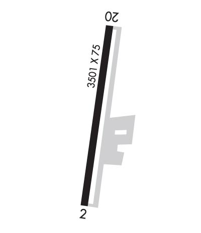
Runway Identifications
Runway Identification: 02/20Length: 3501 ft
Width: 75 ft
Surface: ASPHALT-GOOD CONDITION
Edge lights: Medium IntensityTreatment: NONE
| | Runway: 02 | | Runway: 20 |
| Mag heading: | 22° | Mag heading: | 202° |
| Rwy Slope: | .28% Up | Rwy Slope: | -.28% Down |
| Approach: | | Approach: | |
| Pattern: | Left Traffic | Pattern: | Left Traffic |
| Markings: | NONPRECISION INSTRUMENT | Markings: | BASIC |
| Marking Condition: | GOOD | Marking Condition: | GOOD |
| Arresting Dev: | | Arresting Dev: | |
| Lat & Long: | N4205.8 W07202.4 | Lat. & Long.: | N4206.4 W07202.3 |
| Elev: | 689.0 ft. MSL | Elev: | 698.8 ft. MSL |
| TCH: | 40 ft. AGL | TCH: | 45 ft. AGL |
| Visual Glide Path: | 3.00 degrees | Visual Glide Path: | 3.50 degrees |
| Displaced Threshold: | No | Displaced Threshold: | No |
| Touchdown Zone: | YES | Touchdown Zone: | YES |
| Touchdown Elev.: | 696.4 feet | Touchdown Elev.: | 698.8 feet |
| Visual Glide Slope: | 4-Light PAPI on LEFT side of Runway | Visual Glide Slope: | 4-Light PAPI on LEFT side of Runway |
| RVR Equipment: | | RVR Equipment: | |
| RVV Equipment: | NO | RVV Equipment: | NO |
| Approach Lights: | | Approach Lights: | |
| REIL: | YES | REIL: | YES |
| Centerline Lights: | NO | Centerline Lights: | NO |
| Touchdown lights: | NO | Touchdown lights: | NO |
| Runway Category: | Runway with a Non-precision Approach having visibility minimums greater than 3/4 mile | Runway Category: | Runway with a Visual Approach |
| Declared Distances: | | Declared Distances: | |
| Obstructions: | TREES | Obstructions: | TREES |
| Marked: | NOT Marked/Lighted | Marked: | NOT Marked/Lighted |
| Clearance slope: | 34:1 | Clearance slope: | 34:1 |
| Obstruction height: | 23 feet AGL | Obstruction height: | 52 feet AGL |
| Dist. from runway: | 1000 feet | Dist. from runway: | 2000 feet |
| Centerline offset: | 125 right of centerline | Centerline offset: | B |
| Comments: | | Comments: | |

