| |||||||||||||||||||||||||||||||||||||||||||||||||||||||||||||||||||||
| |||||||||||||||||||||||||||||||||||||||||||||||||||||||||||||||||||||
| |||||||||||||||||||||||||||||||||||||||||||||||||||||||||||||||||||||
| |||||||||||||||||||||||||||||||||||||||||||||||||||||||||||||||||||||
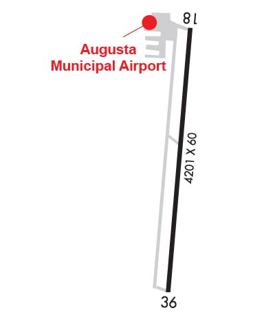
| Rwy | Rwy | |||||||
| 4201x60 | 4201' | 4201x60 | 4201' | |||||
| Runway ID | Single Wheel | Double Wheel | Double Tandem Wheel | Dual Double Wheel |
| 18/36 | 12,000 | N/A | N/A | N/A |
| These numbers are Advisory and are not limits. The Airport Manager should have more accurate Weight Limits | ||||
 Airport Diagram might not be current. | |
| Facility Name: | AUGUSTA MUNI |
| City Name: | AUGUSTA |
| County: | BUTLER |
| State abbrev: | KS |
| State Name: | KANSAS |
| Ownership: | PUBLICLY OWNED |
| Use: | OPEN TO THE PUBLIC |
| Owner's Name: | CITY OF AUGUSTA |
| Address: | 113 EAST 6TH AVE., BOX 489 |
| AUGUSTA, KS 67010 | |
| Owner's Phone: | 316-775-4510 |
| Manager's Name: | RAY SEIF |
| Address: | 4800 W. BEECH DR, STE 1, PO BOX 489, PO BOX 489 |
| AUGUSTA, KS 67010 | |
| Phone: | 316-733-1327 |
| FAA Region: | CENTRAL |
| FAA Field Office: | NONE |
| Date | Sunrise | Sunset |
|---|---|---|
| 04/25/24 Thursday | 6:39 | 20:14 |
| 04/26/24 Friday | 6:38 | 20:15 |
| 04/27/24 Saturday | 6:37 | 20:16 |
| 04/28/24 Sunday | 6:35 | 20:17 |
| 04/29/24 Monday | 6:34 | 20:17 |
| 04/30/24 Tuesday | 6:33 | 20:18 |
| 05/01/24 Wednesday | 6:32 | 20:19 |
| 05/02/24 Thursday | 6:31 | 20:20 |
| 05/03/24 Friday | 6:30 | 20:21 |
| 05/04/24 Saturday | 6:29 | 20:22 |
| 05/05/24 Sunday | 6:27 | 20:23 |
| 05/06/24 Monday | 6:26 | 20:24 |
| 05/07/24 Tuesday | 6:25 | 20:25 |
| 05/08/24 Wednesday | 6:24 | 20:26 |
| Airport Attendance Schedule | MON-FRI 0800-1700 |
| Airport Status | OPERATIONAL (This Status can change at any time - please check NOTAMS) |
| Airport Lighting Schedule | ACTVT HIRL RY 18/36; REIL RYS 18 & 36; VASI RY 36; PAPI RY 18 - CTAF. |
| Airport Storage Available | Tie Downs, Hanger |
| Extra Services Available | Avionics, Charter, Flight Instruction, Aircraft Rental |
| Wind Indicator | YES - (unlit) |
| Control Tower | NO |
| CTAF Frequency | 122.800 |
| Unicom Frequency | 122.800 |
| Rotating Beacon Color | WG |
| Segmented Circle | YES |
| Landing Fee | NO |
| Airport Inspected | STATE - performed by STATE AERONAUTICAL PERSONNEL |
| Inspection Date | 07/09/2021 |
| Type of Fuel Available | Grade 100LL, JET AMOGAS; -10SELF SVC AND FULL SVC 100LL, MOGAS, JET A+ FULL SVC. |
| Airframe Repair Service | MAJOR |
| Power Plant Repair Service | MAJOR |
| Latitude | N3740.3 |
| Longitude | W09704.7 (ESTIMATED) |
| Arpt Elevation | 1328ft (SURVEYED) |
| Magnetic Variation | 04E |
| 5 miles W | of AUGUSTA |
| Traffic Pattern Altitude | |
| Sectional Chart | WICHITA |
| Operations (Reported) | Yearly | Avg. Daily |
|---|---|---|
| General Aviation Transient | 15000 | 41 |
| General Aviation Local | 21000 | 58 |
| Air Taxi | 0 | 0 |
| Commerical | 0 | 0 |
| Commuter | 0 | 0 |
| Military | 0 | 0 |
| Aircraft based on Field | |
|---|---|
| General Aviation Singles | 77 |
| General Aviation Multi | 9 |
| Jet Aircraft | 1 |
| General Aviation Helicopters | 0 |
| Military Aircraft | 0 |
| Gliders | 0 |
| Ultralights | 0 |
| FSS on field | NO |
| FSS tie-in | WICHITA |
| FSS Phone | 1-800-WX-BRIEF |
| Who issues Notams | ICT |
| Notam D service at airport | YES |
| ARTCC Name | KANSAS CITY |
| Airport Certification | |
| Aircraft Rescue & Firefighting Index | None |
| Airport of Entry | No |
| Custom Landing Rights | No |
| Joint Civil/Military | No |
| Military Landing rights | YES |
| NATIONAL PLAN OF INTEGRATED AIRPORT SYSTEMS (NPIAS) |
| GRANT AGREEMENTS UNDER FAAP/ADAP/AIP |
| ASSURANCES PURSUANT TO TITLE VI, CIVIL RIGHTS ACT OF 1964 |
| FOR SVC AFT HRS CALL (316)-733-1326. |
| PAEW MOWING SUMMER MONTHS. |
| RY ENDS LINE OF SITE OBSTRUCTED BY TERRAIN |
| CALM WIND RUNWAY IS RUNWAY 18 |
| AIRPORT LINE OFFICE PHONE 316-733 1326 |
| FOR CD CTC WICHITA APCH AT 316-350-1520. |
| 5FT DITCH 330 FT N OF APCH END OF RWY 18. |
Airport Communications & Frequencies:
| ||||||||||||||||
| Runway: 18 | Runway: 36 | ||
| Mag heading: | 180° | Mag heading: | 0° |
| Rwy Slope: | -.51% Down | Rwy Slope: | .51% Up |
| Approach: | Approach: | ||
| Pattern: | Left Traffic | Pattern: | Right Traffic |
| Markings: | NONPRECISION INSTRUMENT | Markings: | NONPRECISION INSTRUMENT |
| Marking Condition: | FAIR | Marking Condition: | FAIR |
| Arresting Dev: | Arresting Dev: | ||
| Lat & Long: | N3740.6 W09704.6 | Lat. & Long.: | N3740.0 W09704.7 |
| Elev: | 1328.0 ft. MSL | Elev: | 1306.4 ft. MSL |
| TCH: | TCH: | 43 ft. AGL | |
| Visual Glide Path: | Visual Glide Path: | 3.00 degrees | |
| Displaced Threshold: | No | Displaced Threshold: | No |
| Touchdown Zone: | YES | Touchdown Zone: | YES |
| Touchdown Elev.: | 1328.0 feet | Touchdown Elev.: | 1323.5 feet |
| Visual Glide Slope: | 4-Light PAPI on LEFT side of Runway | Visual Glide Slope: | 2-Box VASI on LEFT side of Runway |
| RVR Equipment: | RVR Equipment: | ||
| RVV Equipment: | NO | RVV Equipment: | NO |
| Approach Lights: | Approach Lights: | ||
| REIL: | YES | REIL: | YES |
| Centerline Lights: | NO | Centerline Lights: | NO |
| Touchdown lights: | NO | Touchdown lights: | NO |
| Runway Category: | Runway with a Visual Approach | Runway Category: | Runway with a Non-precision Approach |
| Declared Distances: | Declared Distances: | ||
| Obstructions: | TREE | Obstructions: | |
| Marked: | NOT Marked/Lighted | Marked: | |
| Clearance slope: | 22:1 | Clearance slope: | 50:1 |
| Obstruction height: | 35 feet AGL | Obstruction height: | |
| Dist. from runway: | 980 feet | Dist. from runway: | |
| Centerline offset: | 165 right of centerline | Centerline offset: | |
| Comments: | Comments: |