Click here for more info on on SMS!

K3A4

SOUTHEAST GREENSBORO
GREENSBORO
NC
Time Zone: Eastern
Lat: N 3556.5
Long: W 07941.1
Elev: 739
Var: +06
Longest Runway: 3063
CTAF: 122.8

FBO & Flight Services info for K3A4

FBOs: Update your Fuel Prices

AIRWAYS INCPh: 336-674-9999
-
Freq: 122.8
Service
Jet
100LL
SAF
MoGas
Fuel Avail: NO FUEL AVAILABLE
Full        Last Update: 04/20/2024 05:45:17

Self        
If you are an FBO, call 1-203-262-1700 to update your info or email: FltPlan.Advertising@garmin.com
Advertise your FBO on FltPlan.com

Runway & Approach Info for K3A4
Rwy
Length
Land Dist**
Approach*
  Rwy
Length
Land Dist**
Approach*
17
3063x30  3063'          
 
  
35
  3063x30  3063'          
 
 * only ILS, LOC, LDA, and SDF approaches to a specific runway are shown
** For any Declared Landing Distance Available, please see A/FD or Approach plates
Runway Weight Capability (lbs.) Help
Runway IDSingle WheelDouble WheelDouble Tandem WheelDual Double Wheel
17/358,000N/AN/AN/A
These numbers are Advisory and are not limits.   The Airport Manager should have more accurate Weight Limits
Approach Charts
FltPlan does not have IFR approach charts available for K3A4.
Current Weather/Notams
Customs Information Send updates to Support@FltPlan.com
Customs Not Available
Database effective 04/18/2024
Airport Diagram of K3A4
Airport Diagram might not be current.

Facility Name: GREENSBORO EXEC
City Name: GREENSBORO
County: GUILFORD
State abbrev: NC
State Name: NORTH CAROLINA
   
Ownership: PRIVATELY OWNED
Use: OPEN TO THE PUBLIC
Owner's Name: 3A4, LLC
Address: 4505 SELLERS AVE
 GREENSBORO, NC 27407-0007
Owner's Phone: 336-420-8623
  
Manager's Name: ANTHONY VOGT
Address: 6334 MONNETT ROAD
 CLIMAX, NC 27233-8088
Phone: 336-420-8623
   
FAA Region: SOUTHERN
FAA Field Office: MEM


Sunrise / Sunset times for GREENSBORO EXEC

DateSunriseSunset
04/19/24 Friday6:4019:56
04/20/24 Saturday6:3819:57
04/21/24 Sunday6:3719:58
04/22/24 Monday6:3619:59
04/23/24 Tuesday6:3520:00
04/24/24 Wednesday6:3320:01
04/25/24 Thursday6:3220:01
04/26/24 Friday6:3120:02
04/27/24 Saturday6:3020:03
04/28/24 Sunday6:2920:04
04/29/24 Monday6:2820:05
04/30/24 Tuesday6:2720:06
05/01/24 Wednesday6:2520:07
05/02/24 Thursday6:2420:07

Airport Facilities

Airport Attendance Schedule7 Days A Week 0700 TO 1700
Airport Status OPERATIONAL (This Status can change at any time - please check NOTAMS)
Airport Lighting ScheduleACTVT MIRL RWY 17/35, 5 CLICKS ONLY - CTAF MORE THAN 5 LOCK OUT CTL FOR 10 MIN.
Airport Storage AvailableTie Downs, Hanger
Extra Services AvailableFlight Instruction, Aircraft Rental
Wind IndicatorYES - (lighted)
Control TowerNO
CTAF Frequency122.800
Unicom Frequency122.800
Rotating Beacon Color
Segmented CircleNO
Landing FeeNO

Airport Inspection Data

Airport InspectedSTATE - performed by STATE AERONAUTICAL PERSONNEL
Inspection Date06/26/2022

Airport Services

Type of Fuel AvailableNone
Airframe Repair ServiceMAJOR
Power Plant Repair ServiceMAJOR

Geographic Data

LatitudeN3556.5
LongitudeW07941.1 (ESTIMATED)
Arpt Elevation739ft (ESTIMATED)
Magnetic Variation06W
8 miles SEof GREENSBORO
Traffic Pattern Altitude
Sectional ChartCHARLOTTE

Aircraft Data

Operations (Reported)YearlyAvg. Daily
General Aviation Transient 20005
General Aviation Local 30008
Air Taxi 00
Commerical 00
Commuter 00
Military 5001
Aircraft based on Field
General Aviation Singles 33
General Aviation Multi 5
Jet Aircraft 0
General Aviation Helicopters 0
Military Aircraft 0
Gliders 0
Ultralights 0

FAA Services

FSS on field NO
FSS tie-in RALEIGH
FSS Phone 1-800-WX-BRIEF
Who issues Notams RDU
Notam D service at airport YES
ARTCC Name WASHINGTON

Federal Status

Airport Certification
Aircraft Rescue & Firefighting IndexNone
Airport of EntryNo
Custom Landing RightsNo
Joint Civil/MilitaryNo
Military Landing rightsNo

Remarks

RWY 17 UPHILL LNDG PREF.
NMRS +50 FT TREES IN THE APCHS & ALONG THE SIDES OF THE RWY; NMRS +15 FT TREES IN THE PRIM SFC.
RWY 17 HAS 50 FT DROP-OFF 60 FT FROM RWY END OFFSET 30 FT BOTH SIDES OF CNTRLN.
FOR CD CTC GREENSBORO APCH AT 743-222-6129.
RWY 17/35 TURN-AROUNDS ARE PART OF THE RWY THERE IS NO RUNUP AREA AT EITHER END.
RWY 17/3 5 ONLY TWO END LGTS EACH SIDE.
Runway Identifications
Runway Identification: 17/35
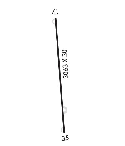
Length: 3063 ft
Width: 30 ft
Surface: ASPHALT-GOOD CONDITION
Edge lights: Medium Intensity

Treatment: NONE

 Runway: 17   Runway: 35
Mag heading: 170°Mag heading: 350°
Rwy Slope: 2.19% UpRwy Slope: -2.19% Down
Approach: Approach:
Pattern: Left TrafficPattern: Left Traffic
Markings: NONSTANDARDMarkings: NONSTANDARD
Marking Condition: FAIR; RWY NRS SMALLER THAN STD.Marking Condition: FAIR; RWY NRS SMALLER THAN STD.
Arresting Dev: Arresting Dev:
Lat & Long: N3556.8  W07941.2Lat. & Long.: N3556.3  W07941.0
Elev: 672.0 ft. MSLElev: 739.0 ft. MSL
TCH: TCH:
Visual Glide Path: Visual Glide Path:
Displaced Threshold: NoDisplaced Threshold: No
Touchdown Zone: NOTouchdown Zone: NO
Touchdown Elev.: Touchdown Elev.:
Visual Glide Slope: Visual Glide Slope:
RVR Equipment: RVR Equipment:
RVV Equipment: NORVV Equipment: NO
Approach Lights: Approach Lights:
REIL: NOREIL: NO
Centerline Lights: NOCenterline Lights: NO
Touchdown lights: NOTouchdown lights: NO
Runway Category: Runway with a Visual ApproachRunway Category: Runway with a Visual Approach
Declared Distances: Declared Distances:
Obstructions: TREESObstructions: TREES
Marked: NOT Marked/LightedMarked: NOT Marked/Lighted
Clearance slope: 7:1Clearance slope: 4:1
Obstruction height: 13 feet AGLObstruction height: 77 feet AGL
Dist. from runway: 292 feetDist. from runway: 529 feet
Centerline offset: 45 left of centerlineCenterline offset:
Comments: HAS 20 FT TREES 20-200 FT FM THR, OFFSET 25 FT R OF CNTRLN.Comments: 5 FT BERM 72 FT FR THR OFFSET 46 FT RIGHT OF CNTRLN AND 20 FT TREES 101 FT FM THR OFFSET 75 FT RIGHT OF CNTRLN AND 36 FT TREES 196 FT FM THR OFFSET 105 FT RIGHT OF CNTRLN.
C:/P: