Current Weather/Notams (Metars, TAFs, Notams, NWS Forecast, PIREPS, and nearby weather)
Customs Information Send updates to Support@FltPlan.com
Customs Not Available
Database effective 05/16/2024
Airport Diagram might not be current.
|
| Facility Name: | NEW TAZEWELL MUNI |
| City Name: | TAZEWELL |
| County: | CLAIBORNE |
| State abbrev: | TN |
| State Name: | TENNESSEE |
| | |
| Ownership: | PUBLICLY OWNED |
| Use: | OPEN TO THE PUBLIC |
| Owner's Name: | CITY OF NEW TAZEWELL |
| Address: | PO BOX 609 |
| | NEW TAZEWELL, TN 37824 |
| Owner's Phone: | (423) 626-5242 |
| | |
| Manager's Name: | JERRY HOOPER |
| Address: | 380 AIRPORT LANE |
| | TAZEWELL, TN 37879 |
| Phone: | 423-626-5242 |
| | |
| FAA Region: | SOUTHERN |
| FAA Field Office: | MEM |
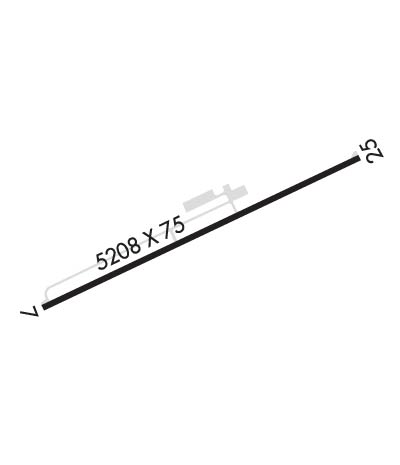
Runway Identifications
Runway Identification: 07/25Length: 5208 ft
Width: 75 ft
Surface: ASPHALT-GOOD CONDITION
Edge lights: Medium IntensityTreatment: NONE
Weight: PCN 9 /F/D/X/T
| | Runway: 07 | | Runway: 25 |
| Mag heading: | 70° | Mag heading: | 250° |
| Rwy Slope: | -.08% Down | Rwy Slope: | .08% Up |
| Approach: | | Approach: | |
| Pattern: | Left Traffic | Pattern: | Left Traffic |
| Markings: | BASIC | Markings: | BASIC |
| Marking Condition: | GOOD | Marking Condition: | GOOD |
| Arresting Dev: | | Arresting Dev: | |
| Lat & Long: | N3624.4 W08333.9 | Lat. & Long.: | N3624.7 W08333.0 |
| Elev: | 1176.6 ft. MSL | Elev: | 1172.2 ft. MSL |
| TCH: | 35 ft. AGL | TCH: | |
| Visual Glide Path: | 3.50 degrees | Visual Glide Path: | |
| Displaced Threshold: | No | Displaced Threshold: | No |
| Touchdown Zone: | YES | Touchdown Zone: | YES |
| Touchdown Elev.: | 1178.7 feet | Touchdown Elev.: | 1178.8 feet |
| Visual Glide Slope: | 2-Light PAPI on LEFT side of Runway | Visual Glide Slope: | 2-Light PAPI on LEFT side of Runway |
| RVR Equipment: | | RVR Equipment: | |
| RVV Equipment: | NO | RVV Equipment: | NO |
| Approach Lights: | | Approach Lights: | |
| REIL: | YES | REIL: | YES |
| Centerline Lights: | NO | Centerline Lights: | NO |
| Touchdown lights: | NO | Touchdown lights: | NO |
| Runway Category: | Runway with a Non-precision Approach | Runway Category: | Runway with a Visual Approach |
| Declared Distances: | | Declared Distances: | |
| Obstructions: | TREES | Obstructions: | TREE |
| Marked: | NOT Marked/Lighted | Marked: | NOT Marked/Lighted |
| Clearance slope: | 20:1 | Clearance slope: | 27:1 |
| Obstruction height: | 29 feet AGL | Obstruction height: | 148 feet AGL |
| Dist. from runway: | 794 feet | Dist. from runway: | 4300 feet |
| Centerline offset: | 59 left of centerline | Centerline offset: | 881 feet left of centerline |
| Comments: | | Comments: | |

