Approach Charts
| FltPlan does not have IFR approach charts available for K37V. |
Current Weather/Notams (Metars, TAFs, Notams, NWS Forecast, PIREPS, and nearby weather)
Customs Information Send updates to Support@FltPlan.com
Customs Not Available
Database effective 04/18/2024
Airport Diagram might not be current.
|
| Facility Name: | ARAPAHOE MUNI |
| City Name: | ARAPAHOE |
| County: | FURNAS |
| State abbrev: | NE |
| State Name: | NEBRASKA |
| | |
| Ownership: | PUBLICLY OWNED |
| Use: | OPEN TO THE PUBLIC |
| Owner's Name: | ARAPAHOE ARPT AUTHORITY; TODD WEVERKA IS CHAIRMAN OF THE ARAPAHOE AIRPORT AUTHORITY (BS 7/2013) |
| Address: | P.O. BOX 331 |
| | ARAPAHOE, NE 68922-0331 |
| Owner's Phone: | 308-962-7218 |
| | |
| Manager's Name: | TODD WEVERKA |
| Address: | P.O. BOX 331 |
| | ARAPAHOE, NE 68922-0331 |
| Phone: | (308) 999-0073 |
| | |
| FAA Region: | CENTRAL |
| FAA Field Office: | NONE |
Runway Identifications
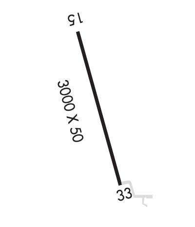
Runway Identification: 15/33Length: 3000 ft
Width: 50 ft
Surface: ASPHALT-FAIR CONDITION
Edge lights: Medium IntensityTreatment: NONE
| | Runway: 15 | | Runway: 33 |
| Mag heading: | 155° | Mag heading: | 335° |
| Rwy Slope: | -.40% Down | Rwy Slope: | .40% Up |
| Approach: | | Approach: | |
| Pattern: | Left Traffic | Pattern: | Left Traffic |
| Markings: | BASIC | Markings: | BASIC |
| Marking Condition: | GOOD | Marking Condition: | GOOD |
| Arresting Dev: | | Arresting Dev: | |
| Lat & Long: | N4020.7 W09954.6 | Lat. & Long.: | N4020.3 W09954.4 |
| Elev: | 2273.0 ft. MSL | Elev: | 2261.0 ft. MSL |
| TCH: | | TCH: | |
| Visual Glide Path: | | Visual Glide Path: | |
| Displaced Threshold: | No | Displaced Threshold: | No |
| Touchdown Zone: | NO | Touchdown Zone: | NO |
| Touchdown Elev.: | | Touchdown Elev.: | |
| Visual Glide Slope: | | Visual Glide Slope: | |
| RVR Equipment: | | RVR Equipment: | |
| RVV Equipment: | NO | RVV Equipment: | NO |
| Approach Lights: | | Approach Lights: | |
| REIL: | NO | REIL: | NO |
| Centerline Lights: | NO | Centerline Lights: | NO |
| Touchdown lights: | NO | Touchdown lights: | NO |
| Runway Category: | Runway with a Visual Approach | Runway Category: | Runway with a Visual Approach |
| Declared Distances: | | Declared Distances: | |
| Obstructions: | | Obstructions: | ROAD |
| Marked: | | Marked: | NOT Marked/Lighted |
| Clearance slope: | 50:1 | Clearance slope: | 30:1 |
| Obstruction height: | | Obstruction height: | 12 feet AGL |
| Dist. from runway: | | Dist. from runway: | 565 feet |
| Centerline offset: | | Centerline offset: | |
| Comments: | | Comments: | |

