Approach Charts
| FltPlan does not have IFR approach charts available for K2K9. |
Current Weather/Notams (Metars, TAFs, Notams, NWS Forecast, PIREPS, and nearby weather)
Customs Information Send updates to Support@FltPlan.com
Customs Not Available
Database effective 05/16/2024
Airport Diagram might not be current.
|
| Facility Name: | HASKELL |
| City Name: | HASKELL |
| County: | MUSKOGEE |
| State abbrev: | OK |
| State Name: | OKLAHOMA |
| | |
| Ownership: | PRIVATELY OWNED |
| Use: | OPEN TO THE PUBLIC |
| Owner's Name: | H.E. REYNOLDS |
| Address: | 15576 S. 289TH E AVE |
| | COWETA, OK 74429 |
| Owner's Phone: | 918-231-3232 |
| | |
| Manager's Name: | H.E. REYNOLDS |
| Address: | 15576 S. 289TH E. AVE |
| | COWETA, OK 74429 |
| Phone: | 918-231-3232 |
| | |
| FAA Region: | SOUTHWEST |
| FAA Field Office: | AOK |
Runway Identifications
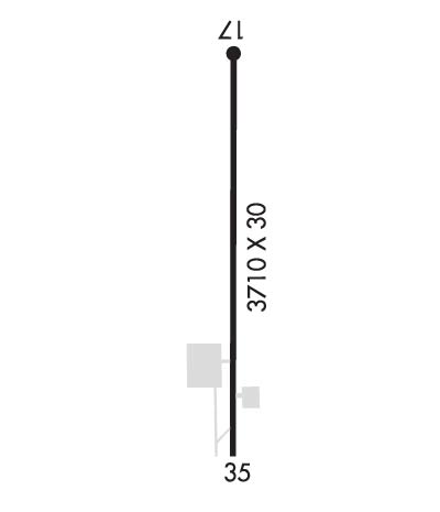
Runway Identification: 17/35Length: 3710 ft
Width: 30 ft
Surface: ASPHALT-FAIR CONDITION
Edge lights: Treatment: NONE
| | Runway: 17 | | Runway: 35 |
| Mag heading: | 173° | Mag heading: | 353° |
| Rwy Slope: | -.08% Down | Rwy Slope: | .08% Up |
| Approach: | | Approach: | |
| Pattern: | Left Traffic; ULTRALIGHT USE RIGHT TFC. | Pattern: | Left Traffic |
| Markings: | NONSTANDARD | Markings: | NONSTANDARD |
| Marking Condition: | GOOD; SML NRS & NTSD CNTRLN. | Marking Condition: | GOOD; SML NRS & NTSD CNTRLN. |
| Arresting Dev: | | Arresting Dev: | |
| Lat & Long: | N3550.3 W09540.0 | Lat. & Long.: | N3549.7 W09540.0 |
| Elev: | 587.0 ft. MSL | Elev: | 584.0 ft. MSL |
| TCH: | | TCH: | |
| Visual Glide Path: | | Visual Glide Path: | |
| Displaced Threshold: | No | Displaced Threshold: | No |
| Touchdown Zone: | NO | Touchdown Zone: | NO |
| Touchdown Elev.: | | Touchdown Elev.: | |
| Visual Glide Slope: | | Visual Glide Slope: | |
| RVR Equipment: | | RVR Equipment: | |
| RVV Equipment: | NO | RVV Equipment: | NO |
| Approach Lights: | | Approach Lights: | |
| REIL: | NO | REIL: | NO |
| Centerline Lights: | NO | Centerline Lights: | NO |
| Touchdown lights: | NO | Touchdown lights: | NO |
| Runway Category: | Runway with a Visual Approach | Runway Category: | Runway with a Visual Approach |
| Declared Distances: | | Declared Distances: | |
| Obstructions: | TREES | Obstructions: | |
| Marked: | NOT Marked/Lighted | Marked: | |
| Clearance slope: | | Clearance slope: | 20:1 |
| Obstruction height: | 58 feet AGL | Obstruction height: | |
| Dist. from runway: | 200 feet | Dist. from runway: | |
| Centerline offset: | 40 right of centerline | Centerline offset: | |
| Comments: | 56 FT TREES 170 FT FM THR 40 FT RIGHT. | Comments: | 13 FT TREES 20 FT FM THR 48 FT RIGHT; 20 FT TREES 20 FT FM THR 65 FT LEFT; 15 FT RD 40 FT FM THR. |

