Current Weather/Notams (Metars, TAFs, Notams, NWS Forecast, PIREPS, and nearby weather)
Customs Information Send updates to Support@FltPlan.com
Customs Not Available
Database effective 04/18/2024
Airport Diagram might not be current.
|
| Facility Name: | QUINCY MUNI |
| City Name: | QUINCY |
| County: | GADSDEN |
| State abbrev: | FL |
| State Name: | FLORIDA |
| | |
| Ownership: | PUBLICLY OWNED |
| Use: | OPEN TO THE PUBLIC |
| Owner's Name: | QUINCY GADSDEN AIRPORT AUTHORITY; JANICE WATSON |
| Address: | PO BOX 1905 |
| | QUINCY, FL 32353 |
| Owner's Phone: | 850-627-2112 |
| | |
| Manager's Name: | JANICE WATSON |
| Address: | 1300 AIRPORT DR |
| | QUINCY, FL 32352 |
| Phone: | 850-643-7752 |
| | |
| FAA Region: | SOUTHERN |
| FAA Field Office: | ORL |
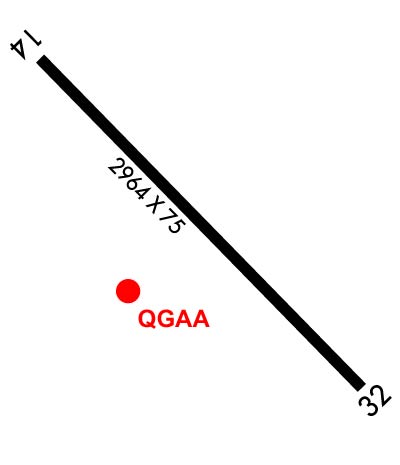
Runway Identifications
Runway Identification: 14/32Length: 2974 ft
Width: 75 ft
Surface: ASPHALT
Edge lights: Medium IntensityTreatment: NONE
Weight: PCN 9 /F/A/Y/T
| | Runway: 14 | | Runway: 32 |
| Mag heading: | 141° | Mag heading: | 321° |
| Rwy Slope: | -.60% Down | Rwy Slope: | .60% Up |
| Approach: | | Approach: | |
| Pattern: | Right Traffic | Pattern: | Left Traffic |
| Markings: | NONPRECISION INSTRUMENT | Markings: | NONPRECISION INSTRUMENT |
| Marking Condition: | GOOD | Marking Condition: | GOOD |
| Arresting Dev: | | Arresting Dev: | |
| Lat & Long: | N3036.0 W08433.6 | Lat. & Long.: | N3035.7 W08433.2 |
| Elev: | 221.1 ft. MSL | Elev: | 203.4 ft. MSL |
| TCH: | 20 ft. AGL | TCH: | 21 ft. AGL |
| Visual Glide Path: | 3.00 degrees | Visual Glide Path: | 3.00 degrees |
| Displaced Threshold: | 267 feet | Displaced Threshold: | 322 feet |
| Touchdown Zone: | YES | Touchdown Zone: | YES |
| Touchdown Elev.: | 221.1 feet | Touchdown Elev.: | 221.2 feet |
| Visual Glide Slope: | 2-Light PAPI on RIGHT side of Runway | Visual Glide Slope: | 2-Light PAPI on LEFT side of Runway |
| RVR Equipment: | | RVR Equipment: | |
| RVV Equipment: | NO | RVV Equipment: | NO |
| Approach Lights: | | Approach Lights: | |
| REIL: | NO | REIL: | NO |
| Centerline Lights: | NO | Centerline Lights: | NO |
| Touchdown lights: | NO | Touchdown lights: | NO |
| Runway Category: | Runway with a Visual Approach | Runway Category: | Runway with a Visual Approach |
| Declared Distances: | TORA:2964' TODA:2964' ASDA:2964' LDA:2700' | Declared Distances: | TORA:2964' TODA:2964' ASDA:2755' LDA:2431' |
| Obstructions: | TREES | Obstructions: | TREES |
| Marked: | NOT Marked/Lighted | Marked: | NOT Marked/Lighted |
| Clearance slope: | 20:1; RWY 32 APCH SLOPE 25:1 TO THE DTHR. | Clearance slope: | 17:1 |
| Obstruction height: | 70 feet AGL | Obstruction height: | 41 feet AGL |
| Dist. from runway: | 1605 feet | Dist. from runway: | 925 feet |
| Centerline offset: | 160 right of centerline | Centerline offset: | 110 feet right of centerline |
| Comments: | | Comments: | |