Approach Charts
| FltPlan does not have IFR approach charts available for K2GC. |
Current Weather/Notams (Metars, TAFs, Notams, NWS Forecast, PIREPS, and nearby weather)
Customs Information Send updates to Support@FltPlan.com
Customs Not Available
Database effective 04/18/2024
Airport Diagram might not be current.
|
| Facility Name: | GRAYS CREEK |
| City Name: | FAYETTEVILLE |
| County: | CUMBERLAND |
| State abbrev: | NC |
| State Name: | NORTH CAROLINA |
| | |
| Ownership: | PRIVATELY OWNED |
| Use: | OPEN TO THE PUBLIC |
| Owner's Name: | ROGER DALE & CINDY SMITH |
| Address: | 7154 BUTLER NURSERY ROAD |
| | FAYETTEVILLE, NC 28306 |
| Owner's Phone: | 910-483-4114 |
| | |
| Manager's Name: | CINDY B SMITH |
| Address: | 7154 BUTLER NURSERY ROAD |
| | FAYETTEVILLE, NC 28306 |
| Phone: | 910-286-3435 |
| | |
| FAA Region: | SOUTHERN |
| FAA Field Office: | MEM |
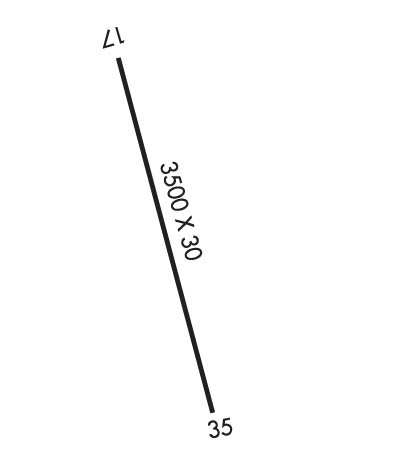
Runway Identifications
Runway Identification: 17/35Length: 3500 ft
Width: 30 ft
Surface: ASPHALT-GOOD CONDITION
Edge lights: Non-Standard Lighting SystemTreatment: NONE
| | Runway: 17 | | Runway: 35 |
| Mag heading: | N/A | Mag heading: | N/A |
| Approach: | | Approach: | |
| Pattern: | Left Traffic | Pattern: | Left Traffic |
| Markings: | BASIC | Markings: | BASIC |
| Marking Condition: | GOOD | Marking Condition: | FAIR |
| Arresting Dev: | | Arresting Dev: | |
| Lat & Long: | | Lat. & Long.: | |
| Elev: | N/A | Elev: | N/A |
| TCH: | | TCH: | |
| Visual Glide Path: | | Visual Glide Path: | |
| Displaced Threshold: | No | Displaced Threshold: | 350 feet; LGTD THR RELCTD 350 FT; 3150 FT OF RY 17/35 USBL AT NGT. |
| Touchdown Zone: | NO | Touchdown Zone: | NO |
| Touchdown Elev.: | | Touchdown Elev.: | |
| Visual Glide Slope: | | Visual Glide Slope: | |
| RVR Equipment: | | RVR Equipment: | |
| RVV Equipment: | NO | RVV Equipment: | NO |
| Approach Lights: | | Approach Lights: | |
| REIL: | NO | REIL: | NO |
| Centerline Lights: | NO | Centerline Lights: | NO |
| Touchdown lights: | NO | Touchdown lights: | NO |
| Runway Category: | Runway with a Visual Approach | Runway Category: | Runway with a Visual Approach |
| Declared Distances: | | Declared Distances: | |
| Obstructions: | TREES | Obstructions: | TREE; RWY 35 APCH ALSO HAS 40 FT UNMKD PLINE 800 FT FM DSPLCD THLD ON CNTRLN EXTDD. |
| Marked: | NOT Marked/Lighted | Marked: | NOT Marked/Lighted |
| Clearance slope: | 14:1 | Clearance slope: | 1:1; APCH RATIO 4:1 TO DSPLCD THLD. |
| Obstruction height: | 76 feet AGL | Obstruction height: | 83 feet AGL |
| Dist. from runway: | 1276 feet | Dist. from runway: | 244 feet |
| Centerline offset: | 89 left of centerline | Centerline offset: | 69 feet left of centerline |
| Comments: | | Comments: | 14 FT BLDG 169 FT FM THR OFFSET 79 FT L OF CNTRLN |

