Click here for more info on on SMS!

K2A0

MARK ANTON
DAYTON
TN
Time Zone: Eastern
Lat: N 3529.2
Long: W 08455.9
Elev: 718
Var: +04
Longest Runway: 5001
AWOS: 135.07
CTAF: 123.0

FBO & Flight Services info for K2A0

FBOs: Update your Fuel Prices

MARK ANTONPh: 423-775-8407 Fax: 423-775-8436 Freq: 123.0
Service
Jet
100LL
SAF
MoGas
Fuel Avail: PRIST PREMIXED. All taxes included.
Full5.80      Caution: Fuel prices have not been updated in 31 days.
Last Update: 03/25/2024 09:29

Self  5.95    
 Address: 350 WALTER SQUIRE RD   DAYTON, TN 37321
AWOSPh: 423-775-4695
-
Freq: 135.07  
If you are an FBO, call 1-203-262-1700 to update your info or email: FltPlan.Advertising@garmin.com
Advertise your FBO on FltPlan.com

Runway & Approach Info for K2A0
Rwy
Length
Land Dist**
Approach*
  Rwy
Length
Land Dist**
Approach*
03
5001x100  5001'          
 
  
21
  5001x100  5001'          
 
 * only ILS, LOC, LDA, and SDF approaches to a specific runway are shown
** For any Declared Landing Distance Available, please see A/FD or Approach plates
Runway Weight Capability (lbs.) Help
Runway IDSingle WheelDouble WheelDouble Tandem WheelDual Double Wheel
03/2128,00037,000N/AN/A
These numbers are Advisory and are not limits.   The Airport Manager should have more accurate Weight Limits
Approach Charts
Approaches    
Current Weather/Notams
Customs Information Send updates to Support@FltPlan.com
Customs Not Available
Database effective 05/16/2024
Airport Diagram of K2A0
Airport Diagram might not be current.

Facility Name: MARK ANTON
City Name: DAYTON
County: RHEA
State abbrev: TN
State Name: TENNESSEE
   
Ownership: PUBLICLY OWNED
Use: OPEN TO THE PUBLIC
Owner's Name: CITY OF DAYTON
Address: P.O. BOX 226
 DAYTON, TN 37321
Owner's Phone: 423-775-1818
  
Manager's Name: BRYAN JANISCH
Address: 350 WALTER SQUIRE RD
 DAYTON, TN 37321
Phone: 423-775-8407
   
FAA Region: SOUTHERN
FAA Field Office: MEM


Sunrise / Sunset times for MARK ANTON

DateSunriseSunset
04/24/24 Wednesday6:5520:21
04/25/24 Thursday6:5420:22
04/26/24 Friday6:5320:23
04/27/24 Saturday6:5220:23
04/28/24 Sunday6:5120:24
04/29/24 Monday6:4920:25
04/30/24 Tuesday6:4820:26
05/01/24 Wednesday6:4720:27
05/02/24 Thursday6:4620:28
05/03/24 Friday6:4520:28
05/04/24 Saturday6:4420:29
05/05/24 Sunday6:4320:30
05/06/24 Monday6:4220:31
05/07/24 Tuesday6:4120:32

Airport Facilities

Airport Attendance ScheduleMON-SAT 0900-1700, SUN 1300-1700; NO SVCS AVBL ON ANY FEDERAL HOLIDAY. PILOT LOUNGE AND RESTROOM AVAILABLE AFTER HOURS VIA UNICOM CODE ON TERMINAL NORTH DOOR.
Airport Status OPERATIONAL (This Status can change at any time - please check NOTAMS)
Airport Lighting ScheduleSS-SR
Airport Storage AvailableTie Downs
Extra Services AvailableNONE
Wind IndicatorYES - (lighted)
Control TowerNO
CTAF Frequency123.000
Unicom Frequency123.000
Rotating Beacon ColorWG
Segmented CircleYES
Landing FeeNO

Airport Inspection Data

Airport InspectedSTATE - performed by STATE AERONAUTICAL PERSONNEL
Inspection Date07/13/2021

Airport Services

Type of Fuel AvailableGrade 100LL, JET A
Airframe Repair ServiceMAJOR
Power Plant Repair ServiceMAJOR

Geographic Data

LatitudeN3529.2
LongitudeW08455.9 (ESTIMATED)
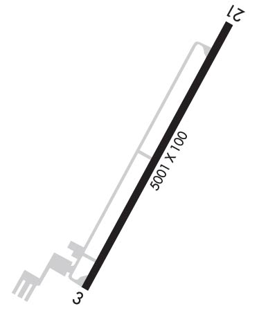
Arpt Elevation718ft (SURVEYED)
Magnetic Variation04W
4 miles Eof DAYTON
Traffic Pattern Altitude
Sectional ChartATLANTA

Aircraft Data

Operations (Reported)YearlyAvg. Daily
General Aviation Transient 400011
General Aviation Local 400011
Air Taxi 00
Commerical 00
Commuter 00
Military 1000
Aircraft based on Field
General Aviation Singles 35
General Aviation Multi 4
Jet Aircraft 0
General Aviation Helicopters 0
Military Aircraft 0
Gliders 0
Ultralights 0

FAA Services

FSS on field NO
FSS tie-in NASHVILLE
FSS Phone 1-800-WX-BRIEF
Who issues Notams BNA
Notam D service at airport YES
ARTCC Name ATLANTA

Federal Status

Airport Certification
Aircraft Rescue & Firefighting IndexNone
Airport of EntryNo
Custom Landing RightsNo
Joint Civil/MilitaryNo
Military Landing rightsYES

Federal Agreements

NATIONAL PLAN OF INTEGRATED AIRPORT SYSTEMS (NPIAS)
GRANT AGREEMENTS UNDER FAAP/ADAP/AIP
ASSURANCES PURSUANT TO TITLE VI, CIVIL RIGHTS ACT OF 1964

Remarks

THIS AIRPORT HAS BEEN SURVEYED BY THE NATIONAL GEODETIC SURVEY.
DEER ON & INVOF ARPT.
SELF SERVICE FUEL 100LL ONLY
FOR CD CTC CHATTANOOGA APCH AT 423-855-6478, WHEN APCH CLSD CTC ATLANTA ARTCC AT 770-210-7692.
Airport Communications & Frequencies:
CTAF Frequency:
123.000
Unicom Frequency:
123.000
Remarks
  • APCH/DEP SVC PRVDD BY ATLANTA ARTCC ON FREQS 133.6/254.3 (HINCH MOUNTAIN RCAG) WHEN CHATTANOOGA APCH CTL CLSD.
  • CHATTANOOGA Primary Approach Frequencies:  
    125.1
    379.1
    CHATTANOOGA Primary Departure Frequencies:  
    125.1
    379.1
    Runway Identifications
    Runway Identification: 03/21
    Length: 5001 ft
    Width: 100 ft
    Surface: ASPHALT-GOOD CONDITION
    Edge lights: Medium Intensity

    Treatment: NONE
    Weight: PCN 16 /F/C/X/T

     Runway: 03   Runway: 21
    Mag heading: 33°Mag heading: 213°
    Rwy Slope: .15% UpRwy Slope: -.15% Down
    Approach: Approach:
    Pattern: Left TrafficPattern: Left Traffic
    Markings: NONPRECISION INSTRUMENTMarkings: NONPRECISION INSTRUMENT
    Marking Condition: GOODMarking Condition: GOOD
    Arresting Dev: Arresting Dev:
    Lat & Long: N3528.8  W08456.1Lat. & Long.: N3529.5  W08455.6
    Elev: 710.7 ft. MSLElev: 718.2 ft. MSL
    TCH: 31 ft. AGLTCH: 31 ft. AGL
    Visual Glide Path: 3.00 degreesVisual Glide Path: 3.00 degrees
    Displaced Threshold: NoDisplaced Threshold: No
    Touchdown Zone: YESTouchdown Zone: YES
    Touchdown Elev.: 714.3 feetTouchdown Elev.: 718.2 feet
    Visual Glide Slope: 2-Light PAPI on LEFT side of RunwayVisual Glide Slope: 2-Light PAPI on LEFT side of Runway
    RVR Equipment: RVR Equipment:
    RVV Equipment: NORVV Equipment: NO
    Approach Lights: Approach Lights:
    REIL: YESREIL: YES
    Centerline Lights: NOCenterline Lights: NO
    Touchdown lights: NOTouchdown lights: NO
    Runway Category: Runway with a Non-precision Approach having visibility minimums greater than 3/4 mileRunway Category: Runway with a Non-precision Approach having visibility minimums greater than 3/4 mile
    Declared Distances: Declared Distances:
    Obstructions: TREEObstructions: TREE
    Marked: NOT Marked/LightedMarked: NOT Marked/Lighted
    Clearance slope: 29:1Clearance slope: 27:1
    Obstruction height: 36 feet AGLObstruction height: 96 feet AGL
    Dist. from runway: 1266 feetDist. from runway: 2833 feet
    Centerline offset: 240 right of centerlineCenterline offset: 441 feet left of centerline
    Comments: Comments:
    C:4/P: