Approach Charts
| FltPlan does not have IFR approach charts available for K29N. |
Current Weather/Notams (Metars, TAFs, Notams, NWS Forecast, PIREPS, and nearby weather)
Customs Information Send updates to Support@FltPlan.com
Customs Not Available
Database effective 05/16/2024
Airport Diagram might not be current.
|
| Facility Name: | KROELINGER |
| City Name: | VINELAND |
| County: | CUMBERLAND |
| State abbrev: | NJ |
| State Name: | NEW JERSEY |
| | |
| Ownership: | PRIVATELY OWNED |
| Use: | OPEN TO THE PUBLIC |
| Owner's Name: | BDGS. INC. |
| Address: | 317 W. ELMER ROAD |
| | VINELAND, NJ 08360 |
| Owner's Phone: | 856-692-8098 |
| | |
| Manager's Name: | ROBERT PANTALEO |
| Address: | 1242 W. GARDEN ROAD |
| | VINELAND, NJ 08360 |
| Phone: | 856-794-2134 |
| | |
| FAA Region: | EASTERN |
| FAA Field Office: | HAR |
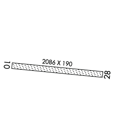
Runway Identifications
Runway Identification: 10/28Length: 2086 ft
Width: 190 ft
Surface: GRASS-GOOD CONDITION
Edge lights: Treatment: NONE
| | Runway: 10 | | Runway: 28 |
| Mag heading: | 106° | Mag heading: | 286° |
| Rwy Slope: | .00% | Rwy Slope: | .00% |
| Approach: | | Approach: | |
| Pattern: | Left Traffic | Pattern: | Left Traffic |
| Markings: | | Markings: | |
| Marking Condition: | | Marking Condition: | |
| Arresting Dev: | | Arresting Dev: | |
| Lat & Long: | N3931.5 W07503.0 | Lat. & Long.: | N3931.4 W07502.6 |
| Elev: | 80.0 ft. MSL | Elev: | 80.0 ft. MSL |
| TCH: | | TCH: | |
| Visual Glide Path: | | Visual Glide Path: | |
| Displaced Threshold: | No | Displaced Threshold: | No |
| Touchdown Zone: | YES | Touchdown Zone: | YES |
| Touchdown Elev.: | 87.0 feet | Touchdown Elev.: | 87.0 feet |
| Visual Glide Slope: | | Visual Glide Slope: | |
| RVR Equipment: | | RVR Equipment: | |
| RVV Equipment: | NO | RVV Equipment: | NO |
| Approach Lights: | | Approach Lights: | |
| REIL: | NO | REIL: | NO |
| Centerline Lights: | NO | Centerline Lights: | NO |
| Touchdown lights: | NO | Touchdown lights: | NO |
| Runway Category: | Runway with a Visual Approach | Runway Category: | Runway with a Visual Approach |
| Declared Distances: | | Declared Distances: | |
| Obstructions: | TREE | Obstructions: | PLINE |
| Marked: | NOT Marked/Lighted | Marked: | MARKED |
| Clearance slope: | | Clearance slope: | 2:1 |
| Obstruction height: | 47 feet AGL | Obstruction height: | 32 feet AGL |
| Dist. from runway: | 20 feet | Dist. from runway: | 90 feet |
| Centerline offset: | 90 left of centerline | Centerline offset: | |
| Comments: | | Comments: | |

