Approach Charts
| FltPlan does not have IFR approach charts available for K23D. |
Current Weather/Notams (Metars, TAFs, Notams, NWS Forecast, PIREPS, and nearby weather)
Customs Information Send updates to Support@FltPlan.com
Customs Not Available
Database effective 05/16/2024
Airport Diagram might not be current.
|
| Facility Name: | KARLSTAD MUNI |
| City Name: | KARLSTAD |
| County: | KITTSON |
| State abbrev: | MN |
| State Name: | MINNESOTA |
| | |
| Ownership: | PUBLICLY OWNED |
| Use: | OPEN TO THE PUBLIC |
| Owner's Name: | CITY OF KARLSTAD |
| Address: | PO BOX 299 |
| | KARLSTAD, MN 56732-0299 |
| Owner's Phone: | 218-436-2178 |
| | |
| Manager's Name: | SHELBY FOSSELL |
| Address: | PO BOX 299 |
| | KARLSTAD, MN 56732-0299 |
| Phone: | 218-436-2178 |
| | |
| FAA Region: | GREAT LAKES |
| FAA Field Office: | DMA |
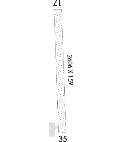
Runway Identifications
Runway Identification: 17/35Length: 2606 ft
Width: 159 ft
Surface: GRASS-FAIR CONDITION
Edge lights: Non-Standard Lighting SystemTreatment: NONE
| | Runway: 17 | | Runway: 35 |
| Mag heading: | N/A | Mag heading: | N/A |
| Rwy Slope: | -.07% Down | Rwy Slope: | .07% Up |
| Approach: | | Approach: | |
| Pattern: | Left Traffic | Pattern: | Left Traffic |
| Markings: | | Markings: | |
| Marking Condition: | YELLOW CONES. | Marking Condition: | YELLOW CONES. |
| Arresting Dev: | | Arresting Dev: | |
| Lat & Long: | N4834.9 W09632.5 | Lat. & Long.: | N4834.4 W09632.5 |
| Elev: | 1025.0 ft. MSL | Elev: | 1023.2 ft. MSL |
| TCH: | | TCH: | |
| Visual Glide Path: | | Visual Glide Path: | |
| Displaced Threshold: | No | Displaced Threshold: | No |
| Touchdown Zone: | NO | Touchdown Zone: | NO |
| Touchdown Elev.: | | Touchdown Elev.: | |
| Visual Glide Slope: | | Visual Glide Slope: | |
| RVR Equipment: | | RVR Equipment: | |
| RVV Equipment: | NO | RVV Equipment: | NO |
| Approach Lights: | | Approach Lights: | |
| REIL: | NO | REIL: | NO |
| Centerline Lights: | NO | Centerline Lights: | NO |
| Touchdown lights: | NO | Touchdown lights: | NO |
| Runway Category: | Runway with a Visual Approach | Runway Category: | Runway with a Visual Approach |
| Declared Distances: | | Declared Distances: | |
| Obstructions: | NMRS APCH SFC PENETRATIONS. | Obstructions: | ROAD |
| Marked: | NOT Marked/Lighted | Marked: | NOT Marked/Lighted |
| Clearance slope: | 20:1 | Clearance slope: | 9:1; RY 35 ROAD: SIGNS POSTED TO CONTROL TFC. |
| Obstruction height: | | Obstruction height: | 15 feet AGL |
| Dist. from runway: | | Dist. from runway: | 143 feet |
| Centerline offset: | | Centerline offset: | 124 feet left of centerline |
| Comments: | | Comments: | |

