Current Weather/Notams (Metars, TAFs, Notams, NWS Forecast, PIREPS, and nearby weather)
Customs Information Send updates to Support@FltPlan.com
Customs Not Available
Database effective 05/16/2024
Airport Diagram might not be current.
|
| Facility Name: | JAKE ARNER MEML |
| City Name: | LEHIGHTON |
| County: | CARBON |
| State abbrev: | PA |
| State Name: | PENNSYLVANIA |
| | |
| Ownership: | PUBLICLY OWNED |
| Use: | OPEN TO THE PUBLIC |
| Owner's Name: | CARBON COUNTY AIRPORT AUTHORITY |
| Address: | 2321 MAHONING DR EAST |
| | LEHIGHTON, PA 18235 |
| Owner's Phone: | 570-386-5025 |
| | |
| Manager's Name: | PAUL SMITH |
| Address: | 2321 MAHONING DRIVE EAST |
| | LEHIGHTON, PA 18235 |
| Phone: | 570-778-4783; FOR ASST AFTER HRS CTC 570-778-4783. |
| | |
| FAA Region: | EASTERN |
| FAA Field Office: | HAR |
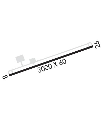
Runway Identifications
Runway Identification: 08/26Length: 3000 ft
Width: 60 ft
Surface: ASPHALT-GOOD CONDITION
Edge lights: Medium IntensityTreatment: NONE
| | Runway: 08 | | Runway: 26 |
| Mag heading: | 81° | Mag heading: | 261° |
| Rwy Slope: | -.83% Down | Rwy Slope: | .83% Up |
| Approach: | | Approach: | |
| Pattern: | Left Traffic | Pattern: | Left Traffic |
| Markings: | NONPRECISION INSTRUMENT | Markings: | NONPRECISION INSTRUMENT |
| Marking Condition: | GOOD | Marking Condition: | GOOD |
| Arresting Dev: | | Arresting Dev: | |
| Lat & Long: | N4048.5 W07546.0 | Lat. & Long.: | N4048.7 W07545.4 |
| Elev: | 532.0 ft. MSL | Elev: | 507.0 ft. MSL |
| TCH: | 40 ft. AGL | TCH: | 40 ft. AGL |
| Visual Glide Path: | 3.00 degrees | Visual Glide Path: | 3.00 degrees |
| Displaced Threshold: | No | Displaced Threshold: | No |
| Touchdown Zone: | YES | Touchdown Zone: | YES |
| Touchdown Elev.: | 534.0 feet | Touchdown Elev.: | 534.0 feet |
| Visual Glide Slope: | 2-Light PAPI on LEFT side of Runway | Visual Glide Slope: | 2-Light PAPI on LEFT side of Runway |
| RVR Equipment: | | RVR Equipment: | |
| RVV Equipment: | NO | RVV Equipment: | NO |
| Approach Lights: | | Approach Lights: | |
| REIL: | YES | REIL: | YES |
| Centerline Lights: | NO | Centerline Lights: | NO |
| Touchdown lights: | NO | Touchdown lights: | NO |
| Runway Category: | Runway with a Non-precision Approach | Runway Category: | Runway with a Non-precision Approach |
| Declared Distances: | | Declared Distances: | |
| Obstructions: | TREE | Obstructions: | TREES |
| Marked: | NOT Marked/Lighted | Marked: | NOT Marked/Lighted |
| Clearance slope: | 11:1 | Clearance slope: | 3:1 |
| Obstruction height: | 47 feet AGL | Obstruction height: | 74 feet AGL |
| Dist. from runway: | 748 feet | Dist. from runway: | 437 feet |
| Centerline offset: | 287 left of centerline | Centerline offset: | 263 feet left of centerline |
| Comments: | 11 FT BRUSH, 163 FT FM RWY END, 90 FT R. | Comments: | |

