Current Weather/Notams (Metars, TAFs, Notams, NWS Forecast, PIREPS, and nearby weather)
Customs Information Send updates to Support@FltPlan.com
Customs Not Available
Database effective 04/18/2024
Airport Diagram might not be current.
|
| Facility Name: | ROBBINS FLD |
| City Name: | ONEONTA |
| County: | BLOUNT |
| State abbrev: | AL |
| State Name: | ALABAMA |
| | |
| Ownership: | PUBLICLY OWNED |
| Use: | OPEN TO THE PUBLIC |
| Owner's Name: | CITY OF ONEONTA & BLOUNT CTY. |
| Address: | 202 3RD AVE EAST |
| | ONEONTA, AL 35121 |
| Owner's Phone: | 205-274-2150 |
| | |
| Manager's Name: | BRANDON HORTON |
| Address: | 202 3RD AVE EAST |
| | ONEONTA, AL 35121 |
| Phone: | 205-960-3553 |
| | |
| FAA Region: | SOUTHERN |
| FAA Field Office: | JAN |
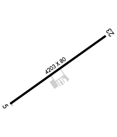
Runway Identifications
Runway Identification: 06/24Length: 4203 ft
Width: 80 ft
Surface: ASPHALT
Edge lights: Medium IntensityTreatment: AGGREGATE FRICTION SEAL COAT
| | Runway: 06 | | Runway: 24 |
| Mag heading: | 58° | Mag heading: | 238° |
| Rwy Slope: | .40% Up | Rwy Slope: | -.40% Down |
| Approach: | | Approach: | |
| Pattern: | Left Traffic | Pattern: | Left Traffic |
| Markings: | NONPRECISION INSTRUMENT | Markings: | NONPRECISION INSTRUMENT |
| Marking Condition: | GOOD | Marking Condition: | GOOD |
| Arresting Dev: | | Arresting Dev: | |
| Lat & Long: | N3358.1 W08623.2 | Lat. & Long.: | N3358.5 W08622.5 |
| Elev: | 1108.1 ft. MSL | Elev: | 1124.8 ft. MSL |
| TCH: | 58 ft. AGL | TCH: | 33 ft. AGL |
| Visual Glide Path: | 4.00 degrees | Visual Glide Path: | 3.00 degrees |
| Displaced Threshold: | No | Displaced Threshold: | 105 feet |
| Touchdown Zone: | YES | Touchdown Zone: | YES |
| Touchdown Elev.: | 1120.8 feet | Touchdown Elev.: | 1124.9 feet |
| Visual Glide Slope: | 2-Light PAPI on LEFT side of Runway | Visual Glide Slope: | 2-Light PAPI on LEFT side of Runway |
| RVR Equipment: | | RVR Equipment: | |
| RVV Equipment: | NO | RVV Equipment: | NO |
| Approach Lights: | | Approach Lights: | |
| REIL: | NO | REIL: | NO |
| Centerline Lights: | NO | Centerline Lights: | NO |
| Touchdown lights: | NO | Touchdown lights: | NO |
| Runway Category: | Runway with a Non-precision Approach | Runway Category: | Runway with a Non-precision Approach |
| Declared Distances: | TORA:4098' TODA:4098' ASDA:4098' LDA:4098' | Declared Distances: | TORA:4203' TODA:4203' ASDA:4203' LDA:4098' |
| Obstructions: | TREES | Obstructions: | TREES |
| Marked: | NOT Marked/Lighted | Marked: | NOT Marked/Lighted |
| Clearance slope: | 3:1; RWY 24 APCH SLP 12:1 TO DSPLCD THR. | Clearance slope: | 5:1 |
| Obstruction height: | 89 feet AGL | Obstruction height: | 44 feet AGL |
| Dist. from runway: | 529 feet | Dist. from runway: | 449 feet |
| Centerline offset: | 233 left of centerline | Centerline offset: | 296 feet right of centerline |
| Comments: | | Comments: | |

