Approach Charts
| FltPlan does not have IFR approach charts available for K1U2. |
Current Weather/Notams (Metars, TAFs, Notams, NWS Forecast, PIREPS, and nearby weather)
Customs Information Send updates to Support@FltPlan.com
Customs Not Available
Database effective 05/16/2024
Airport Diagram might not be current.
|
| Facility Name: | MUD LAKE/WEST JEFFERSON COUNTY |
| City Name: | MUD LAKE |
| County: | JEFFERSON |
| State abbrev: | ID |
| State Name: | IDAHO |
| | |
| Ownership: | PUBLICLY OWNED |
| Use: | OPEN TO THE PUBLIC |
| Owner's Name: | CITY OF MUD LAKE |
| Address: | PO BOX 131 |
| | TERRETON, ID 83450 |
| Owner's Phone: | 208-663-4567 |
| | |
| Manager's Name: | SHAWN CALDER; SCALDER@DESERTAIRAG.COM. |
| Address: | 1583N 1000 E |
| | MUD LAKE, ID 83450 |
| Phone: | 208-681-0418 |
| | |
| FAA Region: | NORTHWEST MOUNTAIN |
| FAA Field Office: | HLN |
Runway Identifications
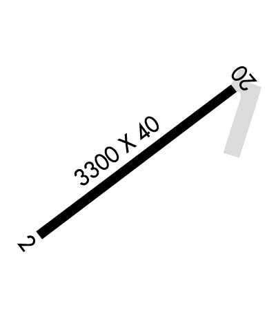
Runway Identification: 04/22Length: 2950 ft
Width: 40 ft
Surface: ASPHALT-FAIR CONDITION
Edge lights: Non-Standard Lighting SystemTreatment: NONE
| | Runway: 04 | | Runway: 22 |
| Mag heading: | N/A | Mag heading: | N/A |
| Rwy Slope: | -.24% Down | Rwy Slope: | .24% Up |
| Approach: | | Approach: | |
| Pattern: | Left Traffic | Pattern: | Left Traffic |
| Markings: | BASIC | Markings: | BASIC |
| Marking Condition: | FAIR | Marking Condition: | FAIR |
| Arresting Dev: | | Arresting Dev: | |
| Lat & Long: | N4350.9 W11230.3 | Lat. & Long.: | N4351.3 W11229.8 |
| Elev: | 4795.0 ft. MSL | Elev: | 4788.0 ft. MSL |
| TCH: | | TCH: | |
| Visual Glide Path: | | Visual Glide Path: | |
| Displaced Threshold: | No | Displaced Threshold: | No |
| Touchdown Zone: | NO | Touchdown Zone: | NO |
| Touchdown Elev.: | | Touchdown Elev.: | |
| Visual Glide Slope: | | Visual Glide Slope: | |
| RVR Equipment: | | RVR Equipment: | |
| RVV Equipment: | NO | RVV Equipment: | NO |
| Approach Lights: | | Approach Lights: | |
| REIL: | NO | REIL: | NO |
| Centerline Lights: | NO | Centerline Lights: | NO |
| Touchdown lights: | NO | Touchdown lights: | NO |
| Runway Category: | Runway with a Visual Approach | Runway Category: | Runway with a Visual Approach |
| Declared Distances: | | Declared Distances: | |
| Obstructions: | FENCE | Obstructions: | ROAD; ADNL OBSTN: +40 FT POLE AT 650 FT, 130 FT R FM THR. |
| Marked: | NOT Marked/Lighted | Marked: | NOT Marked/Lighted |
| Clearance slope: | 18:1; 17 FT ROAD AT 580 FT, 33:1 FM THR. | Clearance slope: | 8:1; THR 450 FT FM 15 FT ROAD. 22:1 SLP FM THR. |
| Obstruction height: | 5 feet AGL | Obstruction height: | 12 feet AGL |
| Dist. from runway: | 290 feet | Dist. from runway: | 300 feet |
| Centerline offset: | | Centerline offset: | 150 feet left of centerline |
| Comments: | 17 FT HWY AT 80 FT ON CNTRLN, FM END OF PAVEMENT. | Comments: | |

