Current Weather/Notams (Metars, TAFs, Notams, NWS Forecast, PIREPS, and nearby weather)
Customs Information Send updates to Support@FltPlan.com
Customs Not Available
Database effective 05/16/2024
Airport Diagram might not be current.
|
| Facility Name: | DOUGLAS HUNTER FLD |
| City Name: | PORTLAND |
| County: | SUMNER |
| State abbrev: | TN |
| State Name: | TENNESSEE |
| | |
| Ownership: | PUBLICLY OWNED |
| Use: | OPEN TO THE PUBLIC |
| Owner's Name: | CITY OF PORTLAND |
| Address: | 100 SOUTH RUSSELL ST. |
| | MOBILE, TN 37148 |
| Owner's Phone: | 615-533-7210 |
| | |
| Manager's Name: | DOUGLAS HUNTER |
| Address: | 601 AIRPORT RD |
| | PORTLAND, TN 37148 |
| Phone: | 615-323-7500; 615-533-7210. |
| | |
| FAA Region: | SOUTHERN |
| FAA Field Office: | MEM |
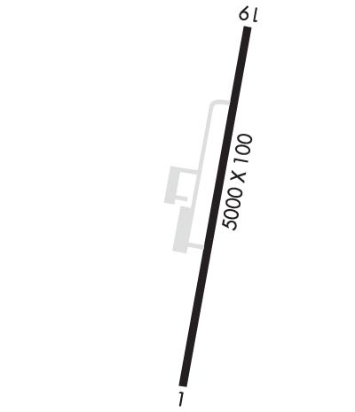
Runway Identifications
Runway Identification: 01/19Length: 5000 ft
Width: 100 ft
Surface: ASPHALT-FAIR CONDITION
Edge lights: Medium IntensityTreatment: NONE
Weight: PCN 13 /F/C/X/T
| | Runway: 01 | | Runway: 19 |
| Mag heading: | 13° | Mag heading: | 193° |
| Rwy Slope: | -.94% Down | Rwy Slope: | .94% Up |
| Approach: | | Approach: | |
| Pattern: | Left Traffic | Pattern: | Left Traffic |
| Markings: | NONPRECISION INSTRUMENT | Markings: | NONPRECISION INSTRUMENT |
| Marking Condition: | FAIR | Marking Condition: | FAIR |
| Arresting Dev: | | Arresting Dev: | |
| Lat & Long: | N3635.2 W08628.7 | Lat. & Long.: | N3636.0 W08628.5 |
| Elev: | 817.2 ft. MSL | Elev: | 770.0 ft. MSL |
| TCH: | | TCH: | 21 ft. AGL |
| Visual Glide Path: | 3.50 degrees | Visual Glide Path: | 3.00 degrees |
| Displaced Threshold: | No | Displaced Threshold: | No |
| Touchdown Zone: | YES | Touchdown Zone: | YES |
| Touchdown Elev.: | 817.2 feet | Touchdown Elev.: | 803.7 feet |
| Visual Glide Slope: | 4-Light PAPI on RIGHT side of Runway | Visual Glide Slope: | 4-Light PAPI on RIGHT side of Runway |
| RVR Equipment: | | RVR Equipment: | |
| RVV Equipment: | NO | RVV Equipment: | NO |
| Approach Lights: | | Approach Lights: | |
| REIL: | YES | REIL: | YES |
| Centerline Lights: | NO | Centerline Lights: | NO |
| Touchdown lights: | NO | Touchdown lights: | NO |
| Runway Category: | Runway with a Non-precision Approach having visibility minimums greater than 3/4 mile | Runway Category: | Runway with a Non-precision Approach having visibility minimums greater than 3/4 mile |
| Declared Distances: | | Declared Distances: | |
| Obstructions: | TREE | Obstructions: | |
| Marked: | NOT Marked/Lighted | Marked: | |
| Clearance slope: | 19:1 | Clearance slope: | 34:1 |
| Obstruction height: | 84 feet AGL | Obstruction height: | |
| Dist. from runway: | 1840 feet | Dist. from runway: | |
| Centerline offset: | 344 right of centerline | Centerline offset: | |
| Comments: | | Comments: | |

