
| ||||||
| ||||||
|
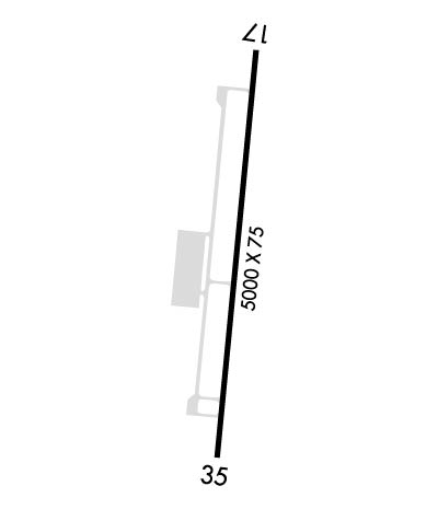
| Rwy | Rwy | |||||||
| 5000x75 | 5000' | 5000x75 | 5000' | |||||
| Runway ID | Single Wheel | Double Wheel | Double Tandem Wheel | Dual Double Wheel |
| 17/35 | 30,000 | N/A | N/A | N/A |
| These numbers are Advisory and are not limits. The Airport Manager should have more accurate Weight Limits | ||||
| FltPlan does not have IFR approach charts available for K1G4. |
 Airport Diagram might not be current. | |
| Facility Name: | GRAND CANYON WEST |
| City Name: | PEACH SPRINGS |
| County: | MOHAVE |
| State abbrev: | AZ |
| State Name: | ARIZONA |
| Ownership: | PUBLICLY OWNED |
| Use: | OPEN TO THE PUBLIC |
| Owner's Name: | THE HUALAPAI INDIAN TRIBE |
| Address: | P.O. BOX 359 |
| PEACH SPRINGS, AZ 86434 | |
| Owner's Phone: | 928-769-2419 |
| Manager's Name: | |
| Address: | PO BOX 359 |
| PEACH SPRINGS, AZ 86434 | |
| Phone: | 928-351-1802; ARPT OPS & EMERG SERVICES PHONE: 928-351-1802 |
| FAA Region: | WESTERN-PACIFIC |
| FAA Field Office: | PHX |
| Date | Sunrise | Sunset |
|---|---|---|
| 04/22/24 Monday | 5:52 | 19:16 |
| 04/23/24 Tuesday | 5:51 | 19:16 |
| 04/24/24 Wednesday | 5:50 | 19:17 |
| 04/25/24 Thursday | 5:49 | 19:18 |
| 04/26/24 Friday | 5:47 | 19:19 |
| 04/27/24 Saturday | 5:46 | 19:20 |
| 04/28/24 Sunday | 5:45 | 19:21 |
| 04/29/24 Monday | 5:44 | 19:22 |
| 04/30/24 Tuesday | 5:43 | 19:22 |
| 05/01/24 Wednesday | 5:42 | 19:23 |
| 05/02/24 Thursday | 5:41 | 19:24 |
| 05/03/24 Friday | 5:40 | 19:25 |
| 05/04/24 Saturday | 5:39 | 19:26 |
| 05/05/24 Sunday | 5:38 | 19:27 |
| Airport Attendance Schedule | 7 Days A Week DALGT |
| Airport Status | OPERATIONAL (This Status can change at any time - please check NOTAMS) |
| Airport Lighting Schedule | ACTVT REIL RWY 17, 35; MIRL RWY 17/35 - CTAF. |
| Airport Storage Available | Tie Downs |
| Extra Services Available | NONE |
| Wind Indicator | YES - (unlit) |
| Control Tower | NO |
| CTAF Frequency | 122.900 |
| Unicom Frequency | |
| Rotating Beacon Color | WG |
| Segmented Circle | YES |
| Landing Fee | NO |
| Airport Inspected | 5010-2 PRIVATE USE MAILOUT PROGRAM - performed by FAA AIRPORTS FIELD PERSONNEL |
| Inspection Date | 06/10/2023 |
| Type of Fuel Available | None |
| Airframe Repair Service | NONE |
| Power Plant Repair Service | NONE |
| Latitude | N3559.2 |
| Longitude | W11349.0 (ESTIMATED) |
| Arpt Elevation | 4816ft (SURVEYED) |
| Magnetic Variation | 14E |
| 60 miles NW | of PEACH SPRINGS |
| Traffic Pattern Altitude | |
| Sectional Chart | LAS VEGAS |
| Operations (Reported) | Yearly | Avg. Daily |
|---|---|---|
| General Aviation Transient | 155 | 0 |
| General Aviation Local | 0 | 0 |
| Air Taxi | 12762 | 35 |
| Commerical | 0 | 0 |
| Commuter | 0 | 0 |
| Military | 0 | 0 |
| Aircraft based on Field | |
|---|---|
| General Aviation Singles | 0 |
| General Aviation Multi | 0 |
| Jet Aircraft | 0 |
| General Aviation Helicopters | 0 |
| Military Aircraft | 0 |
| Gliders | 0 |
| Ultralights | 0 |
| FSS on field | NO |
| FSS tie-in | PRESCOTT |
| FSS Phone | 1-800-WX-BRIEF |
| Who issues Notams | PRC |
| Notam D service at airport | YES |
| ARTCC Name | LOS ANGELES |
| Airport Certification | AIRPORT RECEIVING SCHEDULED AIR CARRIER SERVICE FROM CARRIERS CERTIFICATED BY THE CIVIL AERONAUTICS BOARD |
| Aircraft Rescue & Firefighting Index | AIRPORT HAS A CERTIFICATE UNDER CFR PART 139 |
| Airport of Entry | No |
| Custom Landing Rights | No |
| Joint Civil/Military | No |
| Military Landing rights | No |
| NATIONAL PLAN OF INTEGRATED AIRPORT SYSTEMS (NPIAS) |
| GRANT AGREEMENTS UNDER FAAP/ADAP/AIP |
| ASSURANCES PURSUANT TO TITLE VI, CIVIL RIGHTS ACT OF 1964 |
| (E111-1) DUE TO THE PROXIMITY OF THIS ARPT TO SPECIAL FEDERAL AVIATION REGULATION - SFAR 50-2 - GRAND CANYON NATIONAL PARK SPECIAL FLIGHT RULES AREA; PARTICULAR ATTENTION SHALL BE GIVEN TO THE SPECIFIC REGULATION IN THE SFAR THAT APPLY TO ALL ACFT OPNS BLO 14500 FT MSL. |
| DUE TO HIGH COMMERICAL FIXED WING AND HELICOPTER TRAFFIC VOLUME NO PRACTICE TOUCH AND GO OPERATIONS. |
| CALM WINDS RECOMMEND USING RWY 35 FOR DEPT AND RWY 17 FOR LANDING. |
| USE EXTREME CARE DUE TO LARGE VOLUME OF HIGH-SPEED FIXED WING & ROTARY WING TFC IN & AROUND VICINITY OF THE ARPT. |
| TRANSIENT AIRCRAFT MUST PARK AT SOUTH END OF APRON. |
| FOR CD CTC LOS ANGELES ARTCC AT 661-265-8205. |
| AWOS 928-237-1354 |
| Runway: 17 | Runway: 35 | ||
| Mag heading: | N/A | Mag heading: | N/A |
| Rwy Slope: | 1.10% Up | Rwy Slope: | -1.10% Down |
| Approach: | Approach: | ||
| Pattern: | Right Traffic | Pattern: | Left Traffic |
| Markings: | NONPRECISION INSTRUMENT | Markings: | NONPRECISION INSTRUMENT |
| Marking Condition: | GOOD | Marking Condition: | GOOD |
| Arresting Dev: | Arresting Dev: | ||
| Lat & Long: | N3559.6 W11349.0 | Lat. & Long.: | N3558.8 W11349.1 |
| Elev: | 4761.5 ft. MSL | Elev: | 4816.7 ft. MSL |
| TCH: | 39 ft. AGL | TCH: | 38 ft. AGL |
| Visual Glide Path: | 3.00 degrees | Visual Glide Path: | 3.00 degrees |
| Displaced Threshold: | No | Displaced Threshold: | No |
| Touchdown Zone: | YES | Touchdown Zone: | YES |
| Touchdown Elev.: | 4798.8 feet | Touchdown Elev.: | 4816.7 feet |
| Visual Glide Slope: | 4-Light PAPI on LEFT side of Runway | Visual Glide Slope: | 4-Light PAPI on LEFT side of Runway |
| RVR Equipment: | RVR Equipment: | ||
| RVV Equipment: | NO | RVV Equipment: | NO |
| Approach Lights: | Approach Lights: | ||
| REIL: | YES | REIL: | YES |
| Centerline Lights: | NO | Centerline Lights: | NO |
| Touchdown lights: | NO | Touchdown lights: | NO |
| Runway Category: | Runway with a Visual Approach | Runway Category: | Runway with a Visual Approach |
| Declared Distances: | TORA:5000' TODA:5000' ASDA:5000' LDA:5000' | Declared Distances: | TORA:5000' TODA:5000' ASDA:5000' LDA:5000' |
