Approach Charts
| FltPlan does not have IFR approach charts available for K1F5. |
Current Weather/Notams (Metars, TAFs, Notams, NWS Forecast, PIREPS, and nearby weather)
Customs Information Send updates to Support@FltPlan.com
Customs Not Available
Database effective 04/18/2024
Airport Diagram might not be current.
|
| Facility Name: | HOXIE-SHERIDAN COUNTY |
| City Name: | HOXIE |
| County: | SHERIDAN |
| State abbrev: | KS |
| State Name: | KANSAS |
| | |
| Ownership: | PUBLICLY OWNED |
| Use: | OPEN TO THE PUBLIC |
| Owner's Name: | COUNTY CITY AIRPORT COMMISSION |
| Address: | PO BOX 898 |
| | HOXIE, KS 67740 |
| Owner's Phone: | 785-675-3291 |
| | |
| Manager's Name: | ROGER MAUCK |
| Address: | P O BOX 898 |
| | HOXIE, KS 67740 |
| Phone: | 785-675-3988 |
| | |
| FAA Region: | CENTRAL |
| FAA Field Office: | NONE |
Runway Identifications
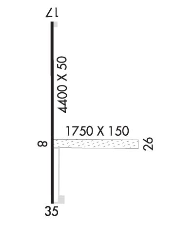
Runway Identification: 08/26Length: 1750 ft
Width: 150 ft
Surface: GRASS-FAIR CONDITION
Edge lights: Treatment: NONE
| | Runway: 08 | | Runway: 26 |
| Mag heading: | 80° | Mag heading: | 260° |
| Rwy Slope: | -1.43% Down | Rwy Slope: | 1.43% Up |
| Approach: | | Approach: | |
| Pattern: | Left Traffic | Pattern: | Left Traffic |
| Markings: | | Markings: | |
| Marking Condition: | | Marking Condition: | |
| Arresting Dev: | | Arresting Dev: | |
| Lat & Long: | N3921.9 W10026.5 | Lat. & Long.: | N3921.9 W10026.1 |
| Elev: | 2725.0 ft. MSL | Elev: | 2700.0 ft. MSL |
| TCH: | | TCH: | |
| Visual Glide Path: | | Visual Glide Path: | |
| Displaced Threshold: | No | Displaced Threshold: | No |
| Touchdown Zone: | NO | Touchdown Zone: | NO |
| Touchdown Elev.: | | Touchdown Elev.: | |
| Visual Glide Slope: | | Visual Glide Slope: | |
| RVR Equipment: | | RVR Equipment: | |
| RVV Equipment: | NO | RVV Equipment: | NO |
| Approach Lights: | | Approach Lights: | |
| REIL: | NO | REIL: | NO |
| Centerline Lights: | NO | Centerline Lights: | NO |
| Touchdown lights: | NO | Touchdown lights: | NO |
| Runway Category: | Runway with a Visual Approach | Runway Category: | Runway with a Visual Approach |
| Declared Distances: | | Declared Distances: | |
| Obstructions: | ROAD | Obstructions: | |
| Marked: | NOT Marked/Lighted | Marked: | |
| Clearance slope: | 10:1 | Clearance slope: | 20:1 |
| Obstruction height: | 17 feet AGL | Obstruction height: | |
| Dist. from runway: | 180 feet | Dist. from runway: | |
| Centerline offset: | | Centerline offset: | |
| Comments: | | Comments: | |
Runway Identification: 17/35Length: 4400 ft
Width: 50 ft
Surface: ASPHALT-GOOD CONDITION
Edge lights: Medium IntensityTreatment: NONE
| | Runway: 17 | | Runway: 35 |
| Mag heading: | N/A | Mag heading: | N/A |
| Approach: | | Approach: | |
| Pattern: | Left Traffic | Pattern: | Left Traffic |
| Markings: | NUMBERS ONLY | Markings: | NUMBERS ONLY |
| Marking Condition: | GOOD; MARKINGS FADED. | Marking Condition: | GOOD |
| Arresting Dev: | | Arresting Dev: | |
| Lat & Long: | | Lat. & Long.: | |
| Elev: | N/A | Elev: | N/A |
| TCH: | | TCH: | |
| Visual Glide Path: | | Visual Glide Path: | |
| Displaced Threshold: | No | Displaced Threshold: | No |
| Touchdown Zone: | NO | Touchdown Zone: | NO |
| Touchdown Elev.: | | Touchdown Elev.: | |
| Visual Glide Slope: | | Visual Glide Slope: | |
| RVR Equipment: | | RVR Equipment: | |
| RVV Equipment: | NO | RVV Equipment: | NO |
| Approach Lights: | | Approach Lights: | |
| REIL: | NO | REIL: | NO |
| Centerline Lights: | NO | Centerline Lights: | NO |
| Touchdown lights: | NO | Touchdown lights: | NO |
| Runway Category: | Runway with a Visual Approach | Runway Category: | Runway with a Visual Approach |
| Declared Distances: | | Declared Distances: | |
| Obstructions: | TREE | Obstructions: | |
| Marked: | NOT Marked/Lighted | Marked: | |
| Clearance slope: | 7:1 | Clearance slope: | 20:1 |
| Obstruction height: | 25 feet AGL | Obstruction height: | |
| Dist. from runway: | 387 feet | Dist. from runway: | |
| Centerline offset: | 58 left of centerline | Centerline offset: | |
| Comments: | 4 FT FENCE 160 FT FM RWY END. | Comments: | 4 FT FENCE 160 FT FM APCH END; 11 FT SIGN 90 FT FM APCH END 90 FT L; 11 FT SIGN 155 FT FM RWY END 100 FT L; 10 FT RD 187 FT FM RWY END. |

