Current Weather/Notams (Metars, TAFs, Notams, NWS Forecast, PIREPS, and nearby weather)
Customs Information Send updates to Support@FltPlan.com
Customs Not Available
Database effective 05/16/2024
Airport Diagram might not be current.
|
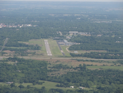
| Facility Name: | ARDMORE DOWNTOWN EXEC |
| City Name: | ARDMORE |
| County: | CARTER |
| State abbrev: | OK |
| State Name: | OKLAHOMA |
| | |
| Ownership: | PUBLICLY OWNED |
| Use: | OPEN TO THE PUBLIC |
| Owner's Name: | CITY OF ARDMORE |
| Address: | PO BOX 249 |
| | ARDMORE, OK 73402 |
| Owner's Phone: | 580-226-2100 |
| | |
| Manager's Name: | DAN LUTTRELL |
| Address: | 620 GENERAL DR., SUITE 1 |
| | ARDMORE, OK 73401 |
| Phone: | (580) 389-5238 |
| | |
| FAA Region: | SOUTHWEST |
| FAA Field Office: | AOK |
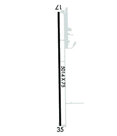
Runway Identifications
Runway Identification: 17/35Length: 5014 ft
Width: 75 ft
Surface: ASPHALT-GOOD CONDITION
Edge lights: Medium IntensityTreatment: NONE
| | Runway: 17 | | Runway: 35 |
| Mag heading: | 175° | Mag heading: | 355° |
| Rwy Slope: | .10% Up | Rwy Slope: | -.10% Down |
| Approach: | | Approach: | |
| Pattern: | Left Traffic | Pattern: | Right Traffic |
| Markings: | NONPRECISION INSTRUMENT | Markings: | NONPRECISION INSTRUMENT |
| Marking Condition: | FAIR | Marking Condition: | FAIR |
| Arresting Dev: | | Arresting Dev: | |
| Lat & Long: | N3409.2 W09707.4 | Lat. & Long.: | N3408.4 W09707.4 |
| Elev: | 839.9 ft. MSL | Elev: | 844.9 ft. MSL |
| TCH: | 41 ft. AGL | TCH: | 40 ft. AGL |
| Visual Glide Path: | 4.00 degrees | Visual Glide Path: | 3.00 degrees |
| Displaced Threshold: | No | Displaced Threshold: | No |
| Touchdown Zone: | YES | Touchdown Zone: | YES |
| Touchdown Elev.: | 840.0 feet | Touchdown Elev.: | 844.9 feet |
| Visual Glide Slope: | 4-Light PAPI on LEFT side of Runway | Visual Glide Slope: | 4-Light PAPI on LEFT side of Runway |
| RVR Equipment: | | RVR Equipment: | |
| RVV Equipment: | NO | RVV Equipment: | NO |
| Approach Lights: | | Approach Lights: | |
| REIL: | YES | REIL: | YES |
| Centerline Lights: | NO | Centerline Lights: | NO |
| Touchdown lights: | NO | Touchdown lights: | NO |
| Runway Category: | Runway with a Non-precision Approach having visibility minimums greater than 3/4 mile | Runway Category: | Runway with a Non-precision Approach having visibility minimums greater than 3/4 mile |
| Declared Distances: | | Declared Distances: | |
| Obstructions: | TREES | Obstructions: | ROAD |
| Marked: | LIGHTED | Marked: | NOT Marked/Lighted |
| Clearance slope: | 14:1 | Clearance slope: | 20:1 |
| Obstruction height: | 36 feet AGL | Obstruction height: | 18 feet AGL |
| Dist. from runway: | 727 feet | Dist. from runway: | 575 feet |
| Centerline offset: | 76 left of centerline | Centerline offset: | |
| Comments: | | Comments: | +10 FT HILL 0-200 FT FM RY END & 200 FT L. |