Current Weather/Notams (Metars, TAFs, Notams, NWS Forecast, PIREPS, and nearby weather)
Customs Information Send updates to Support@FltPlan.com
Customs Not Available
Database effective 05/16/2024
Airport Diagram might not be current.
|
| Facility Name: | PAXTON |
| City Name: | PAXTON |
| County: | FORD |
| State abbrev: | IL |
| State Name: | ILLINOIS |
| | |
| Ownership: | PRIVATELY OWNED |
| Use: | OPEN TO THE PUBLIC |
| Owner's Name: | DAVID HRUPSA |
| Address: | 4960 FORT DENAUD RD |
| | FORT DENAUD, FL 33935 |
| Owner's Phone: | 252-945-4804 |
| | |
| Manager's Name: | DAVID HRUPSA |
| Address: | 4960 FORT DENAUD RD |
| | FORT DEANUD, FL 33935 |
| Phone: | 252-945-4804 |
| | |
| FAA Region: | GREAT LAKES |
| FAA Field Office: | CHI |
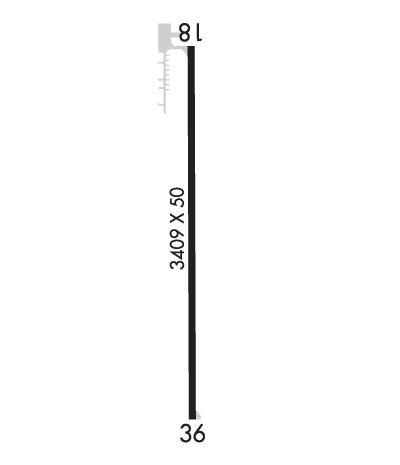
Runway Identifications
Runway Identification: 18/36Length: 3409 ft
Width: 50 ft
Surface: ASPHALT-FAIR CONDITION
Edge lights: Non-Standard Lighting SystemTreatment: NONE
| | Runway: 18 | | Runway: 36 |
| Mag heading: | 183° | Mag heading: | 3° |
| Rwy Slope: | -.70% Down | Rwy Slope: | .70% Up |
| Approach: | | Approach: | |
| Pattern: | Left Traffic | Pattern: | Left Traffic |
| Markings: | NONPRECISION INSTRUMENT | Markings: | NUMBERS ONLY |
| Marking Condition: | GOOD | Marking Condition: | GOOD |
| Arresting Dev: | | Arresting Dev: | |
| Lat & Long: | N4027.2 W08807.7 | Lat. & Long.: | N4026.7 W08807.7 |
| Elev: | 779.0 ft. MSL | Elev: | 755.0 ft. MSL |
| TCH: | | TCH: | 50 ft. AGL |
| Visual Glide Path: | | Visual Glide Path: | 3.00 degrees |
| Displaced Threshold: | 800 feet; DTHR PAINTED WHITE LINE ACROSS RY. | Displaced Threshold: | No |
| Touchdown Zone: | YES | Touchdown Zone: | NO |
| Touchdown Elev.: | 777.4 feet | Touchdown Elev.: | |
| Visual Glide Slope: | | Visual Glide Slope: | TRI-COLOR VASI ON LEFT SIDE OF RUNWAY |
| RVR Equipment: | | RVR Equipment: | |
| RVV Equipment: | NO | RVV Equipment: | NO |
| Approach Lights: | | Approach Lights: | |
| REIL: | YES | REIL: | NO |
| Centerline Lights: | NO | Centerline Lights: | NO |
| Touchdown lights: | NO | Touchdown lights: | NO |
| Runway Category: | Runway with a Non-precision Approach | Runway Category: | Runway with a Visual Approach |
| Declared Distances: | | Declared Distances: | |
| Obstructions: | TREE | Obstructions: | |
| Marked: | NOT Marked/Lighted | Marked: | |
| Clearance slope: | 7:1; RWY 18 APCH RATIO 22:1 TO DTHR. | Clearance slope: | 20:1 |
| Obstruction height: | 56 feet AGL | Obstruction height: | |
| Dist. from runway: | 601 feet | Dist. from runway: | |
| Centerline offset: | 58 left of centerline | Centerline offset: | |
| Comments: | 25 FT BLDG 175 FT FM RWY END AND 150 FT R. | Comments: | |