Click here for more info on on SMS!

K1A7

JACKSON COUNTY
GAINESBORO
TN
Time Zone: Central
Lat: N 3623.8
Long: W 08538.5
Elev: 517
Var: +02
Longest Runway: 3497
CTAF: 122.9

FBO & Flight Services info for K1A7

FBOs: Update your Fuel Prices

AIRPORTPh: 931-268-9643
-
Freq: 122.9
Service
Jet
100LL
SAF
MoGas
Fuel Avail: NO FUEL AVAILABLE
Full        Last Update: 04/26/2024 00:15:42

Self        
If you are an FBO, call 1-203-262-1700 to update your info or email: FltPlan.Advertising@garmin.com
Advertise your FBO on FltPlan.com

Runway & Approach Info for K1A7
Rwy
Length
Land Dist**
Approach*
  Rwy
Length
Land Dist**
Approach*
18
3497x75  3497'          
 
  
36
  3497x75  3497'          
 
 * only ILS, LOC, LDA, and SDF approaches to a specific runway are shown
** For any Declared Landing Distance Available, please see A/FD or Approach plates
Runway Weight Capability (lbs.) Help
Runway IDSingle WheelDouble WheelDouble Tandem WheelDual Double Wheel
18/3621,00031,000N/AN/A
These numbers are Advisory and are not limits.   The Airport Manager should have more accurate Weight Limits
Approach Charts
FltPlan does not have IFR approach charts available for K1A7.
Current Weather/Notams
Customs Information Send updates to Support@FltPlan.com
Customs Not Available
Database effective 05/16/2024
Airport Diagram of K1A7
Airport Diagram might not be current.

Facility Name: JACKSON COUNTY
City Name: GAINESBORO
County: JACKSON
State abbrev: TN
State Name: TENNESSEE
   
Ownership: PUBLICLY OWNED
Use: OPEN TO THE PUBLIC
Owner's Name: JACKSON COUNTY
Address: PO BOX 617
 GAINESBORO, TN 38562
Owner's Phone: 931-268-9888
  
Manager's Name: JIM YOUNG
Address: 153 WARD LANE
 GAINESBORO, TN 38562
Phone: 931-397-6643
   
FAA Region: SOUTHERN
FAA Field Office: MEM


Sunrise / Sunset times for JACKSON COUNTY

DateSunriseSunset
04/25/24 Thursday5:5519:26
04/26/24 Friday5:5419:27
04/27/24 Saturday5:5319:28
04/28/24 Sunday5:5219:29
04/29/24 Monday5:5119:29
04/30/24 Tuesday5:5019:30
05/01/24 Wednesday5:4819:31
05/02/24 Thursday5:4719:32
05/03/24 Friday5:4619:33
05/04/24 Saturday5:4519:34
05/05/24 Sunday5:4419:35
05/06/24 Monday5:4319:35
05/07/24 Tuesday5:4219:36
05/08/24 Wednesday5:4119:37

Airport Facilities

Airport Attendance ScheduleUNATTENDED
Airport Status OPERATIONAL (This Status can change at any time - please check NOTAMS)
Airport Lighting Schedule
Airport Storage AvailableNONE
Extra Services AvailableNONE
Wind IndicatorYES - (unlit)
Control TowerNO
CTAF Frequency122.900
Unicom Frequency
Rotating Beacon Color
Segmented CircleYES
Landing FeeNO

Airport Inspection Data

Airport InspectedSTATE - performed by STATE AERONAUTICAL PERSONNEL
Inspection Date08/01/2023

Airport Services

Type of Fuel AvailableNone
Airframe Repair ServiceNone
Power Plant Repair ServiceNone

Geographic Data

LatitudeN3623.8
LongitudeW08538.5 (ESTIMATED)
Arpt Elevation517ft (SURVEYED)
Magnetic Variation02W
3 miles NEof GAINESBORO
Traffic Pattern Altitude
Sectional ChartST LOUIS

Aircraft Data

Operations (Reported)YearlyAvg. Daily
General Aviation Transient 1250
General Aviation Local 3001
Air Taxi 00
Commerical 00
Commuter 00
Military 1750
Aircraft based on Field
General Aviation Singles 17
General Aviation Multi 0
Jet Aircraft 0
General Aviation Helicopters 0
Military Aircraft 0
Gliders 0
Ultralights 0

FAA Services

FSS on field NO
FSS tie-in NASHVILLE
FSS Phone 1-800-WX-BRIEF
Who issues Notams BNA
Notam D service at airport YES
ARTCC Name MEMPHIS

Federal Status

Airport Certification
Aircraft Rescue & Firefighting IndexNone
Airport of EntryNo
Custom Landing RightsNo
Joint Civil/MilitaryNo
Military Landing rightsYES

Federal Agreements

NATIONAL PLAN OF INTEGRATED AIRPORT SYSTEMS (NPIAS)
ASSURANCES PURSUANT TO TITLE VI, CIVIL RIGHTS ACT OF 1964
GRANT AGREEMENT HAS EXPIRED; HOWEVER, AGREEMENT REMAINS IN EFFECT FOR THIS FACILITY AS LONG AS IT IS PUBLIC USE.

Remarks

HIGH TRRN ALL QUADS.
FOR CD CTC MEMPHIS ARTCC AT 901-368-8453/8449.
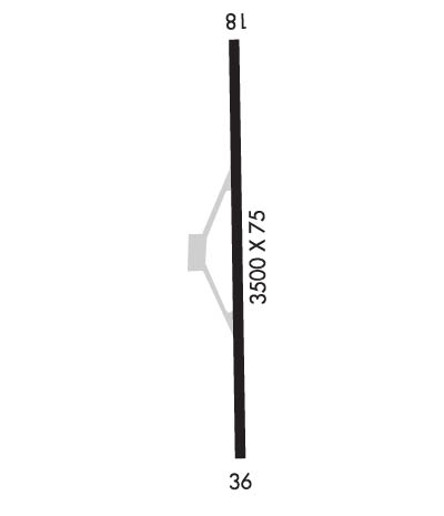
Runway Identifications
Runway Identification: 18/36
Length: 3497 ft
Width: 75 ft
Surface: ASPHALT-GOOD CONDITION
Edge lights:

Treatment: NONE

 Runway: 18   Runway: 36
Mag heading: 184°Mag heading:
Rwy Slope: .00%Rwy Slope: .00%
Approach: Approach:
Pattern: Left TrafficPattern: Left Traffic
Markings: NONPRECISION INSTRUMENTMarkings: NONPRECISION INSTRUMENT
Marking Condition: GOODMarking Condition: GOOD
Arresting Dev: Arresting Dev:
Lat & Long: N3624.1  W08538.5Lat. & Long.: N3623.5  W08538.5
Elev: 517.0 ft. MSLElev: 517.0 ft. MSL
TCH: TCH:
Visual Glide Path: Visual Glide Path:
Displaced Threshold: NoDisplaced Threshold: No
Touchdown Zone: YESTouchdown Zone: YES
Touchdown Elev.: 517.3 feetTouchdown Elev.: 517.3 feet
Visual Glide Slope: Visual Glide Slope:
RVR Equipment: RVR Equipment:
RVV Equipment: NORVV Equipment: NO
Approach Lights: Approach Lights:
REIL: NOREIL: NO
Centerline Lights: NOCenterline Lights: NO
Touchdown lights: NOTouchdown lights: NO
Runway Category: Runway with a Visual ApproachRunway Category: Runway with a Visual Approach
Declared Distances: Declared Distances:
Obstructions: UnknownObstructions: Unknown
Marked: NOT Marked/LightedMarked: NOT Marked/Lighted
Clearance slope: 7:1Clearance slope: 4:1
Obstruction height: 45 feet AGLObstruction height: 33 feet AGL
Dist. from runway: 550 feetDist. from runway: 347 feet
Centerline offset: 548 left of centerlineCenterline offset: 345 feet right of centerline
Comments: Comments:
C:/P: