Click here for more info on on SMS!

K19M

C. A. MOORE
LEXINGTON
MS
Time Zone: Central
Lat: N 3307.5
Long: W 09001.5
Elev: 340
Var: -02
Longest Runway: 3199
CTAF: 122.9

FBO & Flight Services info for K19M

FBOs: Update your Fuel Prices

AIRPORTPh: 662-834-3508
-
Freq: 122.9
Service
Jet
100LL
SAF
MoGas
Fuel Avail: NO FUEL AVAILABLE
Full        Last Update: 04/19/2024 00:01:45

Self        
If you are an FBO, call 1-203-262-1700 to update your info or email: FltPlan.Advertising@garmin.com
Advertise your FBO on FltPlan.com

Runway & Approach Info for K19M
Rwy
Length
Land Dist**
Approach*
  Rwy
Length
Land Dist**
Approach*
01
3199x60  3199'          
 
  
19
  3199x60  3199'          
 
 * only ILS, LOC, LDA, and SDF approaches to a specific runway are shown
** For any Declared Landing Distance Available, please see A/FD or Approach plates
Runway Weight Capability (lbs.) Help
Runway IDSingle WheelDouble WheelDouble Tandem WheelDual Double Wheel
01/1920,000N/AN/AN/A
These numbers are Advisory and are not limits.   The Airport Manager should have more accurate Weight Limits
Approach Charts
Approaches    
Current Weather/Notams
Customs Information Send updates to Support@FltPlan.com
Customs Not Available
Database effective 04/18/2024
Airport Diagram of K19M
Airport Diagram might not be current.

Facility Name: C A MOORE
City Name: LEXINGTON
County: HOLMES
State abbrev: MS
State Name: MISSISSIPPI
   
Ownership: PUBLICLY OWNED
Use: OPEN TO THE PUBLIC
Owner's Name: CITY OF LEXINGTON
Address: 112 SPRING ST
 LEXINGTON, MS 39095
Owner's Phone: 662-834-1261
  
Manager's Name: MAYOR ROBIN MCCRORY
Address: PO BOX 455, 112 SPRING ST
 LEXINGTON, MS 39095
Phone: 662-834-1261; POLICE DEPT 662-834-3508.
   
FAA Region: SOUTHERN
FAA Field Office: JAN


Sunrise / Sunset times for C A MOORE

DateSunriseSunset
04/19/24 Friday6:2419:34
04/20/24 Saturday6:2319:35
04/21/24 Sunday6:2219:36
04/22/24 Monday6:2119:36
04/23/24 Tuesday6:2019:37
04/24/24 Wednesday6:1919:38
04/25/24 Thursday6:1819:39
04/26/24 Friday6:1719:39
04/27/24 Saturday6:1619:40
04/28/24 Sunday6:1519:41
04/29/24 Monday6:1419:42
04/30/24 Tuesday6:1319:42
05/01/24 Wednesday6:1219:43
05/02/24 Thursday6:1119:44

Airport Facilities

Airport Attendance ScheduleUNATTENDED
Airport Status OPERATIONAL (This Status can change at any time - please check NOTAMS)
Airport Lighting ScheduleSS-SR
Airport Storage AvailableTie Downs
Extra Services AvailableNONE
Wind IndicatorYES - (lighted)
Control TowerNO
CTAF Frequency122.900
Unicom Frequency
Rotating Beacon ColorWG
Segmented CircleYES
Landing FeeNO

Airport Inspection Data

Airport InspectedSTATE - performed by STATE AERONAUTICAL PERSONNEL
Inspection Date02/29/2024

Airport Services

Type of Fuel AvailableNone
Airframe Repair ServiceNONE
Power Plant Repair ServiceNONE

Geographic Data

LatitudeN3307.5
LongitudeW09001.5 (ESTIMATED)
Arpt Elevation340ft (SURVEYED)
Magnetic Variation02E
2 miles NEof LEXINGTON
Traffic Pattern Altitude
Sectional ChartMEMPHIS

Aircraft Data

Operations (Reported)YearlyAvg. Daily
General Aviation Transient 12103
General Aviation Local 20906
Air Taxi 00
Commerical 00
Commuter 00
Military 00
Aircraft based on Field
General Aviation Singles 10
General Aviation Multi 0
Jet Aircraft 0
General Aviation Helicopters 0
Military Aircraft 0
Gliders 0
Ultralights 0

FAA Services

FSS on field NO
FSS tie-in GREENWOOD
FSS Phone 1-800-WX-BRIEF
Who issues Notams GWO
Notam D service at airport YES
ARTCC Name MEMPHIS

Federal Status

Airport Certification
Aircraft Rescue & Firefighting IndexNone
Airport of EntryNo
Custom Landing RightsNo
Joint Civil/MilitaryNo
Military Landing rightsYES

Federal Agreements

NATIONAL PLAN OF INTEGRATED AIRPORT SYSTEMS (NPIAS)
GRANT AGREEMENTS UNDER FAAP/ADAP/AIP
ASSURANCES PURSUANT TO TITLE VI, CIVIL RIGHTS ACT OF 1964

Remarks

FOR CD CTC MEMPHIS ARTCC AT 901-368-8453/8449.
Airport Communications & Frequencies:
CTAF Frequency:
122.900
Remarks
  • APCH/DEP SVC PRVDD BY MEMPHIS ARTCC ON FREQS 132.5/259.1 (GREENWOOD RCAG).
  • Runway Identifications
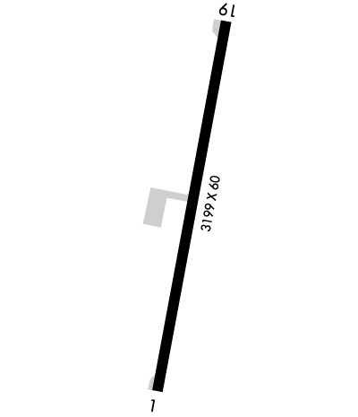
    Runway Identification: 01/19
    Length: 3199 ft
    Width: 60 ft
    Surface: ASPHALT-GOOD CONDITION
    Edge lights: Medium Intensity

    Treatment: NONE

     Runway: 01   Runway: 19
    Mag heading: 10°Mag heading: 190°
    Rwy Slope: .47% UpRwy Slope: -.47% Down
    Approach: Approach:
    Pattern: Left TrafficPattern: Left Traffic
    Markings: BASICMarkings: BASIC
    Marking Condition: GOODMarking Condition: GOOD
    Arresting Dev: Arresting Dev:
    Lat & Long: N3307.3  W09001.6Lat. & Long.: N3307.8  W09001.5
    Elev: 324.0 ft. MSLElev: 339.0 ft. MSL
    TCH: 40 ft. AGLTCH: 40 ft. AGL
    Visual Glide Path: 3.00 degreesVisual Glide Path: 4.00 degrees
    Displaced Threshold: NoDisplaced Threshold: No
    Touchdown Zone: YESTouchdown Zone: YES
    Touchdown Elev.: 324.0 feetTouchdown Elev.: 339.0 feet
    Visual Glide Slope: 2-Light PAPI on LEFT side of RunwayVisual Glide Slope: 2-Light PAPI on LEFT side of Runway
    RVR Equipment: RVR Equipment:
    RVV Equipment: NORVV Equipment: NO
    Approach Lights: Approach Lights:
    REIL: NOREIL: NO
    Centerline Lights: NOCenterline Lights: NO
    Touchdown lights: NOTouchdown lights: NO
    Runway Category: Runway with a Visual ApproachRunway Category: Runway with a Visual Approach
    Declared Distances: Declared Distances:
    Obstructions: TREESObstructions: TREE
    Marked: NOT Marked/LightedMarked: NOT Marked/Lighted
    Clearance slope: 36:1Clearance slope: 24:1
    Obstruction height: 32 feet AGLObstruction height: 41 feet AGL
    Dist. from runway: 1365 feetDist. from runway: 1200 feet
    Centerline offset: 50 right of centerlineCenterline offset: 60 feet left of centerline
    Comments: Comments:
    C:1/P: