Click here for more info on on SMS!

K17M

MAGEE MUNI
MAGEE
MS
Time Zone: Central
Lat: N 3151.8
Long: W 08948.0
Elev: 556
Var: +01
Longest Runway: 3103
CTAF: 122.8

FBO & Flight Services info for K17M

FBOs: Update your Fuel Prices

MAGEE MUNIPh: 601-849-3571
-
Freq: 122.8

If you are an FBO, call 1-203-262-1700 to update your info or email: FltPlan.Advertising@garmin.com
Advertise your FBO on FltPlan.com

Runway & Approach Info for K17M
Rwy
Length
Land Dist**
Approach*
  Rwy
Length
Land Dist**
Approach*
18
3103x60  3103'          
 
  
36
  3103x60  3103'          
 
 * only ILS, LOC, LDA, and SDF approaches to a specific runway are shown
** For any Declared Landing Distance Available, please see A/FD or Approach plates
Runway Weight Capability (lbs.) Help
Runway IDSingle WheelDouble WheelDouble Tandem WheelDual Double Wheel
18/3619,000N/AN/AN/A
These numbers are Advisory and are not limits.   The Airport Manager should have more accurate Weight Limits
Approach Charts
Approaches    
Current Weather/Notams
Customs Information Send updates to Support@FltPlan.com
Customs Not Available
Database effective 05/16/2024
Airport Diagram of K17M
Airport Diagram might not be current.

Facility Name: MAGEE MUNI
City Name: MAGEE
County: SIMPSON
State abbrev: MS
State Name: MISSISSIPPI
   
Ownership: PUBLICLY OWNED
Use: OPEN TO THE PUBLIC
Owner's Name: CITY OF MAGEE
Address: 123 N MAIN ST
 MAGEE, MS 39111
Owner's Phone: 601-849-3344
  
Manager's Name: ASHLEY STEELE
Address: 111 PRINE DR
 MAGEE, MS 39111
Phone: 601-382-5752
   
FAA Region: SOUTHERN
FAA Field Office: JAN


Sunrise / Sunset times for MAGEE MUNI

DateSunriseSunset
04/23/24 Tuesday6:2119:34
04/24/24 Wednesday6:2019:35
04/25/24 Thursday6:1919:36
04/26/24 Friday6:1819:37
04/27/24 Saturday6:1719:37
04/28/24 Sunday6:1619:38
04/29/24 Monday6:1519:39
04/30/24 Tuesday6:1419:39
05/01/24 Wednesday6:1319:40
05/02/24 Thursday6:1219:41
05/03/24 Friday6:1119:41
05/04/24 Saturday6:1019:42
05/05/24 Sunday6:0919:43
05/06/24 Monday6:0819:44

Airport Facilities

Airport Attendance ScheduleCONTINUOUS
Airport Status OPERATIONAL (This Status can change at any time - please check NOTAMS)
Airport Lighting ScheduleACTVT MIRL RWY 18/36 - CTAF.
Airport Storage AvailableTie Downs
Extra Services AvailableNONE
Wind IndicatorYES - (lighted)
Control TowerNO
CTAF Frequency122.800
Unicom Frequency122.800
Rotating Beacon ColorWG
Segmented CircleYES
Landing FeeNO

Airport Inspection Data

Airport InspectedSTATE - performed by STATE AERONAUTICAL PERSONNEL
Inspection Date05/19/2023

Airport Services

Type of Fuel AvailableGrade 100LL; -10FUEL AVBL 24 HRS WITH CREDIT CARD.
Airframe Repair ServiceNONE
Power Plant Repair ServiceNONE

Geographic Data

LatitudeN3151.8
LongitudeW08948.0 (ESTIMATED)
Arpt Elevation555ft (SURVEYED)
Magnetic Variation01W
3 miles Wof MAGEE
Traffic Pattern Altitude
Sectional ChartNEW ORLEANS

Aircraft Data

Operations (Reported)YearlyAvg. Daily
General Aviation Transient 510514
General Aviation Local 31599
Air Taxi 00
Commerical 00
Commuter 00
Military 3711
Aircraft based on Field
General Aviation Singles 8
General Aviation Multi 0
Jet Aircraft 0
General Aviation Helicopters 0
Military Aircraft 0
Gliders 0
Ultralights 0

FAA Services

FSS on field NO
FSS tie-in GREENWOOD
FSS Phone 1-800-WX-BRIEF
Who issues Notams GWO
Notam D service at airport YES
ARTCC Name MEMPHIS

Federal Status

Airport Certification
Aircraft Rescue & Firefighting IndexNone
Airport of EntryNo
Custom Landing RightsNo
Joint Civil/MilitaryNo
Military Landing rightsYES

Federal Agreements

NATIONAL PLAN OF INTEGRATED AIRPORT SYSTEMS (NPIAS)
GRANT AGREEMENTS UNDER FAAP/ADAP/AIP
ASSURANCES PURSUANT TO TITLE VI, CIVIL RIGHTS ACT OF 1964

Remarks

RWY 36 4 FT DEEP DITCH 250 FT FM THR.
FOR CD CTC MEMPHIS ARTCC AT 901-368-8453/8449.
Airport Communications & Frequencies:
CTAF Frequency:
122.800
Unicom Frequency:
122.800
Remarks
  • APCH/DEP SVC PRVDD BY MEMPHIS ARTCC ON FREQS 125.975/307.275 (MERIDIAN RCAG).
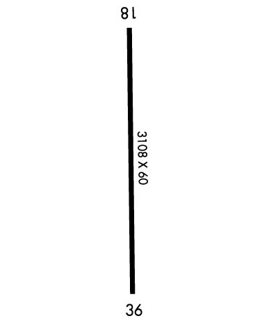
  • Runway Identifications
    Runway Identification: 18/36
    Length: 3103 ft
    Width: 60 ft
    Surface: ASPHALT
    Edge lights: Medium Intensity

    Treatment: NONE
    Weight: PCN 15 /F/C/Y/T

     Runway: 18   Runway: 36
    Mag heading: 180°Mag heading: 360°
    Rwy Slope: -.14% DownRwy Slope: .14% Up
    Approach: Approach:
    Pattern: Left TrafficPattern: Left Traffic
    Markings: NONPRECISION INSTRUMENTMarkings: NONPRECISION INSTRUMENT
    Marking Condition: GOODMarking Condition: GOOD
    Arresting Dev: Arresting Dev:
    Lat & Long: N3152.0  W08948.0Lat. & Long.: N3151.5  W08948.0
    Elev: 553.2 ft. MSLElev: 548.9 ft. MSL
    TCH: 43 ft. AGLTCH:
    Visual Glide Path: 3.00 degreesVisual Glide Path:
    Displaced Threshold: NoDisplaced Threshold: No
    Touchdown Zone: YESTouchdown Zone: YES
    Touchdown Elev.: 555.8 feetTouchdown Elev.: 555.8 feet
    Visual Glide Slope: 2-Light PAPI on LEFT side of RunwayVisual Glide Slope:
    RVR Equipment: RVR Equipment:
    RVV Equipment: NORVV Equipment: NO
    Approach Lights: Approach Lights:
    REIL: NOREIL: NO
    Centerline Lights: NOCenterline Lights: NO
    Touchdown lights: NOTouchdown lights: NO
    Runway Category: Runway with a Non-precision ApproachRunway Category: Runway with a Non-precision Approach
    Declared Distances: Declared Distances:
    Obstructions: TREESObstructions: TREES
    Marked: NOT Marked/LightedMarked: NOT Marked/Lighted
    Clearance slope: 21:1Clearance slope: 28:1
    Obstruction height: 50 feet AGLObstruction height: 80 feet AGL
    Dist. from runway: 1250 feetDist. from runway: 2500 feet
    Centerline offset: 250 left of centerlineCenterline offset:
    Comments: Comments:
    C:/P: