Click here for more info on on SMS!

K17J

DONALSONVILLE MUNI
DONALSONVILLE
GA
Time Zone: Eastern
Lat: N 3100.4
Long: W 08452.7
Elev: 147
Var: +05
Longest Runway: 5512
CTAF: 122.9

FBO & Flight Services info for K17J

FBOs: Update your Fuel Prices

DONALSONVILLEPh: 229-220-8696 Fax: N/A Freq: 122.9
Service
Jet
100LL
SAF
MoGas
Fuel Avail: 24 hr self serve credit card operated
Full        Last Update: 04/20/2024 14:51

Self  5.05    
 Address: 127 EAT 2 STREET   IRON CITY, GA 39859
If you are an FBO, call 1-203-262-1700 to update your info or email: FltPlan.Advertising@garmin.com
Advertise your FBO on FltPlan.com

Runway & Approach Info for K17J
Rwy
Length
Land Dist**
Approach*
  Rwy
Length
Land Dist**
Approach*
01
5512x100  5512'          
 
  
19
  5512x100  5512'          
 
 * only ILS, LOC, LDA, and SDF approaches to a specific runway are shown
** For any Declared Landing Distance Available, please see A/FD or Approach plates
Runway Weight Capability (lbs.) Help
Runway IDSingle WheelDouble WheelDouble Tandem WheelDual Double Wheel
01/1920,000N/AN/AN/A
These numbers are Advisory and are not limits.   The Airport Manager should have more accurate Weight Limits
Approach Charts
Approaches    
Current Weather/Notams
Customs Information Send updates to Support@FltPlan.com
Customs Not Available
Database effective 05/16/2024
Airport Diagram of K17J
Airport Diagram might not be current.

Facility Name: DONALSONVILLE MUNI
City Name: DONALSONVILLE
County: SEMINOLE
State abbrev: GA
State Name: GEORGIA
   
Ownership: PUBLICLY OWNED
Use: OPEN TO THE PUBLIC
Owner's Name: DONALSONVILLE - SEMINOLE COUNTY; AIRPORT COMMISSION
Address: PO BOX 671
 DONALSVILLE, GA 39845
Owner's Phone: 229-524-2118
  
Manager's Name: JERRY ISLER
Address: 6063 SCOTT DRIVE
 DONALSONVILLE, GA 39845
Phone: 229-524-2118
   
FAA Region: SOUTHERN
FAA Field Office: ATL


Sunrise / Sunset times for DONALSONVILLE MUNI

DateSunriseSunset
04/24/24 Wednesday7:0120:14
04/25/24 Thursday7:0020:15
04/26/24 Friday6:5920:16
04/27/24 Saturday6:5820:16
04/28/24 Sunday6:5720:17
04/29/24 Monday6:5620:18
04/30/24 Tuesday6:5520:18
05/01/24 Wednesday6:5420:19
05/02/24 Thursday6:5420:20
05/03/24 Friday6:5320:20
05/04/24 Saturday6:5220:21
05/05/24 Sunday6:5120:22
05/06/24 Monday6:5020:22
05/07/24 Tuesday6:4920:23

Airport Facilities

Airport Attendance Schedule7 Days A Week 0800-1700
Airport Status OPERATIONAL (This Status can change at any time - please check NOTAMS)
Airport Lighting ScheduleACTVT MIRL RWY 01/19 - CTAF. PAPI RWY 01/19 OPR CONSLY DUSK - 2300, AFT 2300 - CTAF.
Airport Storage AvailableTie Downs, Hanger
Extra Services AvailableCrop Dusting
Wind IndicatorYES - (lighted)
Control TowerNO
CTAF Frequency122.900
Unicom Frequency
Rotating Beacon ColorWG
Segmented CircleYES
Landing FeeNO

Airport Inspection Data

Airport InspectedSTATE - performed by STATE AERONAUTICAL PERSONNEL
Inspection Date01/04/2024

Airport Services

Type of Fuel AvailableGrade 100LL; -10FUEL 24 HR CREDIT CARD SVC AVBL.
Airframe Repair ServiceNONE
Power Plant Repair ServiceNONE

Geographic Data

LatitudeN3100.4
LongitudeW08452.7 (ESTIMATED)
Arpt Elevation147ft (SURVEYED)
Magnetic Variation05W
1 miles Sof DONALSONVILLE
Traffic Pattern Altitude
Sectional ChartJACKSONVILLE

Aircraft Data

Operations (Reported)YearlyAvg. Daily
General Aviation Transient 20005
General Aviation Local 1000027
Air Taxi 00
Commerical 00
Commuter 00
Military 00
Aircraft based on Field
General Aviation Singles 24
General Aviation Multi 0
Jet Aircraft 0
General Aviation Helicopters 0
Military Aircraft 0
Gliders 0
Ultralights 0

FAA Services

FSS on field NO
FSS tie-in MACON
FSS Phone 1-800-WX-BRIEF
Who issues Notams MCN
Notam D service at airport YES
ARTCC Name JACKSONVILLE

Federal Status

Airport Certification
Aircraft Rescue & Firefighting IndexNone
Airport of EntryNo
Custom Landing RightsNo
Joint Civil/MilitaryNo
Military Landing rightsYES

Federal Agreements

NATIONAL PLAN OF INTEGRATED AIRPORT SYSTEMS (NPIAS)
SURPLUS PROPERTY AGREEMENT UNDER REGULATION 16-WAA

Remarks

FOR CD CTC CAIRNS APCH AT 334-255-8402, WHEN APCH CLSD CTC JACKSONVILLE ARTCC AT 904-845-1592.
Airport Communications & Frequencies:
CTAF Frequency:
122.900
Remarks
  • APCH/DEP SVC PRVDD BY JACKSONVILLE ARTCC ON FREQS 134.3/322.55 (DOTHAN RCAG) WHEN CAIRNS APCH/DEP CLSD.
  • CAIRNS Primary Approach Frequencies:  
    125.4
    327.125
    CAIRNS Primary Departure Frequencies:  
    125.4
    327.125
    Runway Identifications
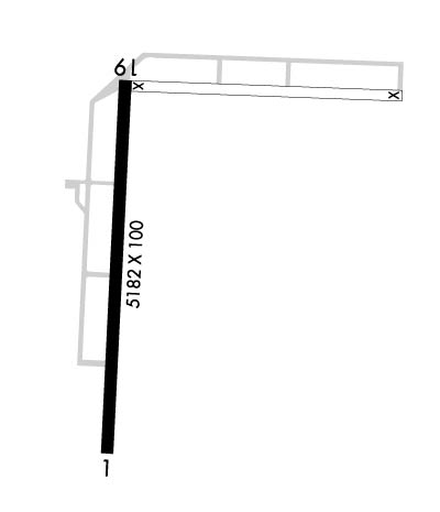
    Runway Identification: 01/19
    Length: 5512 ft
    Width: 100 ft
    Surface: ASPHALT-GOOD CONDITION
    Edge lights: Medium Intensity

    Treatment: NONE

     Runway: 01   Runway: 19
    Mag heading: Mag heading: 187°
    Rwy Slope: .31% UpRwy Slope: -.31% Down
    Approach: Approach:
    Pattern: Left TrafficPattern: Left Traffic
    Markings: NONPRECISION INSTRUMENTMarkings: NONPRECISION INSTRUMENT
    Marking Condition: GOODMarking Condition: GOOD
    Arresting Dev: Arresting Dev:
    Lat & Long: N3059.9  W08452.7Lat. & Long.: N3100.8  W08452.6
    Elev: 129.9 ft. MSLElev: 146.9 ft. MSL
    TCH: 26 ft. AGLTCH: 46 ft. AGL
    Visual Glide Path: 3.00 degreesVisual Glide Path: 3.00 degrees
    Displaced Threshold: NoDisplaced Threshold: No
    Touchdown Zone: YESTouchdown Zone: YES
    Touchdown Elev.: 141.1 feetTouchdown Elev.: 147.4 feet
    Visual Glide Slope: 2-Light PAPI on LEFT side of RunwayVisual Glide Slope: 2-Light PAPI on LEFT side of Runway
    RVR Equipment: RVR Equipment:
    RVV Equipment: NORVV Equipment: NO
    Approach Lights: Approach Lights:
    REIL: NOREIL: NO
    Centerline Lights: NOCenterline Lights: NO
    Touchdown lights: NOTouchdown lights: NO
    Runway Category: DRunway Category: D
    Declared Distances: Declared Distances:
    Obstructions: TREESObstructions: TREES
    Marked: NOT Marked/LightedMarked: NOT Marked/Lighted
    Clearance slope: 12:1Clearance slope: 6:1
    Obstruction height: 80 feet AGLObstruction height: 64 feet AGL
    Dist. from runway: 1160 feetDist. from runway: 584 feet
    Centerline offset: 641 left of centerlineCenterline offset: 498 feet left of centerline
    Comments: Comments:
    C:1/P: