Click here for more info on on SMS!

K12V

ONA AIRPARK
MILTON
WV
Time Zone: Eastern
Lat: N 3826.5
Long: W 08212.0
Elev: 572
Var: +06
Longest Runway: 3154
CTAF: 122.8

FBO & Flight Services info for K12V

FBOs: Update your Fuel Prices

ONA AIRPARKPh: 304-743-4523
-
Freq: 122.8

If you are an FBO, call 1-203-262-1700 to update your info or email: FltPlan.Advertising@garmin.com
Advertise your FBO on FltPlan.com

Runway & Approach Info for K12V
Rwy
Length
Land Dist**
Approach*
  Rwy
Length
Land Dist**
Approach*
07
3154x40  3154'          
 
  
25
  3154x40  3154'          
 
 * only ILS, LOC, LDA, and SDF approaches to a specific runway are shown
** For any Declared Landing Distance Available, please see A/FD or Approach plates
Runway Weight Capability (lbs.) Help
Runway IDSingle WheelDouble WheelDouble Tandem WheelDual Double Wheel
07/25N/AN/AN/AN/A
These numbers are Advisory and are not limits.   The Airport Manager should have more accurate Weight Limits
Approach Charts
Approaches    
Current Weather/Notams
Customs Information Send updates to Support@FltPlan.com
Customs Not Available
Database effective 04/18/2024
Airport Diagram of K12V
Airport Diagram might not be current.

Facility Name: ONA AIRPARK
City Name: MILTON
County: CABELL
State abbrev: WV
State Name: WEST VIRGINIA
   
Ownership: PRIVATELY OWNED
Use: OPEN TO THE PUBLIC
Owner's Name: ONA LAND MANAGEMENT SERVICES, LLC
Address: #1 FAIR SKIES DR
 ONA, WV 25545-1500
Owner's Phone: (954) 328-7646
  
Manager's Name: BILL & LYNN BAUER
Address: # 1 FAIR SKIES DR.
 ONA, WV 25545-1500
Phone: (954) 328-7646
   
FAA Region: EASTERN
FAA Field Office: BKW


Sunrise / Sunset times for ONA AIRPARK

DateSunriseSunset
04/17/24 Wednesday6:4920:08
04/18/24 Thursday6:4820:09
04/19/24 Friday6:4620:10
04/20/24 Saturday6:4520:11
04/21/24 Sunday6:4420:12
04/22/24 Monday6:4220:13
04/23/24 Tuesday6:4120:14
04/24/24 Wednesday6:4020:15
04/25/24 Thursday6:3820:16
04/26/24 Friday6:3720:17
04/27/24 Saturday6:3620:17
04/28/24 Sunday6:3520:18
04/29/24 Monday6:3320:19
04/30/24 Tuesday6:3220:20

Airport Facilities

Airport Attendance ScheduleCONTINUOUS
Airport Status OPERATIONAL (This Status can change at any time - please check NOTAMS)
Airport Lighting ScheduleSS-SR
Airport Storage AvailableTie Downs, Hanger
Extra Services AvailableCharter, Flight Instruction, Aircraft Rental
Wind IndicatorYES - (unlit)
Control TowerNO
CTAF Frequency122.800
Unicom Frequency122.800
Rotating Beacon Color
Segmented CircleNO
Landing FeeNO

Airport Inspection Data

Airport InspectedSTATE - performed by PRIVATE CONTRACT PERSONNEL
Inspection Date07/06/2022

Airport Services

Type of Fuel AvailableGrade 100LL; -1024 HR SELF-SERVE.
Airframe Repair ServiceMAJOR
Power Plant Repair ServiceMAJOR

Geographic Data

LatitudeN3826.5
LongitudeW08212.0 (ESTIMATED)
Arpt Elevation571ft (SURVEYED)
Magnetic Variation06W
4 miles Wof MILTON
Traffic Pattern Altitude
Sectional ChartCINCINNATI

Aircraft Data

Operations (Reported)YearlyAvg. Daily
General Aviation Transient 14604
General Aviation Local 548015
Air Taxi 00
Commerical 00
Commuter 00
Military 00
Aircraft based on Field
General Aviation Singles 50
General Aviation Multi 4
Jet Aircraft 0
General Aviation Helicopters 0
Military Aircraft 0
Gliders 0
Ultralights 0

FAA Services

FSS on field NO
FSS tie-in ELKINS
FSS Phone 1-800-WX-BRIEF
Who issues Notams EKN
Notam D service at airport YES
ARTCC Name INDIANAPOLIS

Federal Status

Airport Certification
Aircraft Rescue & Firefighting IndexNone
Airport of EntryNo
Custom Landing RightsNo
Joint Civil/MilitaryNo
Military Landing rightsNo

Remarks

THIS AIRPORT HAS BEEN SURVEYED BY THE NATIONAL GEODETIC SURVEY.
VEHICLES CROSSING RWY.
FOR CD CTC HUNTINGTON ATCT AT 304-453-2490.
NOISE ABATEMENT PROCEDURES IN EFFECT; DEP RWY 25 FLY 240 DEGS & DEP RWY 07 FLY 090 DEGS TO 1600 FT ALTITUDE.
RWY EXIT TO RAMP HAS DEPRESSION.
(A52-09) +350 HILL 1300 FT DSTC.
FENCE, POLES, BLDGS, IN PRIMARY SFC, WEST SIDE.
RACE TRACK ADJACENT TO RWY 07/25.
RWY 07/2 5 NSTD LIRL LIGHTS, NSTD SPACING AND COLORS.
Airport Communications & Frequencies:
CTAF Frequency:
122.800
Unicom Frequency:
122.800
Remarks
  • APPROACHES FROM THE EAST USE CHARLESTON APCH 124.1/269.125. APPROACHES FROM THE WEST USE HUNTINGTON APCH 119.75/270.1.
  • HUNTINGTON Primary Approach Frequencies:  
    124.1 EAST
    269.125 EAST
    119.75 WEST
    270.1 WEST
    HUNTINGTON Primary Departure Frequencies:  
    124.1 EAST
    269.125 EAST
    119.75 WEST
    270.1 WEST
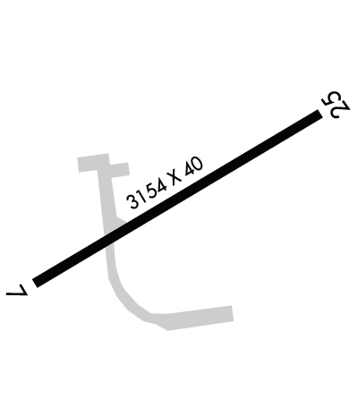
    Runway Identifications
    Runway Identification: 07/25
    Length: 3154 ft
    Width: 40 ft
    Surface: ASPHALT-FAIR CONDITION
    Edge lights: Non-Standard Lighting System

    Treatment: NONE

     Runway: 07   Runway: 25
    Mag heading: 65°Mag heading: 245°
    Rwy Slope: .07% UpRwy Slope: -.07% Down
    Approach: Approach:
    Pattern: Left TrafficPattern: Left Traffic
    Markings: BASICMarkings: BASIC
    Marking Condition: FAIR; MARKINGS FADED. NUMBERS ONLY. NO CNTRLN MKGS.Marking Condition: FAIR; MARKINGS FADED. NUMBERS ONLY. NO CNTRLN MKGS.
    Arresting Dev: Arresting Dev:
    Lat & Long: N3826.3  W08212.3Lat. & Long.: N3826.6  W08211.8
    Elev: 567.1 ft. MSLElev: 569.4 ft. MSL
    TCH: TCH:
    Visual Glide Path: Visual Glide Path:
    Displaced Threshold: NoDisplaced Threshold: No
    Touchdown Zone: YESTouchdown Zone: YES
    Touchdown Elev.: 571.7 feetTouchdown Elev.: 571.7 feet
    Visual Glide Slope: Visual Glide Slope:
    RVR Equipment: RVR Equipment:
    RVV Equipment: NORVV Equipment: NO
    Approach Lights: Approach Lights:
    REIL: NOREIL: NO
    Centerline Lights: NOCenterline Lights: NO
    Touchdown lights: NOTouchdown lights: NO
    Runway Category: Runway with a Visual ApproachRunway Category: Runway with a Visual Approach
    Declared Distances: Declared Distances:
    Obstructions: TREESObstructions: TREES; ALSO +350 FT HILL 1300 FT DISTANCE.
    Marked: NOT Marked/LightedMarked: NOT Marked/Lighted
    Clearance slope: 5:1; ACTUAL OBSTN CLNC SLOPE IS 0:1.Clearance slope: 1:1
    Obstruction height: 75 feet AGLObstruction height: 40 feet AGL
    Dist. from runway: 615 feetDist. from runway: 201 feet
    Centerline offset: 28 left of centerlineCenterline offset: 60 feet left of centerline
    Comments: Comments: 20 FT HILL, 200 FT FM RWY END, 172 FT RIGHT, 40 FT TREES, 200 DSTC, 60-247 FT L.
    C:/P: