Current Weather/Notams (Metars, TAFs, Notams, NWS Forecast, PIREPS, and nearby weather)
Customs Information Send updates to Support@FltPlan.com
Customs Not Available
Database effective 05/16/2024
Airport Diagram might not be current.
|
| Facility Name: | CLAYTON MUNI |
| City Name: | CLAYTON |
| County: | BARBOUR |
| State abbrev: | AL |
| State Name: | ALABAMA |
| | |
| Ownership: | PUBLICLY OWNED |
| Use: | OPEN TO THE PUBLIC |
| Owner's Name: | CITY OF CLAYTON |
| Address: | PO BOX 385 |
| | CLAYTON, AL 36016 |
| Owner's Phone: | 334-775-9176 |
| | |
| Manager's Name: | DARRELL BYRD |
| Address: | 25 ROBERTSON AIRPORT RD. |
| | CLAYTON, AL 36016 |
| Phone: | 334-232-1028 |
| | |
| FAA Region: | SOUTHERN |
| FAA Field Office: | JAN |
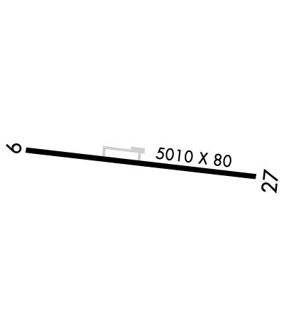
Runway Identifications
Runway Identification: 10/28Length: 5010 ft
Width: 80 ft
Surface: ASPHALT
Edge lights: High IntensityTreatment: AGGREGATE FRICTION SEAL COAT
| | Runway: 10 | | Runway: 28 |
| Mag heading: | 101° | Mag heading: | 281° |
| Rwy Slope: | .25% Up | Rwy Slope: | -.25% Down |
| Approach: | | Approach: | |
| Pattern: | Left Traffic | Pattern: | Left Traffic |
| Markings: | NONPRECISION INSTRUMENT | Markings: | NONPRECISION INSTRUMENT |
| Marking Condition: | GOOD | Marking Condition: | GOOD |
| Arresting Dev: | | Arresting Dev: | |
| Lat & Long: | N3153.0 W08529.6 | Lat. & Long.: | N3153.0 W08528.6 |
| Elev: | 422.0 ft. MSL | Elev: | 434.3 ft. MSL |
| TCH: | 30 ft. AGL | TCH: | 37 ft. AGL |
| Visual Glide Path: | 3.20 degrees | Visual Glide Path: | 3.75 degrees |
| Displaced Threshold: | 278 feet | Displaced Threshold: | No |
| Touchdown Zone: | YES | Touchdown Zone: | YES |
| Touchdown Elev.: | 433.6 feet | Touchdown Elev.: | 434.9 feet |
| Visual Glide Slope: | 2-Light PAPI on LEFT side of Runway | Visual Glide Slope: | 2-Light PAPI on LEFT side of Runway |
| RVR Equipment: | | RVR Equipment: | |
| RVV Equipment: | NO | RVV Equipment: | NO |
| Approach Lights: | | Approach Lights: | |
| REIL: | YES | REIL: | YES |
| Centerline Lights: | NO | Centerline Lights: | NO |
| Touchdown lights: | NO | Touchdown lights: | NO |
| Runway Category: | Runway with a Non-precision Approach having visibility minimums greater than 3/4 mile | Runway Category: | Runway with a Non-precision Approach having visibility minimums greater than 3/4 mile |
| Declared Distances: | | Declared Distances: | |
| Obstructions: | TREE | Obstructions: | TREE |
| Marked: | NOT Marked/Lighted | Marked: | NOT Marked/Lighted |
| Clearance slope: | 7:1; APCH RATIO 19:1 FM DSPLCD THR. | Clearance slope: | 11:1 |
| Obstruction height: | 98 feet AGL | Obstruction height: | 85 feet AGL |
| Dist. from runway: | 925 feet | Dist. from runway: | 1203 feet |
| Centerline offset: | 347 right of centerline | Centerline offset: | 296 feet right of centerline |
| Comments: | | Comments: | +9 FT TREE LCTD 165 FT FM RWY END, 98 FT RIGHT OF CNTLN. |

