Current Weather/Notams (Metars, TAFs, Notams, NWS Forecast, PIREPS, and nearby weather)
Customs Information Send updates to Support@FltPlan.com
Customs Not Available
Database effective 05/16/2024
Airport Diagram might not be current.
|
| Facility Name: | LEE COUNTY |
| City Name: | JONESVILLE |
| County: | LEE |
| State abbrev: | VA |
| State Name: | VIRGINIA |
| | |
| Ownership: | PUBLICLY OWNED |
| Use: | OPEN TO THE PUBLIC |
| Owner's Name: | LEE COUNTY, VIRGINIA |
| Address: | PO BOX 367 |
| | JONESVILLE, VA 24263 |
| Owner's Phone: | 276-346-7714 |
| | |
| Manager's Name: | D. DANE POE; COUNTY ADMINISTRATOR. |
| Address: | PO BOX 367 |
| | JONESVILLE, VA 24263 |
| Phone: | 276-346-7714 |
| | |
| FAA Region: | EASTERN |
| FAA Field Office: | DCA |
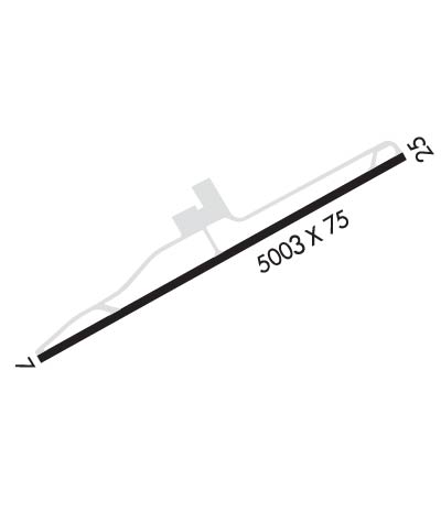
Runway Identifications
Runway Identification: 07/25Length: 5003 ft
Width: 75 ft
Surface: ASPHALT-GOOD CONDITION
Edge lights: Medium IntensityTreatment: NONE
| | Runway: 07 | | Runway: 25 |
| Mag heading: | 66° | Mag heading: | 246° |
| Rwy Slope: | .90% Up | Rwy Slope: | -.90% Down |
| Approach: | | Approach: | |
| Pattern: | Left Traffic | Pattern: | Left Traffic |
| Markings: | NONPRECISION INSTRUMENT | Markings: | NONPRECISION INSTRUMENT |
| Marking Condition: | FAIR | Marking Condition: | FAIR |
| Arresting Dev: | | Arresting Dev: | |
| Lat & Long: | N3639.0 W08313.5 | Lat. & Long.: | N3639.5 W08312.6 |
| Elev: | 1365.8 ft. MSL | Elev: | 1410.9 ft. MSL |
| TCH: | 40 ft. AGL | TCH: | 44 ft. AGL |
| Visual Glide Path: | 3.00 degrees | Visual Glide Path: | 3.25 degrees |
| Displaced Threshold: | No | Displaced Threshold: | No |
| Touchdown Zone: | YES | Touchdown Zone: | YES |
| Touchdown Elev.: | 1393.4 feet | Touchdown Elev.: | 1410.9 feet |
| Visual Glide Slope: | 2-Light PAPI on LEFT side of Runway | Visual Glide Slope: | 2-Light PAPI on LEFT side of Runway |
| RVR Equipment: | | RVR Equipment: | |
| RVV Equipment: | NO | RVV Equipment: | NO |
| Approach Lights: | | Approach Lights: | |
| REIL: | YES | REIL: | YES |
| Centerline Lights: | NO | Centerline Lights: | NO |
| Touchdown lights: | NO | Touchdown lights: | NO |
| Runway Category: | Runway with a Non-precision Approach having visibility minimums greater than 3/4 mile | Runway Category: | Runway with a Non-precision Approach having visibility minimums greater than 3/4 mile |
| Declared Distances: | | Declared Distances: | |
| Obstructions: | TREE | Obstructions: | TREE |
| Marked: | NOT Marked/Lighted | Marked: | NOT Marked/Lighted |
| Clearance slope: | 29:1 | Clearance slope: | 22:1 |
| Obstruction height: | 74 feet AGL | Obstruction height: | 98 feet AGL |
| Dist. from runway: | 2375 feet | Dist. from runway: | 2449 feet |
| Centerline offset: | 437 left of centerline | Centerline offset: | 237 feet right of centerline |
| Comments: | | Comments: | |

