Click here for more info on on SMS!

K0R7

THE RED RIVER
COUSHATTA
LA
Time Zone: Central
Lat: N 3159.4
Long: W 09318.5
Elev: 177
Var: -01
Longest Runway: 5002
CTAF: 122.9

FBO & Flight Services info for K0R7

FBOs: Update your Fuel Prices

AIRPORTPh: 318-932-5927
-
Freq: 122.9
Service
Jet
100LL
SAF
MoGas
Fuel Avail: NO FUEL AVAILABLE
Full        Last Update: 04/19/2024 00:01:45

Self        
If you are an FBO, call 1-203-262-1700 to update your info or email: FltPlan.Advertising@garmin.com
Advertise your FBO on FltPlan.com

Runway & Approach Info for K0R7
Rwy
Length
Land Dist**
Approach*
  Rwy
Length
Land Dist**
Approach*
18
5002x74  5002'          
 
  
36
  5002x74  5002'          
 
 * only ILS, LOC, LDA, and SDF approaches to a specific runway are shown
** For any Declared Landing Distance Available, please see A/FD or Approach plates
Runway Weight Capability (lbs.) Help
Runway IDSingle WheelDouble WheelDouble Tandem WheelDual Double Wheel
18/3644,000N/AN/AN/A
These numbers are Advisory and are not limits.   The Airport Manager should have more accurate Weight Limits
Approach Charts
Approaches    
Current Weather/Notams
Customs Information Send updates to Support@FltPlan.com
Customs Not Available
Database effective 04/18/2024
Airport Diagram of K0R7
Airport Diagram might not be current.

Facility Name: THE RED RIVER
City Name: COUSHATTA
County: RED RIVER
State abbrev: LA
State Name: LOUISIANA
   
Ownership: PUBLICLY OWNED
Use: OPEN TO THE PUBLIC
Owner's Name: RED RIVER PARISH POLICE JURY
Address: PO DRAWER 709
 COUSHATTA, LA 71019
Owner's Phone: 318-932-5719
  
Manager's Name: JESSIE DAVIS
Address: PO DRAWER 709
 COUSHATTA, LA 71019
Phone: 318-932-5710
   
FAA Region: SOUTHWEST
FAA Field Office: LNM


Sunrise / Sunset times for THE RED RIVER

DateSunriseSunset
04/18/24 Thursday6:4019:45
04/19/24 Friday6:3919:46
04/20/24 Saturday6:3819:47
04/21/24 Sunday6:3719:47
04/22/24 Monday6:3619:48
04/23/24 Tuesday6:3519:49
04/24/24 Wednesday6:3419:49
04/25/24 Thursday6:3319:50
04/26/24 Friday6:3119:51
04/27/24 Saturday6:3019:51
04/28/24 Sunday6:2919:52
04/29/24 Monday6:2819:53
04/30/24 Tuesday6:2819:54
05/01/24 Wednesday6:2719:54

Airport Facilities

Airport Attendance ScheduleUNATTENDED
Airport Status OPERATIONAL (This Status can change at any time - please check NOTAMS)
Airport Lighting ScheduleMIRL RY 18/36, REIL RYS 18 & 36 PRESET LOW INTST DUSK-DAWN; TO INCR INTST ACTVT - CTAF.
Airport Storage AvailableTie Downs
Extra Services AvailableNONE
Wind IndicatorYES - (lighted)
Control TowerNO
CTAF Frequency122.900
Unicom Frequency
Rotating Beacon ColorWG; AIRPORT BEACON OUT OF SERVICE
Segmented CircleNO
Landing FeeNO

Airport Inspection Data

Airport InspectedSTATE - performed by STATE AERONAUTICAL PERSONNEL
Inspection Date04/20/2023

Airport Services

Type of Fuel AvailableNone
Airframe Repair ServiceNONE
Power Plant Repair ServiceNONE

Geographic Data

LatitudeN3159.4
LongitudeW09318.5 (ESTIMATED)
Arpt Elevation177ft (SURVEYED)
Magnetic Variation01E
2 miles SEof COUSHATTA
Traffic Pattern Altitude
Sectional ChartHOUSTON

Aircraft Data

Operations (Reported)YearlyAvg. Daily
General Aviation Transient 15004
General Aviation Local 400011
Air Taxi 00
Commerical 00
Commuter 00
Military 00
Aircraft based on Field
General Aviation Singles 2
General Aviation Multi 0
Jet Aircraft 0
General Aviation Helicopters 0
Military Aircraft 0
Gliders 0
Ultralights 0

FAA Services

FSS on field NO
FSS tie-in DE RIDDER
FSS Phone 1-800-WX-BRIEF
Who issues Notams DRI
Notam D service at airport YES
ARTCC Name FORT WORTH

Federal Status

Airport Certification
Aircraft Rescue & Firefighting IndexNone
Airport of EntryNo
Custom Landing RightsNo
Joint Civil/MilitaryNo
Military Landing rightsYES

Federal Agreements

NATIONAL PLAN OF INTEGRATED AIRPORT SYSTEMS (NPIAS)
GRANT AGREEMENTS UNDER FAAP/ADAP/AIP
ASSURANCES PURSUANT TO TITLE VI, CIVIL RIGHTS ACT OF 1964

Remarks

66 FT TREES 253 FT EAST OF RWY CNTRLN FULL LENGTH.
FOR CD CTC FORT WORTH ARTCC AT 817-858-7584.
Airport Communications & Frequencies:
CTAF Frequency:
122.900
POLK Primary Approach Frequencies:  
132.05
254.8
POLK Primary Departure Frequencies:  
132.05
254.8
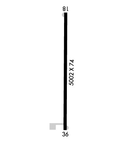
Runway Identifications
Runway Identification: 18/36
Length: 5002 ft
Width: 74 ft
Surface: ASPHALT-GOOD CONDITION
Edge lights: Medium Intensity

Treatment: NONE

 Runway: 18   Runway: 36
Mag heading: 179°Mag heading: 359°
Rwy Slope: -.23% DownRwy Slope: .23% Up
Approach: Approach:
Pattern: Left TrafficPattern: Left Traffic
Markings: NONPRECISION INSTRUMENTMarkings: NONPRECISION INSTRUMENT
Marking Condition: FAIRMarking Condition: FAIR
Arresting Dev: Arresting Dev:
Lat & Long: N3159.8  W09318.5Lat. & Long.: N3159.0  W09318.5
Elev: 177.0 ft. MSLElev: 165.3 ft. MSL
TCH: 50 ft. AGLTCH: 50 ft. AGL
Visual Glide Path: 3.00 degreesVisual Glide Path: 3.00 degrees
Displaced Threshold: NoDisplaced Threshold: No
Touchdown Zone: YESTouchdown Zone: YES
Touchdown Elev.: 177.2 feetTouchdown Elev.: 172.5 feet
Visual Glide Slope: 2-Light PAPI on LEFT side of Runway; RWY 18 PAPI OUT OF SERVICEVisual Glide Slope: 2-Light PAPI on LEFT side of Runway; RWY 36 PAPI OUT OF SERVICE
RVR Equipment: RVR Equipment:
RVV Equipment: NORVV Equipment: NO
Approach Lights: Approach Lights:
REIL: YES; RWY 18 REILS OUT OF SERVICEREIL: YES; RWY 36 REILS OUT OF SERVICE
Centerline Lights: NOCenterline Lights: NO
Touchdown lights: NOTouchdown lights: NO
Runway Category: Runway with a Visual ApproachRunway Category: Runway with a Visual Approach
Declared Distances: Declared Distances:
Obstructions: TREESObstructions: TREES
Marked: NOT Marked/LightedMarked: NOT Marked/Lighted
Clearance slope: 20:1Clearance slope: 19:1
Obstruction height: 53 feet AGLObstruction height: 104 feet AGL
Dist. from runway: 1262 feetDist. from runway: 2195 feet
Centerline offset: 243 left of centerlineCenterline offset: 229 feet left of centerline
Comments: Comments:
C:/P: