Approach Charts
| FltPlan does not have IFR approach charts available for K0R6. |
Current Weather/Notams (Metars, TAFs, Notams, NWS Forecast, PIREPS, and nearby weather)
Customs Information Send updates to Support@FltPlan.com
Customs Not Available
Database effective 04/18/2024
Airport Diagram might not be current.
|
| Facility Name: | HAMPTON MUNI |
| City Name: | HAMPTON |
| County: | CALHOUN |
| State abbrev: | AR |
| State Name: | ARKANSAS |
| | |
| Ownership: | PUBLICLY OWNED |
| Use: | OPEN TO THE PUBLIC |
| Owner's Name: | CALHOUN COUNTY / CITY OF HAMPTON |
| Address: | P.O. BOX 566 |
| | HAMPTON, AR 71744 |
| Owner's Phone: | 870-798-4818 |
| | |
| Manager's Name: | FLOYD W. NUTT / RICK SHIRRON; COUNTY JUDGE / MAYOR |
| Address: | PO BOX 566 |
| | HAMPTON, AR 71744 |
| Phone: | 870-798-4818 |
| | |
| FAA Region: | SOUTHWEST |
| FAA Field Office: | AOK |
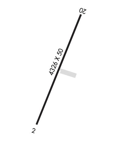
Runway Identifications
Runway Identification: 02/20Length: 4326 ft
Width: 50 ft
Surface: ASPHALT-POOR CONDITION
Edge lights: Treatment: NONE
| | Runway: 02 | | Runway: 20 |
| Mag heading: | N/A | Mag heading: | N/A |
| Rwy Slope: | .09% Up | Rwy Slope: | -.09% Down |
| Approach: | | Approach: | |
| Pattern: | Left Traffic | Pattern: | Left Traffic |
| Markings: | BASIC | Markings: | BASIC |
| Marking Condition: | POOR; MARKINGS FADED. | Marking Condition: | POOR; MARKINGS FADED. |
| Arresting Dev: | | Arresting Dev: | |
| Lat & Long: | N3331.0 W09227.8 | Lat. & Long.: | N3331.7 W09227.5 |
| Elev: | 174.0 ft. MSL | Elev: | 178.0 ft. MSL |
| TCH: | | TCH: | |
| Visual Glide Path: | | Visual Glide Path: | |
| Displaced Threshold: | No | Displaced Threshold: | No |
| Touchdown Zone: | NO | Touchdown Zone: | NO |
| Touchdown Elev.: | | Touchdown Elev.: | |
| Visual Glide Slope: | | Visual Glide Slope: | |
| RVR Equipment: | | RVR Equipment: | |
| RVV Equipment: | NO | RVV Equipment: | NO |
| Approach Lights: | | Approach Lights: | |
| REIL: | NO | REIL: | NO |
| Centerline Lights: | NO | Centerline Lights: | NO |
| Touchdown lights: | NO | Touchdown lights: | NO |
| Runway Category: | Runway with a Visual Approach | Runway Category: | Runway with a Visual Approach |
| Declared Distances: | | Declared Distances: | |
| Obstructions: | TREES | Obstructions: | TREES |
| Marked: | NOT Marked/Lighted | Marked: | NOT Marked/Lighted |
| Clearance slope: | | Clearance slope: | 10:1 |
| Obstruction height: | 25 feet AGL | Obstruction height: | 75 feet AGL |
| Dist. from runway: | 200 feet | Dist. from runway: | 950 feet |
| Centerline offset: | | Centerline offset: | 100 feet left of centerline |
| Comments: | +20 FT TREE 10 FT SOUTH; +15 FT ROAD 30 FT SOUTH. | Comments: | |

