Current Weather/Notams (Metars, TAFs, Notams, NWS Forecast, PIREPS, and nearby weather)
Customs Information Send updates to Support@FltPlan.com
Customs Not Available
Database effective 05/16/2024
Airport Diagram might not be current.
|
| Facility Name: | ATMORE MUNI |
| City Name: | ATMORE |
| County: | ESCAMBIA |
| State abbrev: | AL |
| State Name: | ALABAMA |
| | |
| Ownership: | PUBLICLY OWNED |
| Use: | OPEN TO THE PUBLIC |
| Owner's Name: | TOWN OF ATMORE |
| Address: | PO DRAWER 1297 |
| | ATMORE, AL 36504 |
| Owner's Phone: | 251-368-2253 |
| | |
| Manager's Name: | FREDDIE MCCALL |
| Address: | 15 BEACON LN |
| | ATMORE, AL 36502 |
| Phone: | 251-368-2004; ALSO 251-538-0546 |
| | |
| FAA Region: | SOUTHERN |
| FAA Field Office: | JAN |
Runway Identifications
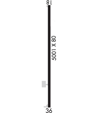
Runway Identification: 18/36Length: 5001 ft
Width: 80 ft
Surface: ASPHALT-GOOD CONDITION
Edge lights: Medium IntensityTreatment: NONE
| | Runway: 18 | | Runway: 36 |
| Mag heading: | 183° | Mag heading: | 3° |
| Rwy Slope: | -.07% Down | Rwy Slope: | .07% Up |
| Approach: | | Approach: | |
| Pattern: | Left Traffic | Pattern: | Left Traffic |
| Markings: | NONPRECISION INSTRUMENT | Markings: | NONPRECISION INSTRUMENT |
| Marking Condition: | FAIR | Marking Condition: | FAIR |
| Arresting Dev: | | Arresting Dev: | |
| Lat & Long: | N3101.4 W08726.8 | Lat. & Long.: | N3100.6 W08726.8 |
| Elev: | 283.2 ft. MSL | Elev: | 279.9 ft. MSL |
| TCH: | 40 ft. AGL | TCH: | 40 ft. AGL |
| Visual Glide Path: | 3.00 degrees | Visual Glide Path: | 3.00 degrees |
| Displaced Threshold: | No | Displaced Threshold: | No |
| Touchdown Zone: | YES | Touchdown Zone: | YES |
| Touchdown Elev.: | 286.0 feet | Touchdown Elev.: | 286.0 feet |
| Visual Glide Slope: | 2-Light PAPI on LEFT side of Runway | Visual Glide Slope: | 2-Light PAPI on LEFT side of Runway |
| RVR Equipment: | | RVR Equipment: | |
| RVV Equipment: | NO | RVV Equipment: | NO |
| Approach Lights: | | Approach Lights: | |
| REIL: | NO | REIL: | NO |
| Centerline Lights: | NO | Centerline Lights: | NO |
| Touchdown lights: | NO | Touchdown lights: | NO |
| Runway Category: | Runway with a Non-precision Approach having visibility minimums greater than 3/4 mile | Runway Category: | Runway with a Non-precision Approach having visibility minimums greater than 3/4 mile |
| Declared Distances: | | Declared Distances: | |
| Obstructions: | TREE | Obstructions: | BRUSH |
| Marked: | NOT Marked/Lighted | Marked: | NOT Marked/Lighted |
| Clearance slope: | 6:1; APCH RATIO 33:1 TO DSPLCD THR. | Clearance slope: | CTLG OBSTN EXCEEDS A 45 DEG SLP. |
| Obstruction height: | 18 feet AGL | Obstruction height: | 20 feet AGL |
| Dist. from runway: | 315 feet | Dist. from runway: | 216 feet |
| Centerline offset: | 200 left of centerline | Centerline offset: | 133 feet right of centerline |
| Comments: | | Comments: | |

