Current Weather/Notams (Metars, TAFs, Notams, NWS Forecast, PIREPS, and nearby weather)
Customs Information Send updates to Support@FltPlan.com
Customs Not Available
Database effective 05/16/2024
Airport Diagram might not be current.
|
| Facility Name: | CYNTHIANA-HARRISON COUNTY |
| City Name: | CYNTHIANA |
| County: | HARRISON |
| State abbrev: | KY |
| State Name: | KENTUCKY |
| | |
| Ownership: | PUBLICLY OWNED |
| Use: | OPEN TO THE PUBLIC |
| Owner's Name: | CYNTHIANA-HARRISON COUNTY ARPT BD |
| Address: | P.O. BOX 395 |
| | CYNTHIANA, KY 41031 |
| Owner's Phone: | 859-234-5533 |
| | |
| Manager's Name: | ROBERT CRAFT |
| Address: | 40 AIRFIELD LANE |
| | CYNTHIANA, KY 41031 |
| Phone: | 859-234-8477 |
| | |
| FAA Region: | SOUTHERN |
| FAA Field Office: | MEM |
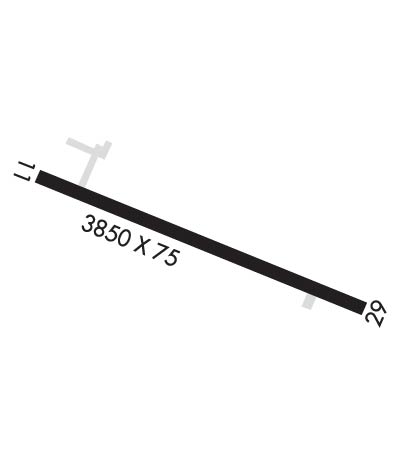
Runway Identifications
Runway Identification: 11/29Length: 3850 ft
Width: 75 ft
Surface: ASPHALT-GOOD CONDITION
Edge lights: Medium IntensityTreatment: NONE
| | Runway: 11 | | Runway: 29 |
| Mag heading: | 112° | Mag heading: | 292° |
| Rwy Slope: | -.02% Down | Rwy Slope: | .02% Up |
| Approach: | | Approach: | |
| Pattern: | Left Traffic | Pattern: | Left Traffic |
| Markings: | NONPRECISION INSTRUMENT | Markings: | NONPRECISION INSTRUMENT |
| Marking Condition: | FAIR | Marking Condition: | FAIR |
| Arresting Dev: | | Arresting Dev: | |
| Lat & Long: | N3822.1 W08417.4 | Lat. & Long.: | N3821.9 W08416.6 |
| Elev: | 720.9 ft. MSL | Elev: | 720.0 ft. MSL |
| TCH: | 41 ft. AGL | TCH: | 50 ft. AGL |
| Visual Glide Path: | 4.00 degrees | Visual Glide Path: | 4.00 degrees |
| Displaced Threshold: | No | Displaced Threshold: | 1094 feet |
| Touchdown Zone: | YES | Touchdown Zone: | YES |
| Touchdown Elev.: | 720.9 feet | Touchdown Elev.: | 720.9 feet |
| Visual Glide Slope: | 2-Light PAPI on LEFT side of Runway | Visual Glide Slope: | 2-Light PAPI on LEFT side of Runway |
| RVR Equipment: | | RVR Equipment: | |
| RVV Equipment: | NO | RVV Equipment: | NO |
| Approach Lights: | | Approach Lights: | |
| REIL: | YES | REIL: | YES |
| Centerline Lights: | NO | Centerline Lights: | NO |
| Touchdown lights: | NO | Touchdown lights: | NO |
| Runway Category: | Runway with a Non-precision Approach having visibility minimums greater than 3/4 mile | Runway Category: | Runway with a Non-precision Approach having visibility minimums greater than 3/4 mile |
| Declared Distances: | TORA:2757' TODA:3852' ASDA:3852' LDA:3852' | Declared Distances: | TORA:3852' TODA:3852' ASDA:3852' LDA:2757' |
| Obstructions: | RR | Obstructions: | TREES |
| Marked: | NOT Marked/Lighted | Marked: | NOT Marked/Lighted |
| Clearance slope: | 14:1 | Clearance slope: | 1:1; APCH RATIO 19:1 TO DSPLCD THR. |
| Obstruction height: | 36 feet AGL | Obstruction height: | 55 feet AGL |
| Dist. from runway: | 716 feet | Dist. from runway: | 5 feet |
| Centerline offset: | 319 right of centerline | Centerline offset: | 211 feet right of centerline |
| Comments: | | Comments: | +55 FT TREES 5 FT FM RWY END 211 FT R OF CNTRLN. |

