Click here for more info on on SMS!

K0A8

BIBB COUNTY
CENTREVILLE
AL
Time Zone: Central
Lat: N 3256.2
Long: W 08705.4
Elev: 251
Var: +02
Longest Runway: 4206
CTAF: 122.97

FBO & Flight Services info for K0A8

FBOs: Update your Fuel Prices

AVIANPh: 205-792-2463 Fax: 267-545-0265 Freq: 122.8
Service
Jet
100LL
SAF
MoGas
Fuel Avail: ~~Call 24 hours in advance for JetA
Full        Last Update: 04/20/2024 05:45:15

Self        
If you are an FBO, call 1-203-262-1700 to update your info or email: FltPlan.Advertising@garmin.com
Advertise your FBO on FltPlan.com

Runway & Approach Info for K0A8
Rwy
Length
Land Dist**
Approach*
  Rwy
Length
Land Dist**
Approach*
10
4206x80  4206'          
 
  
28
  4206x80  4206'          
 
 * only ILS, LOC, LDA, and SDF approaches to a specific runway are shown
** For any Declared Landing Distance Available, please see A/FD or Approach plates
Runway Weight Capability (lbs.) Help
Runway IDSingle WheelDouble WheelDouble Tandem WheelDual Double Wheel
10/2818,000N/AN/AN/A
These numbers are Advisory and are not limits.   The Airport Manager should have more accurate Weight Limits
Approach Charts
Approaches    
Current Weather/Notams
Customs Information Send updates to Support@FltPlan.com
Customs Not Available
Database effective 04/18/2024
Airport Diagram of K0A8
Airport Diagram might not be current.

Facility Name: BIBB COUNTY
City Name: CENTREVILLE
County: BIBB
State abbrev: AL
State Name: ALABAMA
   
Ownership: PUBLICLY OWNED
Use: OPEN TO THE PUBLIC
Owner's Name: BIBB COUNTY COMMISSION
Address: 157 SW DAVIDSON DRIVE
 CENTREVILLE, AL 35042
Owner's Phone: (205) 926-3114
  
Manager's Name: SHANE WALLACE
Address: P.O BOX 308
 CENTREVILLE, AL 35042
Phone: 205-247-6001; FOR ARPT ACES CTC 205-225-4763 OR 205-316-8574.
   
FAA Region: SOUTHERN
FAA Field Office: JAN


Sunrise / Sunset times for BIBB COUNTY

DateSunriseSunset
04/19/24 Friday6:1319:22
04/20/24 Saturday6:1219:23
04/21/24 Sunday6:1119:24
04/22/24 Monday6:1019:24
04/23/24 Tuesday6:0819:25
04/24/24 Wednesday6:0719:26
04/25/24 Thursday6:0619:27
04/26/24 Friday6:0519:27
04/27/24 Saturday6:0419:28
04/28/24 Sunday6:0319:29
04/29/24 Monday6:0219:29
04/30/24 Tuesday6:0119:30
05/01/24 Wednesday6:0019:31
05/02/24 Thursday5:5919:32

Airport Facilities

Airport Attendance ScheduleUNATTENDED; ARPT UNATNDD.
Airport Status OPERATIONAL (This Status can change at any time - please check NOTAMS)
Airport Lighting ScheduleACTVT REIL RWY 10 & 28; PAPI RWY 10 & 28; MIRL RWY 10/28 - CTAF.
Airport Storage AvailableNONE
Extra Services AvailableNONE
Wind IndicatorYES - (lighted)
Control TowerNO
CTAF Frequency122.975
Unicom Frequency122.975
Rotating Beacon ColorWG
Segmented CircleNO
Landing FeeNO

Airport Inspection Data

Airport InspectedSTATE - performed by STATE AERONAUTICAL PERSONNEL
Inspection Date08/04/2023

Airport Services

Type of Fuel AvailableNone
Airframe Repair ServiceNONE
Power Plant Repair ServiceMINOR

Geographic Data

LatitudeN3256.2
LongitudeW08705.4 (ESTIMATED)
Arpt Elevation250ft (SURVEYED)
Magnetic Variation02W
3 miles Eof CENTREVILLE
Traffic Pattern Altitude
Sectional ChartATLANTA

Aircraft Data

Operations (Reported)YearlyAvg. Daily
General Aviation Transient 27508
General Aviation Local 7922
Air Taxi 00
Commerical 00
Commuter 00
Military 00
Aircraft based on Field
General Aviation Singles 8
General Aviation Multi 0
Jet Aircraft 2
General Aviation Helicopters 0
Military Aircraft 0
Gliders 0
Ultralights 0

FAA Services

FSS on field NO
FSS tie-in ANNISTON
FSS Phone 1-800-WX-BRIEF
Who issues Notams ANB
Notam D service at airport YES
ARTCC Name ATLANTA

Federal Status

Airport Certification
Aircraft Rescue & Firefighting IndexNone
Airport of EntryNo
Custom Landing RightsNo
Joint Civil/MilitaryNo
Military Landing rightsNo

Federal Agreements

NATIONAL PLAN OF INTEGRATED AIRPORT SYSTEMS (NPIAS)

Remarks

PILOT ACES VIA WALK THRU GATE ON NORTH SIDE OF ARPT.
FOR CD CTC ATLANTA ARTCC AT 770-210-7692.
Airport Communications & Frequencies:
CTAF Frequency:
122.975
Unicom Frequency:
122.975
Remarks
  • APCH/DEP SVC PRVDD BY ATLANTA ARTCC ON FREQS 132.25/263.025 (UNIONTOWN RCAG).
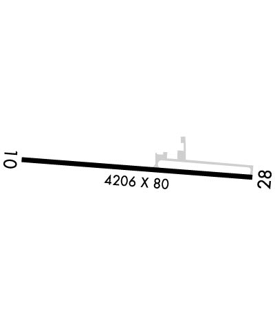
  • Runway Identifications
    Runway Identification: 10/28
    Length: 4206 ft
    Width: 80 ft
    Surface: ASPHALT
    Edge lights: Medium Intensity

    Treatment: AGGREGATE FRICTION SEAL COAT

     Runway: 10   Runway: 28
    Mag heading: 97°Mag heading: 277°
    Rwy Slope: .29% UpRwy Slope: -.29% Down
    Approach: Approach:
    Pattern: Left TrafficPattern: Left Traffic
    Markings: NONPRECISION INSTRUMENTMarkings: NONPRECISION INSTRUMENT
    Marking Condition: GOODMarking Condition: GOOD
    Arresting Dev: Arresting Dev:
    Lat & Long: N3256.2  W08705.8Lat. & Long.: N3256.2  W08705.0
    Elev: 238.5 ft. MSLElev: 250.9 ft. MSL
    TCH: 40 ft. AGLTCH: 40 ft. AGL
    Visual Glide Path: 4.00 degreesVisual Glide Path: 4.00 degrees
    Displaced Threshold: NoDisplaced Threshold: No
    Touchdown Zone: YESTouchdown Zone: YES
    Touchdown Elev.: 240.4 feetTouchdown Elev.: 250.9 feet
    Visual Glide Slope: 2-Light PAPI on LEFT side of RunwayVisual Glide Slope: 2-Light PAPI on LEFT side of Runway
    RVR Equipment: RVR Equipment:
    RVV Equipment: NORVV Equipment: NO
    Approach Lights: Approach Lights:
    REIL: YESREIL: YES
    Centerline Lights: NOCenterline Lights: NO
    Touchdown lights: NOTouchdown lights: NO
    Runway Category: Runway with a Non-precision ApproachRunway Category: Runway with a Non-precision Approach
    Declared Distances: Declared Distances:
    Obstructions: TREEObstructions: TREES
    Marked: NOT Marked/LightedMarked: NOT Marked/Lighted
    Clearance slope: 9:1Clearance slope: 1:1
    Obstruction height: 83 feet AGLObstruction height: 66 feet AGL
    Dist. from runway: 969 feetDist. from runway: 297 feet
    Centerline offset: 356 right of centerlineCenterline offset: 183 feet left of centerline
    Comments: Comments:
    C:1/P: