
| ||||||
| ||||||
|
| Rwy | Rwy | |||||||
| 1935x100 | 1510' | 1935x100 | 1792' | |||||
| Runway ID | Single Wheel | Double Wheel | Double Tandem Wheel | Dual Double Wheel |
| 14/32 | N/A | N/A | N/A | N/A |
| These numbers are Advisory and are not limits. The Airport Manager should have more accurate Weight Limits | ||||
| FltPlan does not have IFR approach charts available for K08B. |
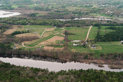
| Facility Name: | MERRYMEETING FLD |
| City Name: | BOWDOINHAM |
| County: | SAGADAHOC |
| State abbrev: | ME |
| State Name: | MAINE |
| Ownership: | PRIVATELY OWNED |
| Use: | OPEN TO THE PUBLIC |
| Owner's Name: | MARK BOWKER |
| Address: | 108 BAY ROAD |
| BOWDOINHAM, ME 04008 | |
| Owner's Phone: | 781-864-7011 |
| Manager's Name: | MARK BOWKER |
| Address: | 108 BAY ROAD |
| BOWDOINHAM, ME 04008 | |
| Phone: | 781-864-7011 |
| FAA Region: | NEW ENGLAND |
| FAA Field Office: | NONE |
| Date | Sunrise | Sunset |
|---|---|---|
| 04/24/24 Wednesday | 5:41 | 19:35 |
| 04/25/24 Thursday | 5:39 | 19:37 |
| 04/26/24 Friday | 5:37 | 19:38 |
| 04/27/24 Saturday | 5:36 | 19:39 |
| 04/28/24 Sunday | 5:34 | 19:40 |
| 04/29/24 Monday | 5:33 | 19:41 |
| 04/30/24 Tuesday | 5:32 | 19:42 |
| 05/01/24 Wednesday | 5:30 | 19:44 |
| 05/02/24 Thursday | 5:29 | 19:45 |
| 05/03/24 Friday | 5:27 | 19:46 |
| 05/04/24 Saturday | 5:26 | 19:47 |
| 05/05/24 Sunday | 5:25 | 19:48 |
| 05/06/24 Monday | 5:23 | 19:50 |
| 05/07/24 Tuesday | 5:22 | 19:51 |
| Airport Attendance Schedule | IRREGULAR |
| Airport Status | OPERATIONAL (This Status can change at any time - please check NOTAMS) |
| Airport Lighting Schedule | |
| Airport Storage Available | Tie Downs |
| Extra Services Available | NONE |
| Wind Indicator | YES - (unlit) |
| Control Tower | NO |
| CTAF Frequency | 122.900 |
| Unicom Frequency | |
| Rotating Beacon Color | |
| Segmented Circle | NO |
| Landing Fee | NO |
| Airport Inspected | STATE - performed by PRIVATE CONTRACT PERSONNEL |
| Inspection Date | 08/16/2023 |
| Type of Fuel Available | None |
| Airframe Repair Service | NONE |
| Power Plant Repair Service | NONE |
| Latitude | N4400.0 |
| Longitude | W06953.2 (ESTIMATED) |
| Arpt Elevation | 61ft (SURVEYED) |
| Magnetic Variation | 18W |
| 1 miles SE | of BOWDOINHAM |
| Traffic Pattern Altitude | |
| Sectional Chart | MONTREAL |
| Operations (Reported) | Yearly | Avg. Daily |
|---|---|---|
| General Aviation Transient | 100 | 0 |
| General Aviation Local | 400 | 1 |
| Air Taxi | 0 | 0 |
| Commerical | 0 | 0 |
| Commuter | 0 | 0 |
| Military | 0 | 0 |
| Aircraft based on Field | |
|---|---|
| General Aviation Singles | 3 |
| General Aviation Multi | 0 |
| Jet Aircraft | 0 |
| General Aviation Helicopters | 0 |
| Military Aircraft | 0 |
| Gliders | 0 |
| Ultralights | 0 |
| FSS on field | NO |
| FSS tie-in | BANGOR |
| FSS Phone | 1-800-WX-BRIEF |
| Who issues Notams | BGR |
| Notam D service at airport | YES |
| ARTCC Name | BOSTON |
| Airport Certification | |
| Aircraft Rescue & Firefighting Index | None |
| Airport of Entry | No |
| Custom Landing Rights | No |
| Joint Civil/Military | No |
| Military Landing rights | No |
| THIS AIRPORT HAS BEEN SURVEYED BY THE NATIONAL GEODETIC SURVEY. |
| NO LINE OF SIGHT BTN RY ENDS. |
| CALL FOR RY CONDITIONS PRIOR TO LANDING. |
| WILDLIFE ON OR INVOF ARPT. |
| WINTER OPERATIONS (NOV 1 - MAY 1) SKIS ONLY - RY NOT PLOWED. |
| RY 14 HAS +15 FT ROADWAY 95 FT RIGHT AND +15 FT BLDG 125 FT LEFT AT THLD. |
| FOR CD CTC PORTLAND APCH AT 207-874-7320, WHEN APCH CLSD CTC BOSTON ARTCC AT 603-879-6859. |
| Runway: 14 | Runway: 32 | ||
| Mag heading: | N/A | Mag heading: | N/A |
| Rwy Slope: | .02% Up | Rwy Slope: | -.02% Down |
| Approach: | Approach: | ||
| Pattern: | Left Traffic | Pattern: | Left Traffic |
| Markings: | Markings: | ||
| Marking Condition: | Marking Condition: | ||
| Arresting Dev: | Arresting Dev: | ||
| Lat & Long: | N4400.1 W06953.4 | Lat. & Long.: | N4359.9 W06953.1 |
| Elev: | 56.2 ft. MSL | Elev: | 56.6 ft. MSL |
| TCH: | TCH: | ||
| Visual Glide Path: | Visual Glide Path: | ||
| Displaced Threshold: | 425 feet | Displaced Threshold: | 143 feet |
| Touchdown Zone: | NO | Touchdown Zone: | NO |
| Touchdown Elev.: | Touchdown Elev.: | ||
| Visual Glide Slope: | Visual Glide Slope: | ||
| RVR Equipment: | RVR Equipment: | ||
| RVV Equipment: | NO | RVV Equipment: | NO |
| Approach Lights: | Approach Lights: | ||
| REIL: | NO | REIL: | NO |
| Centerline Lights: | NO | Centerline Lights: | NO |
| Touchdown lights: | NO | Touchdown lights: | NO |
| Runway Category: | Runway with a Visual Approach | Runway Category: | Runway with a Visual Approach |
| Declared Distances: | Declared Distances: | ||
| Obstructions: | TREES | Obstructions: | TREES |
| Marked: | NOT Marked/Lighted | Marked: | NOT Marked/Lighted |
| Clearance slope: | Clearance slope: | 6:1 | |
| Obstruction height: | 65 feet AGL | Obstruction height: | 35 feet AGL |
| Dist. from runway: | 50 feet | Dist. from runway: | 240 feet |
| Centerline offset: | 125 right of centerline | Centerline offset: | |
| Comments: | Comments: |