Approach Charts
| FltPlan does not have IFR approach charts available for K03B. |
Current Weather/Notams (Metars, TAFs, Notams, NWS Forecast, PIREPS, and nearby weather)
Customs Information Send updates to Support@FltPlan.com
Customs Not Available
Database effective 04/18/2024
Airport Diagram might not be current.
|
| Facility Name: | MANSFIELD MUNI |
| City Name: | MANSFIELD |
| County: | WRIGHT |
| State abbrev: | MO |
| State Name: | MISSOURI |
| | |
| Ownership: | PUBLICLY OWNED |
| Use: | OPEN TO THE PUBLIC |
| Owner's Name: | MANSFIELD, CITY OF |
| Address: | 122 N. BUS. 60, P.O. BOX 467 |
| | MANSFIELD, MO 65704 |
| Owner's Phone: | 417-924-3719 |
| | |
| Manager's Name: | TERESA CLARK; ARPT BOARD CHAIRMAN. |
| Address: | 1588 HWY F |
| | MANSFIELD, MO 65704 |
| Phone: | 417-924-2782 |
| | |
| FAA Region: | CENTRAL |
| FAA Field Office: | NONE |
Runway Identifications
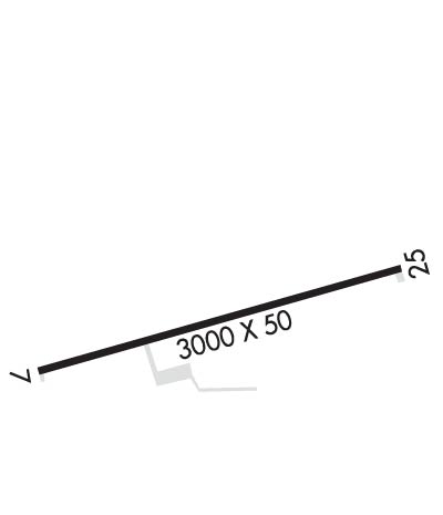
Runway Identification: 07/25Length: 3000 ft
Width: 50 ft
Surface: ASPHALT
Edge lights: Medium IntensityTreatment: AGGREGATE FRICTION SEAL COAT
| | Runway: 07 | | Runway: 25 |
| Mag heading: | N/A | Mag heading: | N/A |
| Rwy Slope: | -.50% Down | Rwy Slope: | .50% Up |
| Approach: | | Approach: | |
| Pattern: | Left Traffic | Pattern: | Left Traffic |
| Markings: | BASIC | Markings: | BASIC |
| Marking Condition: | FAIR | Marking Condition: | FAIR |
| Arresting Dev: | | Arresting Dev: | |
| Lat & Long: | N3707.6 W09237.6 | Lat. & Long.: | N3707.7 W09237.0 |
| Elev: | 1520.0 ft. MSL | Elev: | 1505.0 ft. MSL |
| TCH: | | TCH: | |
| Visual Glide Path: | | Visual Glide Path: | |
| Displaced Threshold: | No | Displaced Threshold: | No |
| Touchdown Zone: | NO | Touchdown Zone: | NO |
| Touchdown Elev.: | | Touchdown Elev.: | |
| Visual Glide Slope: | | Visual Glide Slope: | |
| RVR Equipment: | | RVR Equipment: | |
| RVV Equipment: | NO | RVV Equipment: | NO |
| Approach Lights: | | Approach Lights: | |
| REIL: | NO | REIL: | NO |
| Centerline Lights: | NO | Centerline Lights: | NO |
| Touchdown lights: | NO | Touchdown lights: | NO |
| Runway Category: | Runway with a Visual Approach | Runway Category: | Runway with a Visual Approach |
| Declared Distances: | | Declared Distances: | |
| Obstructions: | TREES | Obstructions: | TREES |
| Marked: | NOT Marked/Lighted | Marked: | NOT Marked/Lighted |
| Clearance slope: | 10:1 | Clearance slope: | 10:1 |
| Obstruction height: | 45 feet AGL | Obstruction height: | 41 feet AGL |
| Dist. from runway: | 650 feet | Dist. from runway: | 620 feet |
| Centerline offset: | 175 right of centerline | Centerline offset: | 120 feet left of centerline |
| Comments: | | Comments: | +2-7 FT BRUSH, SMALL TREES 0-50 FT FM THLD 55-105 FT L & R; +1-5 FT GND 0-200 FT FM THLD LEFT & RIGHT. |

